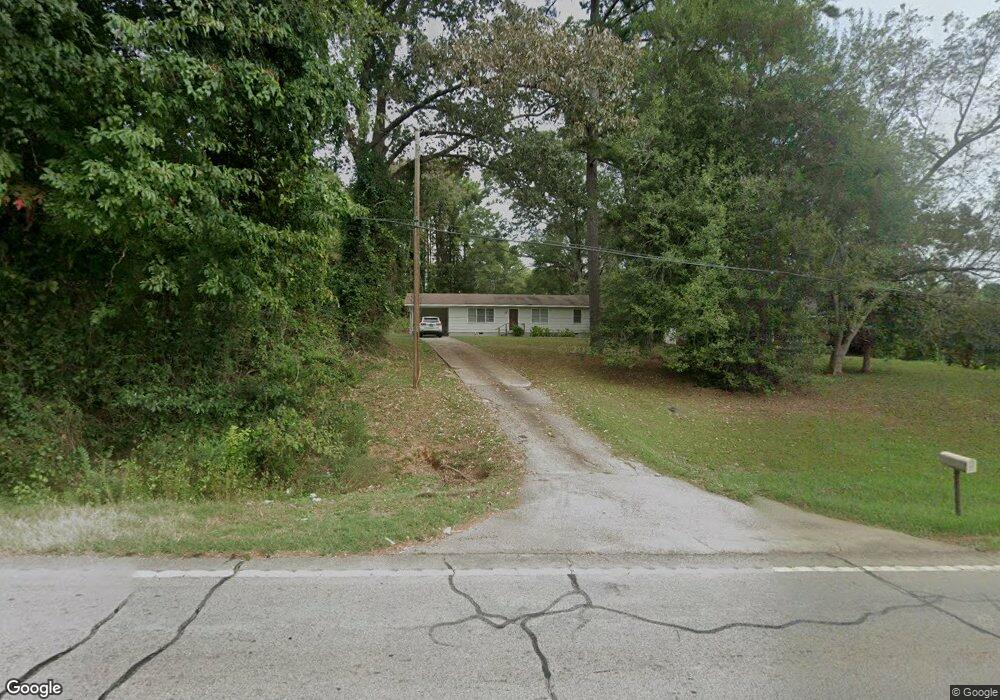
2528 Roanoke Rd Lagrange, GA 30240
Estimated Value: $144,635 - $192,000
3
Beds
1
Bath
1,224
Sq Ft
$146/Sq Ft
Est. Value
About This Home
This home is located at 2528 Roanoke Rd, Lagrange, GA 30240 and is currently estimated at $178,409, approximately $145 per square foot. 2528 Roanoke Rd is a home with nearby schools including Ethel W. Kight Elementary School, Hollis Hand Elementary School, and Franklin Forest Elementary School.
Ownership History
Date
Name
Owned For
Owner Type
Purchase Details
Closed on
Oct 30, 2001
Sold by
Annie Ruth Weathers Trust
Bought by
Weathers Andrew
Current Estimated Value
Purchase Details
Closed on
Jul 25, 1996
Sold by
Annie Ruth Weathers
Bought by
Annie Ruth Weathers Trust
Purchase Details
Closed on
Oct 3, 1991
Bought by
Annie Ruth Weathers
Purchase Details
Closed on
Dec 1, 1982
Sold by
Weathers J D
Purchase Details
Closed on
Jan 1, 1971
Sold by
Albert Sheppard
Bought by
Weathers J D
Purchase Details
Closed on
Jan 1, 1965
Sold by
Mae Clark and Mae Ozley
Bought by
Albert Sheppard
Create a Home Valuation Report for This Property
The Home Valuation Report is an in-depth analysis detailing your home's value as well as a comparison with similar homes in the area
Purchase History
| Date | Buyer | Sale Price | Title Company |
|---|---|---|---|
| Weathers Andrew | -- | -- | |
| Annie Ruth Weathers Trust | -- | -- | |
| Annie Ruth Weathers | -- | -- | |
| -- | -- | -- | |
| Weathers J D | -- | -- | |
| Albert Sheppard | -- | -- |
Source: Public Records
Tax History
| Year | Tax Paid | Tax Assessment Tax Assessment Total Assessment is a certain percentage of the fair market value that is determined by local assessors to be the total taxable value of land and additions on the property. | Land | Improvement |
|---|---|---|---|---|
| 2025 | $837 | $30,700 | $3,480 | $27,220 |
| 2024 | $700 | $25,660 | $3,480 | $22,180 |
| 2023 | $734 | $26,900 | $3,480 | $23,420 |
| 2022 | $711 | $25,460 | $3,480 | $21,980 |
| 2021 | $599 | $19,860 | $2,200 | $17,660 |
| 2020 | $599 | $19,860 | $2,200 | $17,660 |
| 2019 | $588 | $19,512 | $2,200 | $17,312 |
| 2018 | $588 | $19,512 | $2,200 | $17,312 |
| 2017 | $550 | $18,232 | $2,200 | $16,032 |
| 2016 | $535 | $17,726 | $2,224 | $15,502 |
| 2015 | $536 | $17,726 | $2,224 | $15,502 |
| 2014 | $512 | $16,910 | $2,224 | $14,686 |
| 2013 | -- | $18,151 | $2,224 | $15,927 |
Source: Public Records
Map
Nearby Homes
- 223 Pinehaven Dr
- 336 Whitaker Rd
- 117 Brookwood Dr
- 3 Reed Dr
- 0 Unit 10514554
- 104 Spring Valley Dr
- 427 Fling Rd
- 8 Horace Carter Rd
- 509 Connie Dr
- 200 Cheyenne Dr
- 0 Bradfield Dr Unit 10568803
- 641 Whitaker Rd
- 203 Shawnee Dr
- 808 S Fling Rd
- 2239 Pegasus Pkwy
- 217 Highland Trail
- 124 Foxdale Dr
- 214 Willowcrest Way
- 112 Foxdale Dr
- 0 Hills and Dales Farm Rd
- 2524 Roanoke Rd
- 2532 Roanoke Rd
- 2520 Roanoke Rd
- 98 Weathers Dr
- 2522 Roanoke Rd
- 2518 Roanoke Rd
- 100 Weathers Dr
- 2519 Roanoke Rd
- 102 Weathers Dr
- 104 Weathers Dr
- 2526 Roanoke Rd
- 2601 Roanoke Rd
- 108 Weathers Dr
- 103 Weathers Dr
- 107 Weathers Dr
- 109 Weathers Dr
- 118 Weathers Dr
- 2450 Roanoke Rd
- 121 Weathers Dr
- 130 Weathers Dr
Your Personal Tour Guide
Ask me questions while you tour the home.