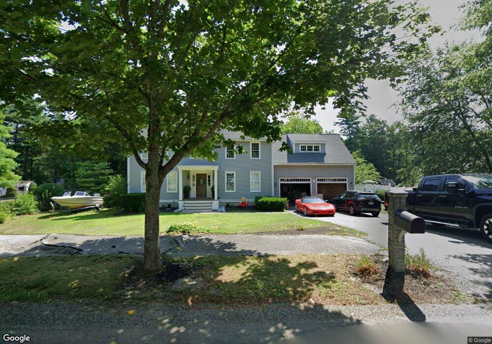
253 Prince Rogers Way Marshfield, MA 02050
Estimated Value: $1,180,000 - $1,378,000
4
Beds
3
Baths
2,690
Sq Ft
$473/Sq Ft
Est. Value
About This Home
This home is located at 253 Prince Rogers Way, Marshfield, MA 02050 and is currently estimated at $1,273,230, approximately $473 per square foot. 253 Prince Rogers Way is a home located in Plymouth County with nearby schools including Martinson Elementary School, Furnace Brook Middle School, and Marshfield High School.
Ownership History
Date
Name
Owned For
Owner Type
Purchase Details
Closed on
Apr 5, 2024
Sold by
Forsyth Eric L and Forsyth Concetta F
Bought by
Forsyth
Current Estimated Value
Purchase Details
Closed on
Apr 14, 1998
Sold by
Krusell Peter W and Krusell Eric H
Bought by
Forsyth Eric L and Forsyth Concetta F
Create a Home Valuation Report for This Property
The Home Valuation Report is an in-depth analysis detailing your home's value as well as a comparison with similar homes in the area
Home Values in the Area
Average Home Value in this Area
Purchase History
| Date | Buyer | Sale Price | Title Company |
|---|---|---|---|
| Forsyth | -- | None Available | |
| Forsyth | -- | None Available | |
| Forsyth Eric L | $300,000 | -- | |
| Forsyth Eric L | $300,000 | -- |
Source: Public Records
Mortgage History
| Date | Status | Borrower | Loan Amount |
|---|---|---|---|
| Previous Owner | Forsyth Eric L | $436,000 | |
| Previous Owner | Forsyth Eric L | $100,000 | |
| Previous Owner | Forsyth Eric L | $59,000 | |
| Previous Owner | Forsyth Eric L | $30,488 |
Source: Public Records
Tax History Compared to Growth
Tax History
| Year | Tax Paid | Tax Assessment Tax Assessment Total Assessment is a certain percentage of the fair market value that is determined by local assessors to be the total taxable value of land and additions on the property. | Land | Improvement |
|---|---|---|---|---|
| 2025 | $10,183 | $1,028,600 | $369,700 | $658,900 |
| 2024 | $9,873 | $950,200 | $348,200 | $602,000 |
| 2023 | $9,277 | $838,300 | $313,400 | $524,900 |
| 2022 | $9,277 | $716,400 | $261,400 | $455,000 |
| 2021 | $8,866 | $672,200 | $261,400 | $410,800 |
| 2020 | $8,812 | $661,100 | $261,400 | $399,700 |
| 2019 | $8,550 | $639,000 | $261,400 | $377,600 |
| 2018 | $8,446 | $631,700 | $261,400 | $370,300 |
| 2017 | $8,354 | $608,900 | $261,400 | $347,500 |
| 2016 | $7,991 | $575,700 | $250,700 | $325,000 |
| 2015 | $7,551 | $568,200 | $250,700 | $317,500 |
| 2014 | $7,517 | $565,600 | $250,700 | $314,900 |
Source: Public Records
Map
Nearby Homes
- 10 Penstock Ln
- 21 Chowdermarch St
- 1155 Main St
- 1 Valley Path
- 451 School St Unit 5-2
- 451 School St Unit 3-4
- 848 Plain St Unit 23
- 21 Union St
- 5 Royal Dane Dr Unit 45
- 2 Proprietors Dr Unit 25
- 2 Proprietors Dr Unit 23
- 2 Proprietors Dr Unit 26
- 2 Proprietors Dr Unit 27
- 2 Proprietors Dr Unit 24
- 341 Furnace St
- 480 Pleasant St
- 167 Planting Field Rd
- 14 Red Pony Path
- 218 Schoosett St
- 480 Ferry St
- 267 Prince Rogers Way
- 241 Prince Rogers Way
- 277 Prince Rogers Way
- 129 Old Barn Path
- 139 Old Barn Path
- 289 Prince Rogers Way
- 258 Prince Rogers Way
- 250 Prince Rogers Way
- 266 Prince Rogers Way
- 149 Old Barn Path
- 276 Prince Rogers Way
- 210 Quail Run
- 117 Old Barn Path
- 290 Prince Rogers Way
- 188 Quail Run
- 300 Prince Rogers Way
- 120 Old Barn Path
- 228 Prince Rogers Way
- 120 Old Barn Pathe
- 240 Prince Rogers Way