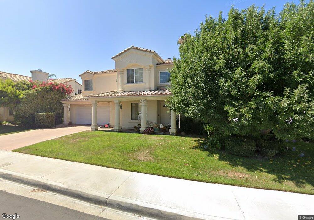
25304 Carson Way Stevenson Ranch, CA 91381
Estimated Value: $893,124 - $1,044,000
3
Beds
3
Baths
2,278
Sq Ft
$432/Sq Ft
Est. Value
About This Home
This home is located at 25304 Carson Way, Stevenson Ranch, CA 91381 and is currently estimated at $983,781, approximately $431 per square foot. 25304 Carson Way is a home located in Los Angeles County with nearby schools including Pico Canyon Elementary School, Rancho Pico Junior High School, and West Ranch High School.
Ownership History
Date
Name
Owned For
Owner Type
Purchase Details
Closed on
May 27, 2025
Sold by
Spunberg David and Ashimine Sandra L
Bought by
Sandra And David Trust and Ashimine
Current Estimated Value
Purchase Details
Closed on
Feb 28, 1995
Sold by
Roberts Bennie L and Roberts Theresa
Bought by
Standard Pacific Svgs Fa
Create a Home Valuation Report for This Property
The Home Valuation Report is an in-depth analysis detailing your home's value as well as a comparison with similar homes in the area
Home Values in the Area
Average Home Value in this Area
Purchase History
| Date | Buyer | Sale Price | Title Company |
|---|---|---|---|
| Sandra And David Trust | -- | None Listed On Document | |
| Standard Pacific Svgs Fa | $241,295 | Chicago Title Company |
Source: Public Records
Tax History Compared to Growth
Tax History
| Year | Tax Paid | Tax Assessment Tax Assessment Total Assessment is a certain percentage of the fair market value that is determined by local assessors to be the total taxable value of land and additions on the property. | Land | Improvement |
|---|---|---|---|---|
| 2025 | $8,479 | $381,644 | $127,234 | $254,410 |
| 2024 | $8,479 | $374,162 | $124,740 | $249,422 |
| 2023 | $8,309 | $366,827 | $122,295 | $244,532 |
| 2022 | $8,193 | $359,636 | $119,898 | $239,738 |
| 2021 | $8,050 | $352,586 | $117,548 | $235,038 |
| 2019 | $7,852 | $342,129 | $114,062 | $228,067 |
| 2018 | $7,635 | $335,422 | $111,826 | $223,596 |
| 2016 | $4,956 | $322,399 | $107,485 | $214,914 |
| 2015 | $4,853 | $317,557 | $105,871 | $211,686 |
| 2014 | $4,661 | $311,338 | $103,798 | $207,540 |
Source: Public Records
Map
Nearby Homes
- 26666 Beartown Ln
- 25535 Chisom Ln
- 25152 Steinbeck Ave
- 25126 Steinbeck Ave Unit D
- 25510 Chisom Ln
- 25710 Wagner Way Unit C
- 25710 Wagner Way Unit C
- 25715 Wagner Way Unit B
- 25768 Perlman Place Unit A
- 25843 Browning Place
- 25726 Emerson Ln
- 25553 Fitzgerald Ave
- 25528 Paine Cir
- 25507 Longfellow Place
- 25803 Anderson Ln
- 25463 Hardy Place
- 27422 Pioneer Ct
- 27227 Coyote Bush Ct
- 26976 Prospector Rd Unit 201
- 27120 Red Tail Place
- 25254 Carson Way
- 25312 Carson Way
- 25331 Bowie Ct
- 25329 Bowie Ct
- 25248 Carson Way
- 25301 Carson Way
- 25328 Carson Way
- 25307 Carson Way
- 25251 Carson Way
- 25327 Bowie Ct
- 25303 Bowie Ct
- 25313 Carson Way
- 25333 Bowie Ct
- 25332 Carson Way
- 0 No Unit 314031606
- 25317 Carson Way
- 25242 Carson Way
- 25307 Bowie Ct
- 25247 Carson Way
- 25301 Bowie Ct