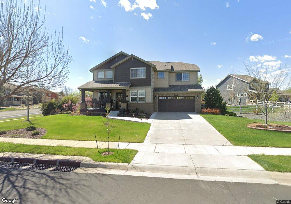
2533 Annelise Way Fort Collins, CO 80525
Rigden Farm NeighborhoodEstimated Value: $720,000 - $813,000
5
Beds
4
Baths
2,823
Sq Ft
$272/Sq Ft
Est. Value
About This Home
This home is located at 2533 Annelise Way, Fort Collins, CO 80525 and is currently estimated at $767,565, approximately $271 per square foot. 2533 Annelise Way is a home located in Larimer County with nearby schools including Riffenburgh Elementary School, Lesher Middle School, and Fort Collins High School.
Ownership History
Date
Name
Owned For
Owner Type
Purchase Details
Closed on
Sep 13, 2011
Sold by
Reynolds William B and Reynolds Ingrid A
Bought by
Lackey Brian D and Lackey Melissa M
Current Estimated Value
Home Financials for this Owner
Home Financials are based on the most recent Mortgage that was taken out on this home.
Original Mortgage
$259,600
Outstanding Balance
$179,210
Interest Rate
4.43%
Mortgage Type
New Conventional
Estimated Equity
$588,355
Purchase Details
Closed on
Sep 15, 2006
Sold by
Melody Homes Inc
Bought by
Reynolds William B and Reynolds Ingrid A
Home Financials for this Owner
Home Financials are based on the most recent Mortgage that was taken out on this home.
Original Mortgage
$291,077
Interest Rate
6.64%
Mortgage Type
Purchase Money Mortgage
Create a Home Valuation Report for This Property
The Home Valuation Report is an in-depth analysis detailing your home's value as well as a comparison with similar homes in the area
Home Values in the Area
Average Home Value in this Area
Purchase History
| Date | Buyer | Sale Price | Title Company |
|---|---|---|---|
| Lackey Brian D | $324,500 | Unified Title Company Of Nor | |
| Reynolds William B | $383,552 | Land Title Guarantee Company |
Source: Public Records
Mortgage History
| Date | Status | Borrower | Loan Amount |
|---|---|---|---|
| Open | Lackey Brian D | $259,600 | |
| Previous Owner | Reynolds William B | $291,077 |
Source: Public Records
Tax History Compared to Growth
Tax History
| Year | Tax Paid | Tax Assessment Tax Assessment Total Assessment is a certain percentage of the fair market value that is determined by local assessors to be the total taxable value of land and additions on the property. | Land | Improvement |
|---|---|---|---|---|
| 2025 | $4,371 | $49,238 | $11,008 | $38,230 |
| 2024 | $4,159 | $49,238 | $11,008 | $38,230 |
| 2022 | $3,461 | $36,655 | $5,213 | $31,442 |
| 2021 | $3,498 | $37,710 | $5,363 | $32,347 |
| 2020 | $3,378 | $36,108 | $5,363 | $30,745 |
| 2019 | $3,393 | $36,108 | $5,363 | $30,745 |
| 2018 | $2,806 | $30,787 | $5,400 | $25,387 |
| 2017 | $2,796 | $30,787 | $5,400 | $25,387 |
| 2016 | $2,702 | $29,595 | $5,970 | $23,625 |
| 2015 | $2,682 | $29,600 | $5,970 | $23,630 |
| 2014 | $2,561 | $28,070 | $4,780 | $23,290 |
Source: Public Records
Map
Nearby Homes
- 2908 Des Moines Dr
- 2550 Custer Dr
- 2521 Des Moines Dr Unit 104
- 2556 Des Moines Dr Unit 103
- 2718 Red Cloud Ct
- 2780 Canby Way
- 2702 Rigden Pkwy Unit F4
- 2702 Rigden Pkwy Unit 1
- 3115 Bryce Dr
- 3114 Bryce Dr
- 2501 Jadestone Ct
- 2975 Denver Dr
- 2750 Illinois Dr Unit 206
- 3150 Bryce Dr
- 2241 Limon Dr Unit 204
- 3214 Anika Dr
- 3012 Sombrero Ln
- 2450 Windrow Dr Unit E106
- 2450 Windrow Dr Unit E203
- 2961 Sagebrush Dr
- 2902 Shaylah Ct
- 3015 Morab Ct
- 3021 Morab Ct
- 2602 William Neal Pkwy
- 2608 William Neal Pkwy
- 2909 Shaylah Ct
- 2614 William Neal Pkwy
- 3027 Morab Ct
- 2903 Shaylah Ct
- 2620 William Neal Pkwy
- 3014 Morab Ct
- 2615 Annelise Way
- 3026 Morab Ct
- 2512 Shavano Ct
- 2626 William Neal Pkwy
- 2518 Shavano Ct
- 2524 Shavano Ct
- 3020 Morab Ct
- 2600 Shavano Ct
- 2515 Annelise Way