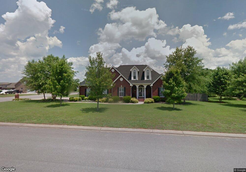
2534 Dorset St Murfreesboro, TN 37130
Estimated Value: $459,385 - $515,000
--
Bed
4
Baths
2,183
Sq Ft
$224/Sq Ft
Est. Value
About This Home
This home is located at 2534 Dorset St, Murfreesboro, TN 37130 and is currently estimated at $489,846, approximately $224 per square foot. 2534 Dorset St is a home located in Rutherford County with nearby schools including John Pittard Elementary School, Oakland Middle School, and Oakland High School.
Ownership History
Date
Name
Owned For
Owner Type
Purchase Details
Closed on
Sep 28, 2004
Sold by
Chris West L and Chris Mary W
Bought by
Mcmurry Donald R and Mcmurry Heather
Current Estimated Value
Home Financials for this Owner
Home Financials are based on the most recent Mortgage that was taken out on this home.
Original Mortgage
$171,920
Outstanding Balance
$79,271
Interest Rate
4.75%
Estimated Equity
$410,575
Create a Home Valuation Report for This Property
The Home Valuation Report is an in-depth analysis detailing your home's value as well as a comparison with similar homes in the area
Home Values in the Area
Average Home Value in this Area
Purchase History
| Date | Buyer | Sale Price | Title Company |
|---|---|---|---|
| Mcmurry Donald R | $214,900 | -- |
Source: Public Records
Mortgage History
| Date | Status | Borrower | Loan Amount |
|---|---|---|---|
| Open | Mcmurry Donald R | $171,920 |
Source: Public Records
Tax History Compared to Growth
Tax History
| Year | Tax Paid | Tax Assessment Tax Assessment Total Assessment is a certain percentage of the fair market value that is determined by local assessors to be the total taxable value of land and additions on the property. | Land | Improvement |
|---|---|---|---|---|
| 2025 | $2,759 | $97,550 | $13,750 | $83,800 |
| 2024 | $2,759 | $97,550 | $13,750 | $83,800 |
| 2023 | $1,831 | $97,575 | $13,750 | $83,825 |
| 2022 | $1,577 | $97,575 | $13,750 | $83,825 |
| 2021 | $1,479 | $66,650 | $11,250 | $55,400 |
| 2020 | $1,479 | $66,650 | $11,250 | $55,400 |
| 2019 | $1,479 | $66,650 | $11,250 | $55,400 |
| 2018 | $2,032 | $66,650 | $0 | $0 |
| 2017 | $2,239 | $57,600 | $0 | $0 |
| 2016 | $2,239 | $57,600 | $0 | $0 |
| 2015 | $2,239 | $57,600 | $0 | $0 |
| 2014 | $1,432 | $57,600 | $0 | $0 |
| 2013 | -- | $59,700 | $0 | $0 |
Source: Public Records
Map
Nearby Homes
- 2607 Mission Ridge Dr
- 2510 Mission Ridge Dr
- 1640 Drayton Dr
- 2639 Mission Ridge Dr
- 2403 English Hill Dr
- 1817 Splash Place
- 2428 Sandstone Cir
- 2514 Sandstone Cir
- 2223 Brick Way
- 1180 Ithaca St
- 2521 Pebblecreek Ln
- 0 Pitts Ln
- 2906 Meadowhill Dr
- 722 Osborne Ln
- 2326 Laurelstone Dr
- 2918 Meadowhill Dr
- 2328 Laurelstone Dr
- 2333 Laurelstone Dr
- 2336 Laurelstone Dr
- 2164 White Poplar Ct
- 1722 Bear Paw Ln
- 2530 Dorset St
- 1631 Savoy Dr
- 2608 Dorset St
- 1714 Bear Paw Ln
- 1726 Bear Paw Ln
- 1723 Bear Paw Ln
- 1635 Savoy Dr
- 2609 Dorset St
- 2529 Dorset St
- 1727 Bear Paw Ln
- 1730 Bear Paw Ln
- 2612 Dorset St
- 2522 Dorset St
- 1724 Walking Dr
- 1639 Savoy Dr
- 1711 Bear Paw Ln
- 2525 Dorset St
- 2526 Mission Ridge Dr
- 1731 Bear Paw Ln