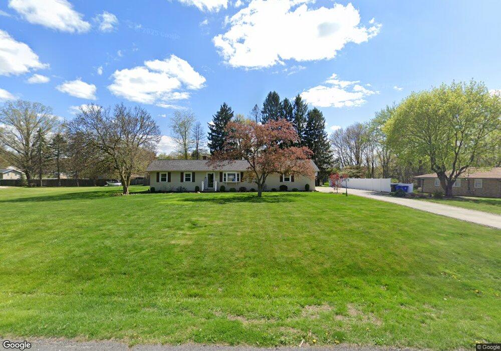
254 Pheasant Dr Mogadore, OH 44260
Estimated Value: $241,000 - $265,000
3
Beds
1
Bath
1,208
Sq Ft
$207/Sq Ft
Est. Value
About This Home
This home is located at 254 Pheasant Dr, Mogadore, OH 44260 and is currently estimated at $249,941, approximately $206 per square foot. 254 Pheasant Dr is a home located in Portage County with nearby schools including O.H. Somers Elementary School and Mogadore High School.
Ownership History
Date
Name
Owned For
Owner Type
Purchase Details
Closed on
Mar 28, 2019
Sold by
Perry Donnel L and Regec Donnel L
Bought by
Tarter Thomas W and Tarter Amber R
Current Estimated Value
Home Financials for this Owner
Home Financials are based on the most recent Mortgage that was taken out on this home.
Original Mortgage
$155,628
Outstanding Balance
$136,322
Interest Rate
4.12%
Mortgage Type
FHA
Estimated Equity
$113,619
Purchase Details
Closed on
Jul 11, 2001
Sold by
Bell Thomas W
Bought by
Regec Donnel L
Home Financials for this Owner
Home Financials are based on the most recent Mortgage that was taken out on this home.
Original Mortgage
$55,100
Interest Rate
7.22%
Purchase Details
Closed on
Jan 1, 1990
Bought by
Bell Thomas W
Create a Home Valuation Report for This Property
The Home Valuation Report is an in-depth analysis detailing your home's value as well as a comparison with similar homes in the area
Home Values in the Area
Average Home Value in this Area
Purchase History
| Date | Buyer | Sale Price | Title Company |
|---|---|---|---|
| Tarter Thomas W | $158,500 | Kevins Title Search | |
| Regec Donnel L | $58,000 | Bond & Associates Title Agen | |
| Bell Thomas W | -- | -- |
Source: Public Records
Mortgage History
| Date | Status | Borrower | Loan Amount |
|---|---|---|---|
| Open | Tarter Thomas W | $155,628 | |
| Previous Owner | Regec Donnel L | $55,100 |
Source: Public Records
Tax History Compared to Growth
Tax History
| Year | Tax Paid | Tax Assessment Tax Assessment Total Assessment is a certain percentage of the fair market value that is determined by local assessors to be the total taxable value of land and additions on the property. | Land | Improvement |
|---|---|---|---|---|
| 2024 | $3,347 | $74,760 | $15,400 | $59,360 |
| 2023 | $2,648 | $53,200 | $15,400 | $37,800 |
| 2022 | $2,963 | $53,200 | $15,400 | $37,800 |
| 2021 | $2,883 | $53,200 | $15,400 | $37,800 |
| 2020 | $2,956 | $50,720 | $15,400 | $35,320 |
| 2019 | $3,163 | $50,720 | $15,400 | $35,320 |
| 2018 | $2,437 | $38,990 | $13,090 | $25,900 |
| 2017 | $2,437 | $38,990 | $13,090 | $25,900 |
| 2016 | $2,511 | $38,990 | $13,090 | $25,900 |
| 2015 | $2,567 | $38,990 | $13,090 | $25,900 |
| 2014 | $2,456 | $42,670 | $15,400 | $27,270 |
| 2013 | $2,474 | $42,670 | $15,400 | $27,270 |
Source: Public Records
Map
Nearby Homes
- 252 Saxe Rd
- 3958 Warner St
- 114 N Cleveland Ave
- V/L Southeast Ave
- 38 Walnut Ct
- 0 Gilchrist Rd
- 199 Elizabeth St
- 3874 Prospect St
- 3755 Louise St
- 3665 Curtis St
- 3736 Louise St
- 1157 Newton St
- 3763 Orchard St
- 1165 Broadview Rd
- 3362 Sunnybrook Rd
- 3985 Etter Rd
- 377 S Cleveland Ave
- 280 Woodside Ln
- 3472 Curtis St
- 48 Marion Ave
- 238 Pheasant Dr
- 253 Pheasant Dr
- 270 Pheasant Dr
- 269 Pheasant Dr
- 255 Vesper Rd
- 241 Pheasant Dr
- 269 Vesper Rd
- 216 Pheasant Dr
- 284 Pheasant Dr
- 229 Pheasant Dr
- 2612 Spring Valley Blvd
- 285 Pheasant Dr
- 285 Vesper Rd
- 2623 Spring Valley Blvd
- 3058 Spring Valley Blvd
- 217 Pheasant Dr
- 3044 Spring Valley Blvd
- 3072 Spring Valley Blvd
- 2598 Spring Valley Blvd
- 3030 Spring Valley Blvd