Estimated Value: $2,282,324 - $2,342,000
5
Beds
4
Baths
4,671
Sq Ft
$496/Sq Ft
Est. Value
About This Home
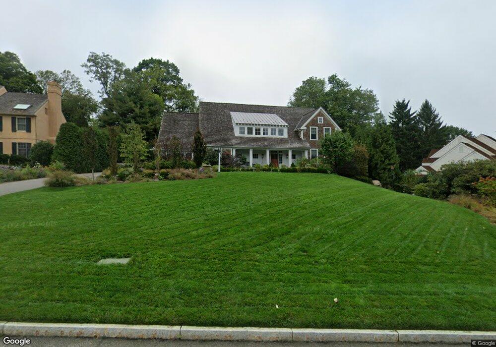
This home is located at 254 Ravenscliff Rd, Wayne, PA 19087 and is currently estimated at $2,318,108, approximately $496 per square foot. 254 Ravenscliff Rd is a home with nearby schools including Wayne Elementary School, Radnor Middle School, and Radnor Senior High School.
Ownership History
Date
Name
Owned For
Owner Type
Purchase Details
Closed on
Sep 15, 2016
Sold by
Bupp Karl E and Bupp Carol G
Bought by
Johnson Elizabeth J
Current Estimated Value
Purchase Details
Closed on
May 30, 2000
Sold by
B J Drueding Builders Inc
Bought by
Bupp Karl E and Bupp Carol G
Purchase Details
Closed on
May 25, 2000
Sold by
Ferraro Jane and Ferraro Josephine
Bought by
B J Drueding Builders Inc
Create a Home Valuation Report for This Property
The Home Valuation Report is an in-depth analysis detailing your home's value as well as a comparison with similar homes in the area
Home Values in the Area
Average Home Value in this Area
Purchase History
| Date | Buyer | Sale Price | Title Company |
|---|---|---|---|
| Johnson Elizabeth J | $537,000 | None Available | |
| Bupp Karl E | $475,000 | Commonwealth Land Title Ins | |
| B J Drueding Builders Inc | $275,000 | Commonwealth Land Title Ins |
Source: Public Records
Tax History Compared to Growth
Tax History
| Year | Tax Paid | Tax Assessment Tax Assessment Total Assessment is a certain percentage of the fair market value that is determined by local assessors to be the total taxable value of land and additions on the property. | Land | Improvement |
|---|---|---|---|---|
| 2025 | $28,811 | $1,425,000 | $297,230 | $1,127,770 |
| 2024 | $28,811 | $1,425,000 | $297,230 | $1,127,770 |
| 2023 | $27,669 | $1,425,000 | $297,230 | $1,127,770 |
| 2022 | $27,367 | $1,425,000 | $297,230 | $1,127,770 |
| 2021 | $43,959 | $1,425,000 | $297,230 | $1,127,770 |
| 2020 | $32,945 | $947,050 | $207,200 | $739,850 |
| 2019 | $32,016 | $947,050 | $207,200 | $739,850 |
| 2018 | $6,867 | $207,200 | $0 | $0 |
| 2017 | $6,723 | $207,200 | $0 | $0 |
| 2016 | $1,137 | $207,200 | $0 | $0 |
| 2015 | $1,160 | $207,200 | $0 | $0 |
| 2014 | $1,160 | $207,200 | $0 | $0 |
Source: Public Records
Map
Nearby Homes
- 201 Church Rd
- 1 Dunminning Rd
- 3314 Saint Davids Rd
- 203 Church St
- 238 Highland Ave
- 120 S Devon Ave
- 412 Fairview Dr
- 718 Lot 1 Waterloo
- 188 Abrahams Ln
- 5 Greythorne Woods Cir Unit 5
- 328 Conestoga Rd
- 232 Conestoga Rd
- 188 Conestoga Rd
- 123 Conestoga Rd
- 112 Conestoga Rd
- 641 Andover Rd
- 2 Sugartown Rd
- 0 Greenwell Ln
- 404 Dorset Rd
- 422 S Waterloo Rd
- 256 Ravenscliff Rd
- 252 Ravenscliff Rd
- 258 Ravenscliff Rd
- 250 Ravenscliff Rd
- 229 Ravenscliff Rd
- 225 Ravenscliff Rd
- 231 Ravenscliff Rd
- 260 Ravenscliff Rd
- 233 Ravenscliff Rd
- 223 Ravenscliff Rd
- 248 Ravenscliff Rd
- 809 Maple Glen Ln
- 846 Maplewood Rd
- 235 Ravenscliff Rd
- 262 Ravenscliff Rd
- 221 Ravenscliff Rd
- 215 Ravenscliff Rd
- 213 Ravenscliff Rd
- 217 Ravenscliff Rd
- 246 Ravenscliff Rd