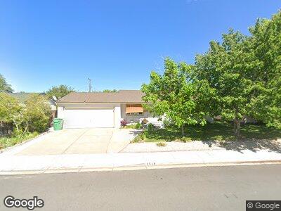
2540 Stine Way Sparks, NV 89431
McCarran Boulevard-Probasco NeighborhoodEstimated Value: $381,000 - $403,000
3
Beds
1
Bath
1,044
Sq Ft
$375/Sq Ft
Est. Value
About This Home
This home is located at 2540 Stine Way, Sparks, NV 89431 and is currently estimated at $390,981, approximately $374 per square foot. 2540 Stine Way is a home located in Washoe County with nearby schools including Florence Drake Elementary School, George L Dilworth Middle School, and Sparks High School.
Ownership History
Date
Name
Owned For
Owner Type
Purchase Details
Closed on
Sep 26, 1995
Sold by
Turner Patricia A
Bought by
Petersen Daniel and Petersen Maria
Current Estimated Value
Home Financials for this Owner
Home Financials are based on the most recent Mortgage that was taken out on this home.
Original Mortgage
$85,000
Outstanding Balance
$3,646
Interest Rate
7.97%
Mortgage Type
Seller Take Back
Estimated Equity
$371,951
Create a Home Valuation Report for This Property
The Home Valuation Report is an in-depth analysis detailing your home's value as well as a comparison with similar homes in the area
Home Values in the Area
Average Home Value in this Area
Purchase History
| Date | Buyer | Sale Price | Title Company |
|---|---|---|---|
| Petersen Daniel | $105,000 | First Centennial Title Co |
Source: Public Records
Mortgage History
| Date | Status | Borrower | Loan Amount |
|---|---|---|---|
| Closed | Petersan Maria | $30,100 | |
| Open | Petersen Daniel | $85,000 |
Source: Public Records
Tax History Compared to Growth
Tax History
| Year | Tax Paid | Tax Assessment Tax Assessment Total Assessment is a certain percentage of the fair market value that is determined by local assessors to be the total taxable value of land and additions on the property. | Land | Improvement |
|---|---|---|---|---|
| 2025 | $617 | $49,989 | $33,565 | $16,424 |
| 2024 | $600 | $46,270 | $30,065 | $16,205 |
| 2023 | $600 | $46,310 | $31,325 | $14,985 |
| 2022 | $586 | $38,374 | $26,180 | $12,194 |
| 2021 | $570 | $29,852 | $17,955 | $11,897 |
| 2020 | $551 | $28,614 | $16,940 | $11,674 |
| 2019 | $484 | $27,066 | $15,890 | $11,176 |
| 2018 | $471 | $22,465 | $11,725 | $10,740 |
| 2017 | $456 | $20,973 | $10,395 | $10,578 |
| 2016 | $444 | $19,908 | $9,345 | $10,563 |
| 2015 | $115 | $18,067 | $7,700 | $10,367 |
| 2014 | $431 | $16,255 | $6,440 | $9,815 |
| 2013 | -- | $13,901 | $4,270 | $9,631 |
Source: Public Records
Map
Nearby Homes
- 2455 Coppa Way
- 655 Gault Way
- 250 Galleron Way
- 990 York Way
- 715 Emerson Way
- 288 Richards Way
- 1945 4th St Unit 10
- 1945 4th St Unit 19
- 1940 4th St Unit 44
- 1940 4th St Unit 20
- 1145 Gault Way
- 1185 Plymouth Way
- 151 Quail St
- 1125 Vance Way
- 1180 Upton Way
- 1325 Dodson Way
- 40 Sheridan Way
- 1345 Plymouth Way
- 706 L St
- 55 E Richards Way