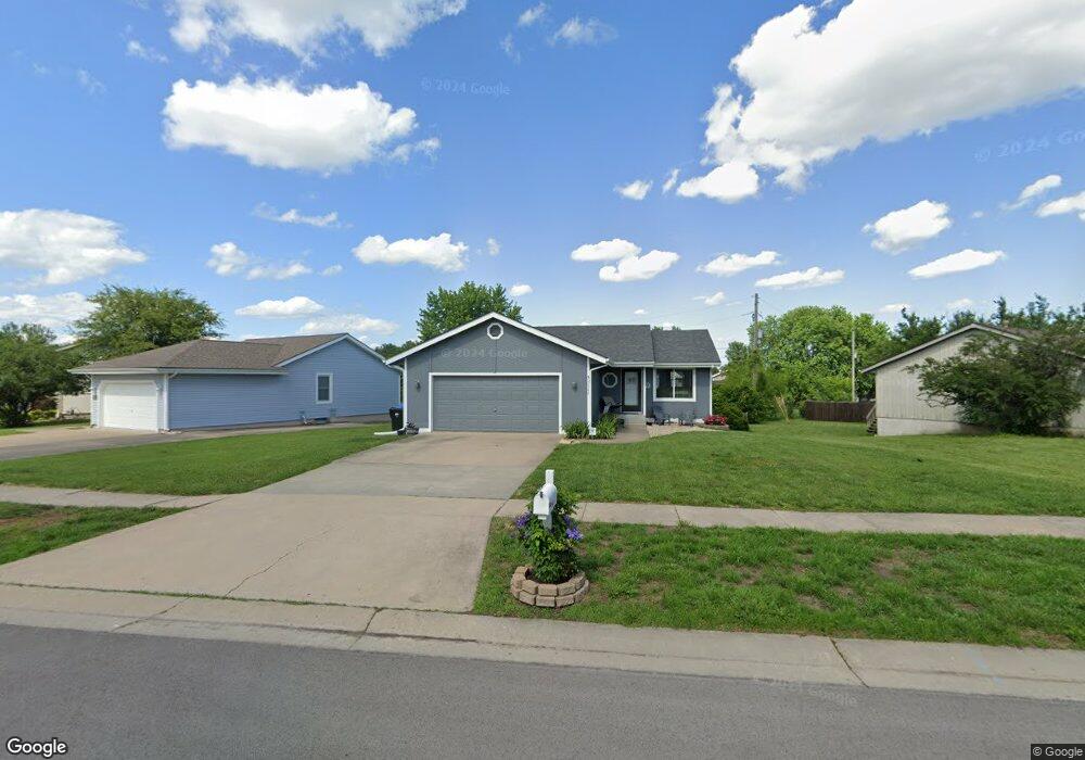
2542 SW Maxfield Rd Topeka, KS 66614
Southwest Topeka NeighborhoodEstimated Value: $232,000 - $275,000
4
Beds
3
Baths
1,040
Sq Ft
$236/Sq Ft
Est. Value
About This Home
This home is located at 2542 SW Maxfield Rd, Topeka, KS 66614 and is currently estimated at $245,736, approximately $236 per square foot. 2542 SW Maxfield Rd is a home located in Shawnee County with nearby schools including Indian Hills Elementary School, Washburn Rural Middle School, and Washburn Rural High School.
Ownership History
Date
Name
Owned For
Owner Type
Purchase Details
Closed on
Mar 20, 2008
Sold by
Hartzler Chris Alan and Hartzler Lisa Michelle
Bought by
Thulin Weslie K and Cook Thulin Shannon A
Current Estimated Value
Home Financials for this Owner
Home Financials are based on the most recent Mortgage that was taken out on this home.
Original Mortgage
$110,000
Outstanding Balance
$67,957
Interest Rate
5.67%
Mortgage Type
New Conventional
Estimated Equity
$177,779
Create a Home Valuation Report for This Property
The Home Valuation Report is an in-depth analysis detailing your home's value as well as a comparison with similar homes in the area
Home Values in the Area
Average Home Value in this Area
Purchase History
| Date | Buyer | Sale Price | Title Company |
|---|---|---|---|
| Thulin Weslie K | -- | Lawyers Title Of Topeka Inc |
Source: Public Records
Mortgage History
| Date | Status | Borrower | Loan Amount |
|---|---|---|---|
| Open | Thulin Weslie K | $110,000 |
Source: Public Records
Tax History Compared to Growth
Tax History
| Year | Tax Paid | Tax Assessment Tax Assessment Total Assessment is a certain percentage of the fair market value that is determined by local assessors to be the total taxable value of land and additions on the property. | Land | Improvement |
|---|---|---|---|---|
| 2025 | $3,525 | $23,525 | -- | -- |
| 2023 | $3,525 | $21,961 | $0 | $0 |
| 2022 | $3,118 | $19,608 | $0 | $0 |
| 2021 | $2,710 | $17,050 | $0 | $0 |
| 2020 | $2,505 | $16,085 | $0 | $0 |
| 2019 | $2,435 | $15,617 | $0 | $0 |
| 2018 | $2,332 | $15,016 | $0 | $0 |
| 2017 | $2,314 | $14,722 | $0 | $0 |
| 2014 | $2,204 | $13,881 | $0 | $0 |
Source: Public Records
Map
Nearby Homes
- 7419 SW 26th Ct
- 7319 SW 25th Ct
- 2418 SW Romar Rd
- 2604 SW Ancaster Rd
- 2401 SW Romar Rd
- 7622 SW 27th St
- 2801 SW Windermere Dr
- 2831 SW Bingham Rd
- 7700 SW 24th Terrace
- 7225 SW Marian Rd
- 7345 SW 23rd Ct
- 7237 SW 23rd Ct
- 7628 SW 28th Terrace
- 7741 SW 26th St
- 0000 SW 24th Terrace
- 2839 SW Santa fe Dr
- 2240 SW Millers Glen Dr
- 2747 SW Lagito Dr
- Blake Plan at Sherwood Park - Sherwood
- Olivia Plan at Sherwood Park - Sherwood
- 2534 SW Maxfield Rd
- 7430 SW 26th Ct
- 2526 SW Maxfield Rd
- 7418 SW 26th Ct
- 2538 SW Stutley Ct
- 2534 SW Stutley Ct
- 2518 SW Maxfield Rd
- 2547 SW Maxfield Rd
- 2605 SW Maxfield Rd
- 7412 SW 26th Ct
- 2541 SW Maxfield Rd
- 2535 SW Maxfield Rd
- 2529 SW Maxfield Rd
- 7427 SW 26th Ct
- 2514 SW Maxfield Rd
- 2523 SW Stutley Ct
- 7406 SW 26th Ct
- 2523 SW Maxfield Rd
- 2530 SW Stutley Ct
- 2508 SW Maxfield Rd