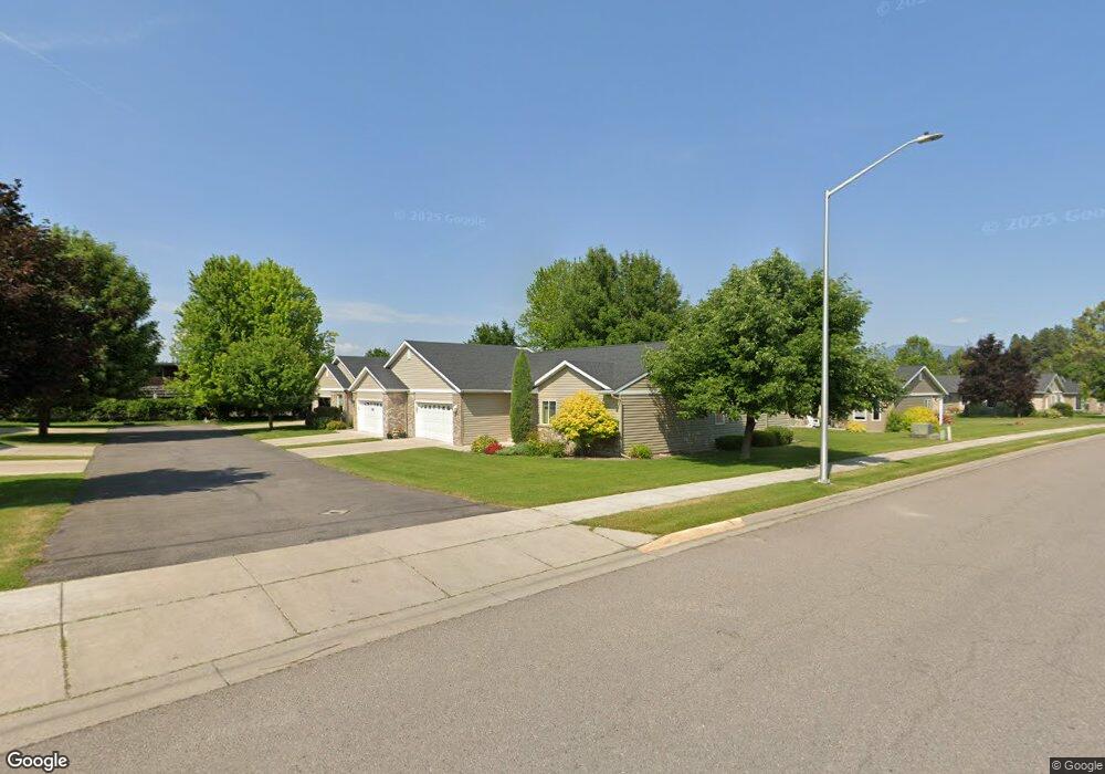
255 Commons Way Kalispell, MT 59901
Estimated Value: $399,000 - $583,622
3
Beds
2
Baths
1,555
Sq Ft
$342/Sq Ft
Est. Value
About This Home
This home is located at 255 Commons Way, Kalispell, MT 59901 and is currently estimated at $532,156, approximately $342 per square foot. 255 Commons Way is a home located in Flathead County with nearby schools including Edgerton School, Glacier High School, and Trinity Lutheran School.
Ownership History
Date
Name
Owned For
Owner Type
Purchase Details
Closed on
Dec 7, 2020
Sold by
Kahil Linda F
Bought by
Strickland Frank R and Strickland Michelle D
Current Estimated Value
Purchase Details
Closed on
Nov 19, 2020
Sold by
Kahil Linda F
Bought by
Estate Of Joan A Johnson
Purchase Details
Closed on
Jul 17, 2015
Sold by
Abel Lucille K
Bought by
Johnson Leigh and Johnson Joan A
Purchase Details
Closed on
Apr 19, 2011
Sold by
Abel Thomas E
Bought by
Abel Lucille K
Purchase Details
Closed on
Feb 2, 2010
Sold by
Abel Lucille K
Bought by
Abel Lucille K and Abel Thomas E
Create a Home Valuation Report for This Property
The Home Valuation Report is an in-depth analysis detailing your home's value as well as a comparison with similar homes in the area
Home Values in the Area
Average Home Value in this Area
Purchase History
| Date | Buyer | Sale Price | Title Company |
|---|---|---|---|
| Strickland Frank R | -- | Insured Titles | |
| Estate Of Joan A Johnson | -- | None Available | |
| Johnson Leigh | -- | First American Title Company | |
| Abel Lucille K | -- | None Available | |
| Abel Lucille K | -- | None Available |
Source: Public Records
Tax History Compared to Growth
Tax History
| Year | Tax Paid | Tax Assessment Tax Assessment Total Assessment is a certain percentage of the fair market value that is determined by local assessors to be the total taxable value of land and additions on the property. | Land | Improvement |
|---|---|---|---|---|
| 2025 | $3,498 | $628,500 | $0 | $0 |
| 2024 | $3,689 | $473,700 | $0 | $0 |
| 2023 | $4,142 | $473,700 | $0 | $0 |
| 2022 | $3,334 | $331,900 | $0 | $0 |
| 2021 | $3,572 | $331,900 | $0 | $0 |
| 2020 | $3,766 | $304,500 | $0 | $0 |
| 2019 | $3,773 | $304,500 | $0 | $0 |
| 2018 | $3,660 | $281,900 | $0 | $0 |
| 2017 | $3,672 | $281,900 | $0 | $0 |
| 2016 | $3,034 | $249,700 | $0 | $0 |
| 2015 | $1,348 | $249,700 | $0 | $0 |
| 2014 | $1,750 | $157,250 | $0 | $0 |
Source: Public Records
Map
Nearby Homes
- 237 Commons Way
- 219 Commons Way
- 143 Indian Trail Rd
- 314 Ponderosa St
- NHN Grandview
- 302 Ponderosa St
- 376 Ponderosa St
- 328 Harrison Blvd
- 2 & 4 Parkway Dr
- 262 Buffalo Hill Dr
- 111 Westview Park Place
- 187 Meadow Vista Loop Unit A
- 178 Meadow Vista Loop Unit A
- 157 Meadow Vista Loop Unit A
- 128 River View Dr
- 175 Meadow Vista Loop Unit B
- 175 Meadow Vista Loop Unit A
- 120 Northern Lights Blvd
- 159 Northland Dr
- 125 Sherry Ln
- 257 Commons Way
- 259 Commons Way
- 271 Commons Way
- 239 Commons Way
- 273 Commons Way
- 241 Commons Way
- LOT 3 Commons Way
- LOT 6 Commons Way
- LOT 2 Commons Way
- LOT 4 Commons Way
- LOT 5 Commons Way
- LOT 1 Commons Way
- 275 Commons Way
- 155 Indian Trail Rd
- 161 Indian Trail Rd
- 161 Indian Trail Rd Unit 2
- 161 Indian Trail Rd Unit 1
- 161 Indian Trail Rd Unit 3
- 291 Commons Way
- 293 Commons Way