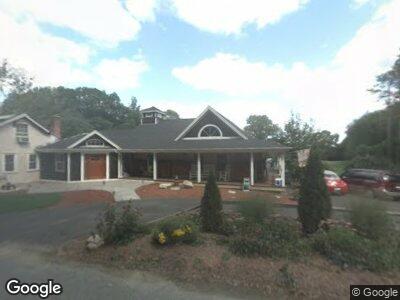
255 Paine Rd Pomfret Center, CT 06259
Estimated Value: $313,000 - $685,000
3
Beds
2
Baths
3,216
Sq Ft
$154/Sq Ft
Est. Value
About This Home
This home is located at 255 Paine Rd, Pomfret Center, CT 06259 and is currently estimated at $496,641, approximately $154 per square foot. 255 Paine Rd is a home with nearby schools including Pomfret Community School.
Ownership History
Date
Name
Owned For
Owner Type
Purchase Details
Closed on
Feb 19, 2010
Sold by
Davis Joyce E
Bought by
Nuttall Daniel E and Nuttall Cheryl A
Current Estimated Value
Purchase Details
Closed on
Nov 15, 2000
Sold by
Paine Ruth C
Bought by
Davis Harry L and Davis Joyce E
Home Financials for this Owner
Home Financials are based on the most recent Mortgage that was taken out on this home.
Original Mortgage
$89,240
Interest Rate
7.78%
Mortgage Type
Purchase Money Mortgage
Create a Home Valuation Report for This Property
The Home Valuation Report is an in-depth analysis detailing your home's value as well as a comparison with similar homes in the area
Home Values in the Area
Average Home Value in this Area
Purchase History
| Date | Buyer | Sale Price | Title Company |
|---|---|---|---|
| Nuttall Daniel E | -- | -- | |
| Davis Harry L | $92,000 | -- |
Source: Public Records
Mortgage History
| Date | Status | Borrower | Loan Amount |
|---|---|---|---|
| Open | Nuttall Daniel E | $170,000 | |
| Previous Owner | Davis Harry L | $40,000 | |
| Previous Owner | Davis Harry L | $150,000 | |
| Previous Owner | Davis Harry L | $89,240 |
Source: Public Records
Tax History Compared to Growth
Tax History
| Year | Tax Paid | Tax Assessment Tax Assessment Total Assessment is a certain percentage of the fair market value that is determined by local assessors to be the total taxable value of land and additions on the property. | Land | Improvement |
|---|---|---|---|---|
| 2024 | $10,233 | $224,400 | $52,500 | $171,900 |
| 2023 | $6,003 | $224,400 | $52,500 | $171,900 |
| 2022 | $6,000 | $224,400 | $52,500 | $171,900 |
| 2021 | $5,949 | $224,400 | $52,500 | $171,900 |
| 2020 | $5,043 | $182,600 | $50,300 | $132,300 |
| 2019 | $4,963 | $182,600 | $50,300 | $132,300 |
| 2018 | $4,912 | $182,600 | $50,300 | $132,300 |
| 2017 | $5,283 | $182,600 | $50,300 | $132,300 |
| 2016 | $4,675 | $182,600 | $50,300 | $132,300 |
| 2015 | $5,086 | $201,500 | $65,900 | $135,600 |
| 2014 | $5,064 | $201,500 | $65,900 | $135,600 |
Source: Public Records
Map
Nearby Homes
- 231 Paine Rd
- 44 Rich Rd
- 834 Hampton Rd
- 13 Brooklyn Rd
- 299 Hampton Rd
- 338 Brooklyn Rd
- 190 Covell Rd
- 11 Cheney Rd
- 492 Taft Pond Rd
- 187 Chaplin Rd
- 562 Taft Pond Rd
- 17 Eastford Rd
- 36 Blossom Dr
- 106 Kennerson Reservoir Rd
- 15 Wolf Den Dr
- 41 Millbridge Rd
- 70 Brayman Hollow Rd
- 308 Orchard Hill Rd
- 74 Woodward Rd
- 00 Sarah Pearl Rd