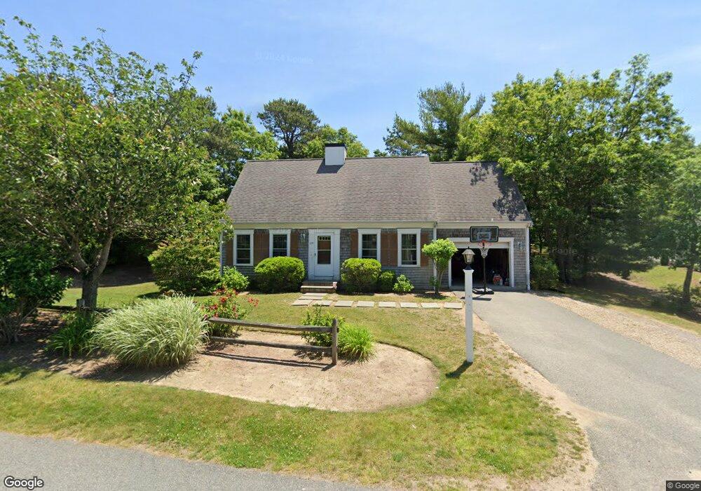
255 Pheasant Hill Cir Cotuit, MA 2635
Cotuit NeighborhoodEstimated Value: $371,000 - $576,000
3
Beds
2
Baths
1,155
Sq Ft
$385/Sq Ft
Est. Value
About This Home
This home is located at 255 Pheasant Hill Cir, Cotuit, MA 2635 and is currently estimated at $445,064, approximately $385 per square foot. 255 Pheasant Hill Cir is a home located in Barnstable County with nearby schools including West Villages Elementary School, Barnstable United Elementary School, and Barnstable Intermediate School.
Ownership History
Date
Name
Owned For
Owner Type
Purchase Details
Closed on
Sep 17, 2009
Sold by
Cotuit Equitable Hsng
Bought by
Sharpe Ellen M
Current Estimated Value
Home Financials for this Owner
Home Financials are based on the most recent Mortgage that was taken out on this home.
Original Mortgage
$144,000
Outstanding Balance
$94,605
Interest Rate
5.28%
Mortgage Type
Purchase Money Mortgage
Estimated Equity
$350,459
Create a Home Valuation Report for This Property
The Home Valuation Report is an in-depth analysis detailing your home's value as well as a comparison with similar homes in the area
Home Values in the Area
Average Home Value in this Area
Purchase History
| Date | Buyer | Sale Price | Title Company |
|---|---|---|---|
| Sharpe Ellen M | $160,000 | -- |
Source: Public Records
Mortgage History
| Date | Status | Borrower | Loan Amount |
|---|---|---|---|
| Open | Sharpe Ellen M | $144,000 |
Source: Public Records
Tax History
| Year | Tax Paid | Tax Assessment Tax Assessment Total Assessment is a certain percentage of the fair market value that is determined by local assessors to be the total taxable value of land and additions on the property. | Land | Improvement |
|---|---|---|---|---|
| 2025 | $2,386 | $285,800 | $125,600 | $160,200 |
| 2024 | $2,199 | $279,000 | $125,600 | $153,400 |
| 2023 | $2,208 | $263,800 | $124,300 | $139,500 |
| 2022 | $2,039 | $197,200 | $79,600 | $117,600 |
| 2021 | $2,070 | $187,500 | $84,600 | $102,900 |
| 2020 | $2,220 | $189,600 | $89,600 | $100,000 |
| 2019 | $2,207 | $185,800 | $94,600 | $91,200 |
| 2018 | $2,056 | $173,100 | $94,300 | $78,800 |
| 2017 | $2,033 | $172,300 | $96,900 | $75,400 |
| 2016 | $1,821 | $158,200 | $82,100 | $76,100 |
| 2015 | $1,795 | $155,800 | $78,700 | $77,100 |
Source: Public Records
Map
Nearby Homes
- 16 Spring Brook Ln
- 22 Stratford Ridge Unit 22
- 4 Bishops Park
- 195 Falmouth Rd Unit 19F
- 195 Falmouth Rd Unit 9D
- 195 Falmouth Rd Unit 19F
- 35 Claulise Ln
- 70 Cape Dr Unit 14D
- 70 Cape Dr Unit 15D
- 70 Cape Dr Unit 11D
- 70 Cape Dr Unit 15D
- 70 Cape Dr Unit 11D
- 10 Butler Ln
- 226 Dunrobin Rd
- 70 Simons Rd Unit E
- 70 Simons Rd
- 173 Main St
- 235 Main St
- 114 Orchard Rd
- 75 Bob White Run
- 267 Pheasant Hill Cir
- 5 Osprey Dr
- 19 Osprey Dr
- 258 Pheasant Hill Cir
- 19 Osprey Dr
- 254 Pheasant Hill Cir
- 266 Pheasant Hill Cir
- 248 Pheasant Hill Cir
- 29 Osprey Dr
- 240 Pheasant Hill Cir
- 277 Pheasant Hill Cir
- 266 Pheasant Hill Cir
- 29 Osprey
- 277 Pheasant Hill Cir
- 240 Pheasant Hill Cir
- 276 Pheasant Hill Cir
- 37 Osprey Dr
- 232 Pheasant Hill Cir
- 287 Pheasant Hill Cir
- 12 Osprey Dr
Your Personal Tour Guide
Ask me questions while you tour the home.