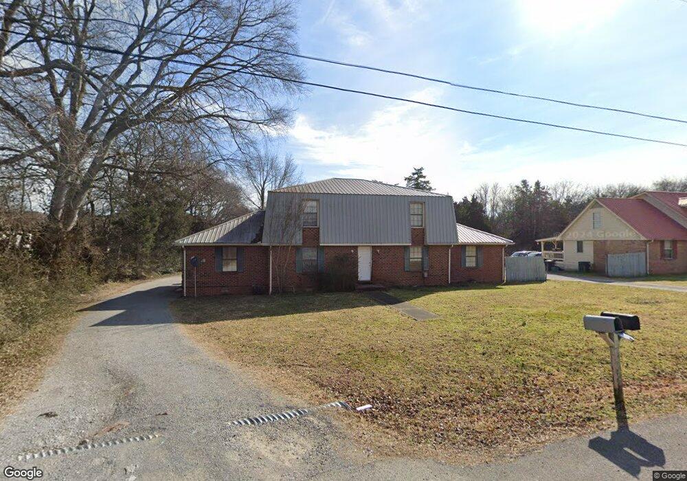
2553 Carriage Dr Unit A Murfreesboro, TN 37128
Estimated Value: $297,000 - $416,961
6
Beds
4
Baths
2,953
Sq Ft
$121/Sq Ft
Est. Value
About This Home
This home is located at 2553 Carriage Dr Unit A, Murfreesboro, TN 37128 and is currently estimated at $357,490, approximately $121 per square foot. 2553 Carriage Dr Unit A is a home located in Rutherford County with nearby schools including Barfield Elementary School, Salem Elementary School, and Christiana Middle School.
Ownership History
Date
Name
Owned For
Owner Type
Purchase Details
Closed on
Jul 8, 2014
Sold by
Parks Linda
Bought by
Canterbury Robert Alvie Mary Ange
Current Estimated Value
Home Financials for this Owner
Home Financials are based on the most recent Mortgage that was taken out on this home.
Original Mortgage
$96,000
Outstanding Balance
$73,396
Interest Rate
4.26%
Mortgage Type
New Conventional
Estimated Equity
$284,094
Purchase Details
Closed on
Sep 12, 1994
Sold by
Leonard Norris
Bought by
Leonard Norris
Create a Home Valuation Report for This Property
The Home Valuation Report is an in-depth analysis detailing your home's value as well as a comparison with similar homes in the area
Home Values in the Area
Average Home Value in this Area
Purchase History
| Date | Buyer | Sale Price | Title Company |
|---|---|---|---|
| Canterbury Robert Alvie Mary Ange | $120,000 | -- | |
| Leonard Norris | -- | -- |
Source: Public Records
Mortgage History
| Date | Status | Borrower | Loan Amount |
|---|---|---|---|
| Open | Canterbury Robert Alvie Mary Ange | $96,000 |
Source: Public Records
Tax History Compared to Growth
Tax History
| Year | Tax Paid | Tax Assessment Tax Assessment Total Assessment is a certain percentage of the fair market value that is determined by local assessors to be the total taxable value of land and additions on the property. | Land | Improvement |
|---|---|---|---|---|
| 2025 | $3,326 | $117,560 | $13,000 | $104,560 |
| 2024 | $3,326 | $117,560 | $13,000 | $104,560 |
| 2023 | $2,206 | $117,560 | $13,000 | $104,560 |
| 2022 | $1,900 | $117,560 | $13,000 | $104,560 |
| 2021 | $1,867 | $84,120 | $13,000 | $71,120 |
| 2020 | $1,867 | $84,120 | $13,000 | $71,120 |
| 2019 | $1,867 | $84,120 | $13,000 | $71,120 |
| 2018 | $2,565 | $84,120 | $0 | $0 |
| 2017 | $2,321 | $59,720 | $0 | $0 |
| 2016 | $2,322 | $59,720 | $0 | $0 |
| 2015 | $2,322 | $59,720 | $0 | $0 |
| 2014 | $1,485 | $59,720 | $0 | $0 |
| 2013 | -- | $51,560 | $0 | $0 |
Source: Public Records
Map
Nearby Homes
- 252 Shoshone Place
- 304 Shoshone Place
- 301 Arapaho Dr
- 0 Caroline Dr
- 304 Arapaho Dr
- 232 Arapaho Dr
- 354 Arapaho Dr
- 423 Forest Glen Cir
- 443 Forest Glen Cir
- 262 Indian Park Dr
- 2702 Comer Dr
- 646 Forest Glen Cir
- 292 Indian Park Dr
- 2638 Big Eagle Trail
- 602 Village Green Cir
- 644 Village Green Cir
- 905 Red Feather Trail
- 2555 Shinnecock Ct
- 2727 Oxford Hall Ave
- 207 Black Hawk Way
- 2563 Carriage Dr Unit A
- 247 Shoshone Place
- 2554 Carriage Dr
- 245 Shoshone Place
- 255 Shoshone Place
- 257 Shoshone Place
- 253 Shoshone Place
- 241 Shoshone Place
- 301 Shoshone Place
- 301 Shoshone Place Unit 44
- 303 Shoshone Place
- 303 Shoshone Place Unit 45
- 2573 Carriage Dr
- 305 Shoshone Place
- 307 Shoshone Place
- 234 Shoshone Place
- 236 Shoshone Place
- 311 Shoshone Place
- 244 Shoshone Place
- 252 Shoshone Place Unit 28
