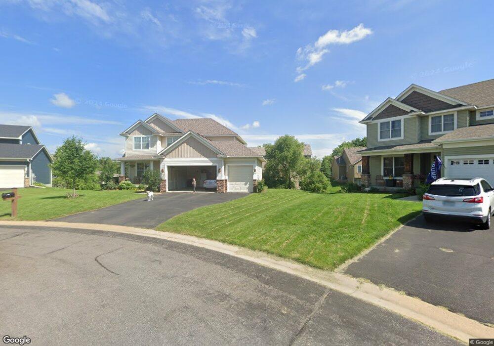
2555 Border Pine Ct Saint Paul, MN 55110
Estimated Value: $481,000 - $567,000
4
Beds
3
Baths
2,332
Sq Ft
$223/Sq Ft
Est. Value
About This Home
This home is located at 2555 Border Pine Ct, Saint Paul, MN 55110 and is currently estimated at $518,918, approximately $222 per square foot. 2555 Border Pine Ct is a home located in Ramsey County with nearby schools including Lincoln Elementary School, Central Middle School, and St. Jude of the Lake Catholic School.
Ownership History
Date
Name
Owned For
Owner Type
Purchase Details
Closed on
Jun 3, 2016
Sold by
Fallon Richard J
Bought by
Blauer Joshua J and Blauer Bess
Current Estimated Value
Home Financials for this Owner
Home Financials are based on the most recent Mortgage that was taken out on this home.
Original Mortgage
$342,000
Outstanding Balance
$272,548
Interest Rate
3.61%
Mortgage Type
New Conventional
Estimated Equity
$246,370
Create a Home Valuation Report for This Property
The Home Valuation Report is an in-depth analysis detailing your home's value as well as a comparison with similar homes in the area
Home Values in the Area
Average Home Value in this Area
Purchase History
| Date | Buyer | Sale Price | Title Company |
|---|---|---|---|
| Blauer Joshua J | $360,000 | Burnet Title |
Source: Public Records
Mortgage History
| Date | Status | Borrower | Loan Amount |
|---|---|---|---|
| Open | Blauer Joshua J | $342,000 |
Source: Public Records
Tax History
| Year | Tax Paid | Tax Assessment Tax Assessment Total Assessment is a certain percentage of the fair market value that is determined by local assessors to be the total taxable value of land and additions on the property. | Land | Improvement |
|---|---|---|---|---|
| 2025 | $5,572 | $480,800 | $62,000 | $418,800 |
| 2023 | $5,572 | $429,500 | $62,000 | $367,500 |
| 2022 | $4,788 | $373,900 | $62,000 | $311,900 |
| 2021 | $4,342 | $346,800 | $62,000 | $284,800 |
| 2020 | $4,910 | $326,600 | $62,000 | $264,600 |
| 2019 | $4,486 | $349,800 | $62,000 | $287,800 |
| 2018 | $4,724 | $342,600 | $62,000 | $280,600 |
| 2017 | $3,944 | $356,900 | $62,000 | $294,900 |
| 2016 | $3,906 | $0 | $0 | $0 |
| 2015 | $3,794 | $287,300 | $57,900 | $229,400 |
| 2014 | $4,134 | $0 | $0 | $0 |
Source: Public Records
Map
Nearby Homes
- 5888 Pintail Ln
- 2561 Blue Bill Cir
- 2618 Parkview Dr
- 5441 Ridgeway St
- 5285 Northwest Ave
- 2676 Stillwater St
- 5301 Oakwood Dr
- 12255 Ethan Ave N
- 12831 Foxhill Ave N
- 12757 Ferrara Ave N
- 5145 Long Ave
- 11 High Point Rd
- 5568 129th Dr N
- 6 Troon Ct
- 11535 Hillcrest Ct N
- 5760 131st St N
- 2249 11th St
- 219X 12th St
- 13037 Europa Trail Way N Unit F
- 13061 Europa Trail Way N Unit D
- 2565 Border Pine Ct
- 2578 Bloom Rd
- 2568 Bloom Rd
- 2588 Bloom Rd
- 2545 Border Pine Ct
- 2575 Border Pine Ct
- 2536 Border Pine Ct
- 5738 Morgan Trail
- 0 Morgan Trail Unit 3652406
- 2558 Bloom Rd
- 5728 Morgan Trail
- 5748 Morgan Trail
- 2546 Border Pine Ct
- 2585 Border Pine Ct
- 2556 Border Pine Ct
- 2566 Border Pine Ct
- 5718 Morgan Trail
- 5739 Morgan Trail
- 0 Border Pine Ct
- 2571 Bloom Rd
Your Personal Tour Guide
Ask me questions while you tour the home.