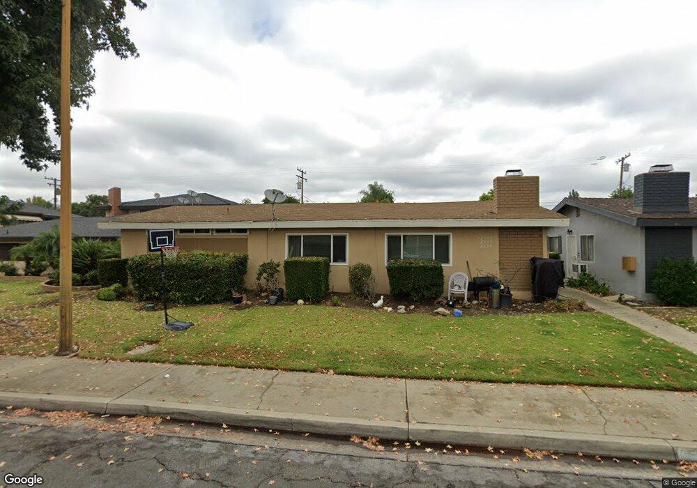
2555 Price Dr La Verne, CA 91750
Old Town NeighborhoodEstimated Value: $925,000 - $1,322,000
5
Beds
5
Baths
3,916
Sq Ft
$299/Sq Ft
Est. Value
About This Home
This home is located at 2555 Price Dr, La Verne, CA 91750 and is currently estimated at $1,172,667, approximately $299 per square foot. 2555 Price Dr is a home located in Los Angeles County with nearby schools including J. Marion Roynon Elementary School, Ramona Middle School, and Bonita High School.
Ownership History
Date
Name
Owned For
Owner Type
Purchase Details
Closed on
Jan 15, 2024
Sold by
Ford Carolann K
Bought by
Ckf Trust and Ford
Current Estimated Value
Purchase Details
Closed on
Jun 16, 2003
Sold by
Ford Carolann K
Bought by
Ford Carolann K
Home Financials for this Owner
Home Financials are based on the most recent Mortgage that was taken out on this home.
Original Mortgage
$200,400
Interest Rate
5.15%
Mortgage Type
Purchase Money Mortgage
Purchase Details
Closed on
Sep 27, 2001
Sold by
Ford Carolann
Bought by
Ford Carolann K and Ckf Trust
Purchase Details
Closed on
Oct 6, 2000
Sold by
Mendoza Emmanuel C
Bought by
Ford Carolann
Home Financials for this Owner
Home Financials are based on the most recent Mortgage that was taken out on this home.
Original Mortgage
$192,448
Interest Rate
7.08%
Create a Home Valuation Report for This Property
The Home Valuation Report is an in-depth analysis detailing your home's value as well as a comparison with similar homes in the area
Home Values in the Area
Average Home Value in this Area
Purchase History
| Date | Buyer | Sale Price | Title Company |
|---|---|---|---|
| Ckf Trust | -- | None Listed On Document | |
| Ford Carolann K | -- | Southland Title | |
| Ford Carolann K | -- | -- | |
| Ford Carolann | $248,000 | Orange Coast Title |
Source: Public Records
Mortgage History
| Date | Status | Borrower | Loan Amount |
|---|---|---|---|
| Previous Owner | Ford Carolann K | $200,400 | |
| Previous Owner | Ford Carolann | $192,448 |
Source: Public Records
Tax History Compared to Growth
Tax History
| Year | Tax Paid | Tax Assessment Tax Assessment Total Assessment is a certain percentage of the fair market value that is determined by local assessors to be the total taxable value of land and additions on the property. | Land | Improvement |
|---|---|---|---|---|
| 2025 | $5,072 | $373,672 | $150,673 | $222,999 |
| 2024 | $5,072 | $366,346 | $147,719 | $218,627 |
| 2023 | $4,967 | $359,164 | $144,823 | $214,341 |
| 2022 | $4,883 | $352,123 | $141,984 | $210,139 |
| 2021 | $4,773 | $345,219 | $139,200 | $206,019 |
| 2019 | $4,682 | $334,981 | $135,072 | $199,909 |
| 2018 | $4,363 | $328,414 | $132,424 | $195,990 |
| 2016 | $4,170 | $315,664 | $127,283 | $188,381 |
| 2015 | $4,106 | $310,924 | $125,372 | $185,552 |
| 2014 | $4,081 | $304,835 | $122,917 | $181,918 |
Source: Public Records
Map
Nearby Homes
- 3252 Florinda St
- 3945 Bradford St Unit 39
- 3945 Bradford St Unit 18
- 3043 N White Ave
- 3036 Knollwood Ave
- 3149 Florinda St
- 3025 N White Ave
- 2376 Lomeli Ln
- 3015 Knollwood Ave Unit 4
- 371 French Ln
- 306 Ivy Ct
- 3800 Bradford St Unit 233
- 3800 Bradford St Unit 138
- 3800 Bradford St Unit 85
- 3800 Bradford St Unit 188
- 3800 Bradford St Unit 182
- 3800 Bradford St Unit 265
- 2734 Grove St
- 3724 Live Oak Dr
- 2810 Nordland Ave
- 2543 Price Dr
- 2561 Price Dr
- 2537 Price Dr
- 2573 Price Dr
- 2560 Hayes Dr
- 2546 Hayes Dr
- 2566 Hayes Dr
- 2540 Hayes Dr
- 2554 Price Dr
- 2562 Price Dr
- 2531 Price Dr
- 2542 Price Dr
- 2587 Price Dr
- 2580 Hayes Dr
- 2539 Price Dr
- 2547 Price Dr
- 2574 Price Dr
- 2528 Hayes Dr Unit 2528 Hayes Drive
- 2528 Hayes Dr
- 2536 Price Dr