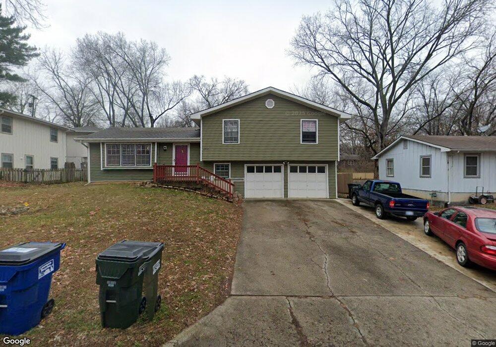
2557 Ousdahl Rd Lawrence, KS 66046
Estimated Value: $258,498 - $284,000
3
Beds
2
Baths
1,360
Sq Ft
$200/Sq Ft
Est. Value
About This Home
This home is located at 2557 Ousdahl Rd, Lawrence, KS 66046 and is currently estimated at $271,625, approximately $199 per square foot. 2557 Ousdahl Rd is a home located in Douglas County with nearby schools including Schwegler Elementary School, Billy Mills Middle School, and Lawrence High School.
Ownership History
Date
Name
Owned For
Owner Type
Purchase Details
Closed on
Apr 21, 2016
Sold by
Mucci David T and Mihalyi Marti C
Bought by
Outhonesak Tom and Outhonesak Bounnam
Current Estimated Value
Home Financials for this Owner
Home Financials are based on the most recent Mortgage that was taken out on this home.
Original Mortgage
$141,980
Outstanding Balance
$112,794
Interest Rate
3.68%
Mortgage Type
FHA
Estimated Equity
$158,831
Create a Home Valuation Report for This Property
The Home Valuation Report is an in-depth analysis detailing your home's value as well as a comparison with similar homes in the area
Home Values in the Area
Average Home Value in this Area
Purchase History
| Date | Buyer | Sale Price | Title Company |
|---|---|---|---|
| Outhonesak Tom | -- | Security 1St Title |
Source: Public Records
Mortgage History
| Date | Status | Borrower | Loan Amount |
|---|---|---|---|
| Open | Outhonesak Tom | $141,980 |
Source: Public Records
Tax History Compared to Growth
Tax History
| Year | Tax Paid | Tax Assessment Tax Assessment Total Assessment is a certain percentage of the fair market value that is determined by local assessors to be the total taxable value of land and additions on the property. | Land | Improvement |
|---|---|---|---|---|
| 2025 | $2,984 | $26,473 | $5,750 | $20,723 |
| 2024 | $2,984 | $24,599 | $5,405 | $19,194 |
| 2023 | $3,005 | $23,656 | $5,175 | $18,481 |
| 2022 | $2,715 | $21,264 | $4,830 | $16,434 |
| 2021 | $2,565 | $19,332 | $3,795 | $15,537 |
| 2020 | $2,392 | $18,147 | $3,795 | $14,352 |
| 2019 | $2,199 | $16,721 | $3,449 | $13,272 |
| 2018 | $2,204 | $16,641 | $3,449 | $13,192 |
| 2017 | $2,228 | $16,629 | $3,449 | $13,180 |
| 2016 | $1,658 | $13,007 | $2,760 | $10,247 |
| 2015 | -- | $13,973 | $2,760 | $11,213 |
| 2014 | -- | $14,283 | $2,760 | $11,523 |
Source: Public Records
Map
Nearby Homes
- 1834 W 27th Terrace
- 2439 Jasu Dr
- 1114 W 25th St
- 1214 W 29th Ct
- 2726 Chipperfield Rd
- 2728 Chipperfield Rd
- 731 W 25th St
- 1620 W 20th Terrace
- 1738 W 20th St
- 2912 Harrison Ave
- 314 Oklahoma St
- 3013 W 23rd Terrace
- 3024 W 23rd Terrace
- 2234 Tennessee St
- 2223 Breckenridge Dr
- 3003 W 29th Terrace
- 2421 Atchison Ave
- 2218 Vail Way
- 1807 Alabama St
- 2301 Massachusetts St
- 2551 Ousdahl Rd
- 2546 Cedarwood Ave
- 2552 Cedarwood Ave
- 2545 Ousdahl Rd
- 2569 Ousdahl Rd
- 2540 Cedarwood Ave
- 2556 Ousdahl Rd
- 2550 Ousdahl Rd
- 2564 Ousdahl Rd
- 2539 Ousdahl Rd
- 2564 Cedarwood Ave
- 2575 Ousdahl Rd
- 2532 Cedarwood Ave
- 2537 Cedarwood Ave
- 2572 Ousdahl Rd
- 2570 Cedarwood Ave
- 2538 Ousdahl Rd
- 1524 W 26th St
- 1513 W 25th Ct
- 2533 Ousdahl Rd