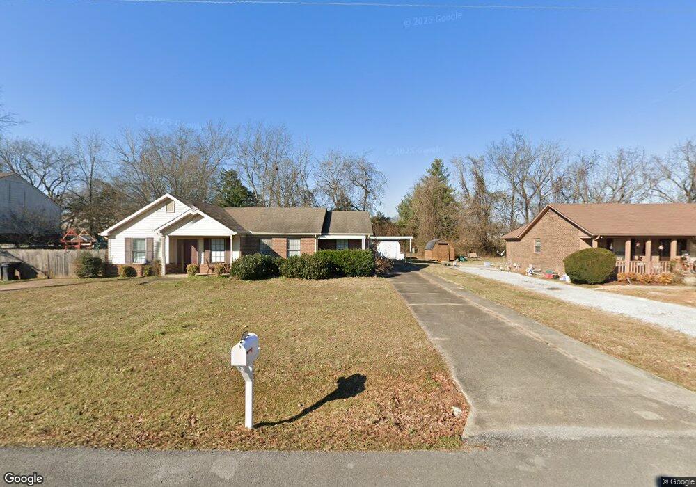
2565 Oak Hill Dr Murfreesboro, TN 37130
Estimated Value: $187,000 - $234,000
Studio
1
Bath
924
Sq Ft
$229/Sq Ft
Est. Value
About This Home
This home is located at 2565 Oak Hill Dr, Murfreesboro, TN 37130 and is currently estimated at $211,887, approximately $229 per square foot. 2565 Oak Hill Dr is a home located in Rutherford County with nearby schools including John Pittard Elementary School, Oakland Middle School, and Oakland High School.
Ownership History
Date
Name
Owned For
Owner Type
Purchase Details
Closed on
Aug 21, 2009
Sold by
Kidd Randall
Bought by
Hoover Pamela
Current Estimated Value
Home Financials for this Owner
Home Financials are based on the most recent Mortgage that was taken out on this home.
Original Mortgage
$63,000
Outstanding Balance
$40,761
Interest Rate
5.14%
Mortgage Type
Purchase Money Mortgage
Estimated Equity
$171,126
Purchase Details
Closed on
Aug 18, 2006
Sold by
Paul Kidd
Bought by
Kidd and Deborah
Purchase Details
Closed on
Apr 4, 2003
Sold by
Cole Sean P
Bought by
Kidd and Keborah
Purchase Details
Closed on
Apr 7, 2000
Sold by
Thomas Blair Joel
Bought by
Cole Sean P
Purchase Details
Closed on
Jul 8, 1999
Sold by
Blair Gayle N
Bought by
Blair Joel T
Home Financials for this Owner
Home Financials are based on the most recent Mortgage that was taken out on this home.
Original Mortgage
$33,508
Interest Rate
7.23%
Create a Home Valuation Report for This Property
The Home Valuation Report is an in-depth analysis detailing your home's value as well as a comparison with similar homes in the area
Home Values in the Area
Average Home Value in this Area
Purchase History
| Date | Buyer | Sale Price | Title Company |
|---|---|---|---|
| Hoover Pamela | $79,000 | -- | |
| Hoover Pamela | $79,000 | -- | |
| Kidd | -- | -- | |
| Kidd | -- | -- | |
| Kidd | $64,000 | -- | |
| Cole Sean P | $53,000 | -- | |
| Blair Joel T | -- | -- |
Source: Public Records
Mortgage History
| Date | Status | Borrower | Loan Amount |
|---|---|---|---|
| Open | Hoover Pamela | $63,000 | |
| Closed | Hoover Pamela | $0 | |
| Closed | Blair Joel T | $63,000 | |
| Previous Owner | Blair Joel T | $33,508 |
Source: Public Records
Tax History
| Year | Tax Paid | Tax Assessment Tax Assessment Total Assessment is a certain percentage of the fair market value that is determined by local assessors to be the total taxable value of land and additions on the property. | Land | Improvement |
|---|---|---|---|---|
| 2025 | $1,028 | $36,363 | $8,750 | $27,613 |
| 2024 | $1,028 | $36,363 | $8,750 | $27,613 |
| 2023 | $682 | $36,363 | $8,750 | $27,613 |
| 2022 | $588 | $36,363 | $8,750 | $27,613 |
| 2021 | $591 | $26,638 | $6,000 | $20,638 |
| 2020 | $591 | $26,638 | $6,000 | $20,638 |
| 2019 | $591 | $26,638 | $6,000 | $20,638 |
| 2018 | $812 | $26,638 | $0 | $0 |
| 2017 | $826 | $21,250 | $0 | $0 |
| 2016 | $826 | $21,250 | $0 | $0 |
| 2015 | $826 | $21,250 | $0 | $0 |
| 2014 | $528 | $21,250 | $0 | $0 |
| 2013 | -- | $19,950 | $0 | $0 |
Source: Public Records
Map
Nearby Homes
- 2127 Patriot Dr
- 2164 White Poplar Ct
- 2111 White Poplar Ct
- 2236 Patriot Dr
- 788 Dejarnette Ln
- 2475 Oak Hill Dr
- 2116 Herring Crossing
- 1518 Anatole Ct
- 2094 Leamington Ln
- 2092 Leamington Ln
- 0 Pitts Ln
- 2403 English Hill Dr
- 2422 English Hill Dr
- 1722 Drayton Dr
- 0 Dejarnette Ln Unit RTC3152425
- 2530 Tellyman Ave
- 2006 Abrams Ct
- 2306 Garrison Cove
- 0 E Pitts Ln
- 1409 E Northfield Blvd
- 2567 Oak Hill Dr
- 2575 Oak Hill Dr Unit 2577
- 2557 Oak Hill Dr
- 2135 White Poplar Ct
- 2555 Oak Hill Dr
- 2585 Oak Hill Dr
- 2163 White Poplar Ct
- 2566 Oak Hill Dr Unit 2568
- 2547 Oak Hill Dr
- 2576 Oak Hill Dr
- 2587 Oak Hill Dr
- 2172 White Poplar Ct
- 2578 Oak Hill Dr
- 2556 Oak Hill Dr Unit 2558
- 2586 Oak Hill Dr
- 2545 Oak Hill Dr
- 2595 Oak Hill Dr
- 2168 White Poplar Ct
- 2155 White Poplar Ct
- 2588 Oak Hill Dr
Your Personal Tour Guide
Ask me questions while you tour the home.