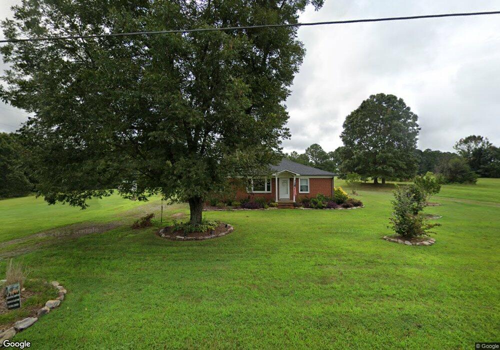
2569 Devine Rd Iron Station, NC 28080
Estimated Value: $182,000 - $241,439
3
Beds
1
Bath
1,290
Sq Ft
$168/Sq Ft
Est. Value
About This Home
This home is located at 2569 Devine Rd, Iron Station, NC 28080 and is currently estimated at $217,110, approximately $168 per square foot. 2569 Devine Rd is a home located in Lincoln County with nearby schools including Iron Station Elementary School, East Lincoln Middle School, and East Lincoln High School.
Ownership History
Date
Name
Owned For
Owner Type
Purchase Details
Closed on
Aug 1, 2018
Sold by
Combs Larry R and Combs Angela S
Bought by
Shank April Michelle
Current Estimated Value
Home Financials for this Owner
Home Financials are based on the most recent Mortgage that was taken out on this home.
Original Mortgage
$99,494
Outstanding Balance
$86,407
Interest Rate
4.5%
Mortgage Type
New Conventional
Estimated Equity
$130,703
Purchase Details
Closed on
Jan 4, 2007
Sold by
Anderson Gary A and Anderson Pamela
Bought by
Combs Larry R and Combs Angela S
Home Financials for this Owner
Home Financials are based on the most recent Mortgage that was taken out on this home.
Original Mortgage
$95,000
Interest Rate
5.94%
Mortgage Type
Purchase Money Mortgage
Purchase Details
Closed on
Apr 20, 2006
Sold by
Turp Sandra H and Turp John Wilmer
Bought by
Anderson Gary A and Anderson Jeremy S
Create a Home Valuation Report for This Property
The Home Valuation Report is an in-depth analysis detailing your home's value as well as a comparison with similar homes in the area
Purchase History
| Date | Buyer | Sale Price | Title Company |
|---|---|---|---|
| Shank April Michelle | $95,000 | None Available | |
| Combs Larry R | $95,000 | None Available | |
| Anderson Gary A | $80,000 | None Available |
Source: Public Records
Mortgage History
| Date | Status | Borrower | Loan Amount |
|---|---|---|---|
| Open | Shank April Michelle | $99,494 | |
| Previous Owner | Combs Larry R | $95,000 |
Source: Public Records
Tax History
| Year | Tax Paid | Tax Assessment Tax Assessment Total Assessment is a certain percentage of the fair market value that is determined by local assessors to be the total taxable value of land and additions on the property. | Land | Improvement |
|---|---|---|---|---|
| 2025 | $1,263 | $179,937 | $39,769 | $140,168 |
| 2024 | $1,243 | $179,937 | $39,769 | $140,168 |
| 2023 | $1,238 | $179,937 | $39,769 | $140,168 |
| 2022 | $839 | $97,352 | $29,834 | $67,518 |
| 2021 | $839 | $97,352 | $29,834 | $67,518 |
| 2020 | $705 | $97,352 | $29,834 | $67,518 |
| 2019 | $705 | $97,352 | $29,834 | $67,518 |
| 2018 | $760 | $89,597 | $27,595 | $62,002 |
| 2017 | $659 | $89,597 | $27,595 | $62,002 |
| 2016 | $659 | $89,597 | $27,595 | $62,002 |
| 2015 | $732 | $89,597 | $27,595 | $62,002 |
| 2014 | $740 | $95,394 | $28,086 | $67,308 |
Source: Public Records
Map
Nearby Homes
- 1987 & 1981 Magnolia Grove Rd
- 1371 Alexis High Shoals Rd
- 1481 Depot St
- 3163 Loomis St
- 1466 Pressley Dr
- 1259 Hardin Rd
- 1222 Hardin Rd
- 325 Holly Ridge Rd
- 1743 Autumn Banks Way Unit 73p
- 1747 Autumn Banks Way Unit 75p
- 1753 Autumn Banks Way Unit 76p
- 1755 Autumn Banks Way Unit 77p
- 324 Old Hardin Rd
- 3132 Fox Den Cir
- 1551 Autumn Banks Way Unit 23
- 4242 John Ritchie Rd
- 1541 Autumn Banks Way Unit 18
- 2336 Salem Church Rd
- 0 Hovis Rd
- 2452 Salem Church Rd
- 2702 Devine Rd
- 2645 Devine Rd
- 2561 Devine Rd
- 2776 Devine Rd
- 2541 Devine Rd
- 2557 Devine Rd
- 2790 Devine Rd
- 2806 Devine Rd
- 2820 Devine Rd
- 2830 Devine Rd
- 2838 Devine Rd
- 2590 Devine Rd
- 2844 Devine Rd
- 2549 Devine Rd
- 2549 Colewood Ln
- 2919 Devine Rd
- 2495 Devine Rd
- 2860 Devine Rd
- 2516 Devine Rd
- 2948 Devine Rd
Your Personal Tour Guide
Ask me questions while you tour the home.