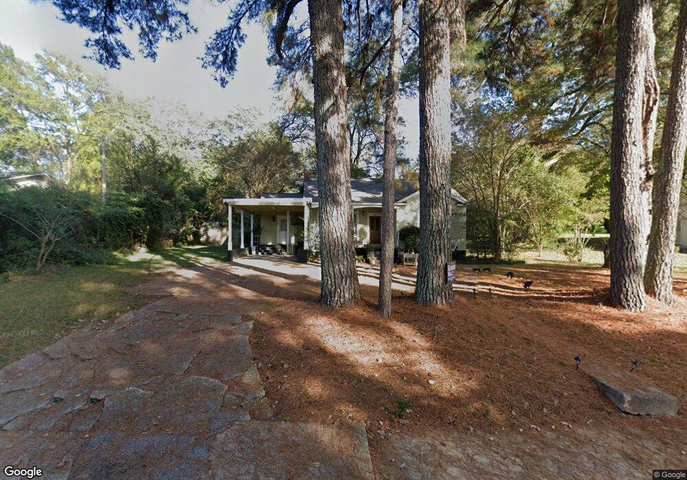
257 Byrd Ave N Unit A Philadelphia, MS 39350
Estimated Value: $113,000 - $231,000
2
Beds
2
Baths
1,319
Sq Ft
$119/Sq Ft
Est. Value
About This Home
This home is located at 257 Byrd Ave N Unit A, Philadelphia, MS 39350 and is currently estimated at $156,395, approximately $118 per square foot. 257 Byrd Ave N Unit A is a home located in Neshoba County with nearby schools including Philadelphia Elementary School, Philadelphia Middle School, and Philadelphia High School.
Ownership History
Date
Name
Owned For
Owner Type
Purchase Details
Closed on
Jan 24, 2019
Sold by
Dickerson Taylor Ray and Dickerson Jordan J
Bought by
Young Shekara L
Current Estimated Value
Home Financials for this Owner
Home Financials are based on the most recent Mortgage that was taken out on this home.
Original Mortgage
$83,460
Outstanding Balance
$74,314
Interest Rate
5.25%
Mortgage Type
FHA
Estimated Equity
$82,081
Purchase Details
Closed on
Nov 29, 2006
Sold by
Shepherd Janell and Shepherd Jan T
Bought by
Allen Ricky Darrell
Create a Home Valuation Report for This Property
The Home Valuation Report is an in-depth analysis detailing your home's value as well as a comparison with similar homes in the area
Home Values in the Area
Average Home Value in this Area
Purchase History
| Date | Buyer | Sale Price | Title Company |
|---|---|---|---|
| Young Shekara L | -- | -- | |
| Allen Ricky Darrell | -- | -- |
Source: Public Records
Mortgage History
| Date | Status | Borrower | Loan Amount |
|---|---|---|---|
| Open | Young Shekara L | $83,460 |
Source: Public Records
Tax History Compared to Growth
Tax History
| Year | Tax Paid | Tax Assessment Tax Assessment Total Assessment is a certain percentage of the fair market value that is determined by local assessors to be the total taxable value of land and additions on the property. | Land | Improvement |
|---|---|---|---|---|
| 2025 | $1,073 | $9,996 | $0 | $0 |
| 2024 | $1,073 | $9,982 | $0 | $0 |
| 2023 | $975 | $9,235 | $0 | $0 |
| 2022 | $975 | $9,235 | $0 | $0 |
| 2021 | $955 | $9,076 | $0 | $0 |
| 2020 | $951 | $9,076 | $0 | $0 |
| 2019 | $892 | $8,744 | $0 | $0 |
| 2018 | $878 | $8,744 | $0 | $0 |
| 2017 | $927 | $8,744 | $0 | $0 |
| 2016 | $927 | $8,744 | $0 | $0 |
| 2015 | -- | $8,678 | $0 | $0 |
| 2014 | -- | $8,678 | $0 | $0 |
Source: Public Records
Map
Nearby Homes
- 271A Byrd Ave
- 423 Pecan Ave
- 437C Pecan Ave
- 414 Columbus Ave Unit A
- 457 Pecan Ave
- 100 Highway 19
- 0 Mississippi 19
- 01 Mississippi 19
- 738 Forest Park Cir
- 0 Columbus Ave
- 507 Poplar Ave
- 736 Forest Park Cir
- 708 Forest Park Cir
- 321 Range Ave
- 517 Holland Ave
- 408 Hospital St
- 521 Holland Ave
- 519 Welch St
- 531 State Ave
- 1133 Weyerhaeuser St
- 255 Byrd Ave N
- 259 Byrd Ave N
- 403 Wilson St
- 444 Center Ave N
- 260 Byrd Ave N
- 282 Byrd Ave N
- 438 Center Ave N
- 404 Wilson St
- 440 Center Ave N
- 436 Center Ave N
- 253 Byrd Ave N
- 210 Wilson St
- 264 Byrd Ave N
- 209 Wilson St
- 267 Byrd Ave N
- 266 Byrd Ave N
- 432 Center Ave N
- 10660 Highway 486
- 251 Byrd Ave
- 247 Byrd Ave N