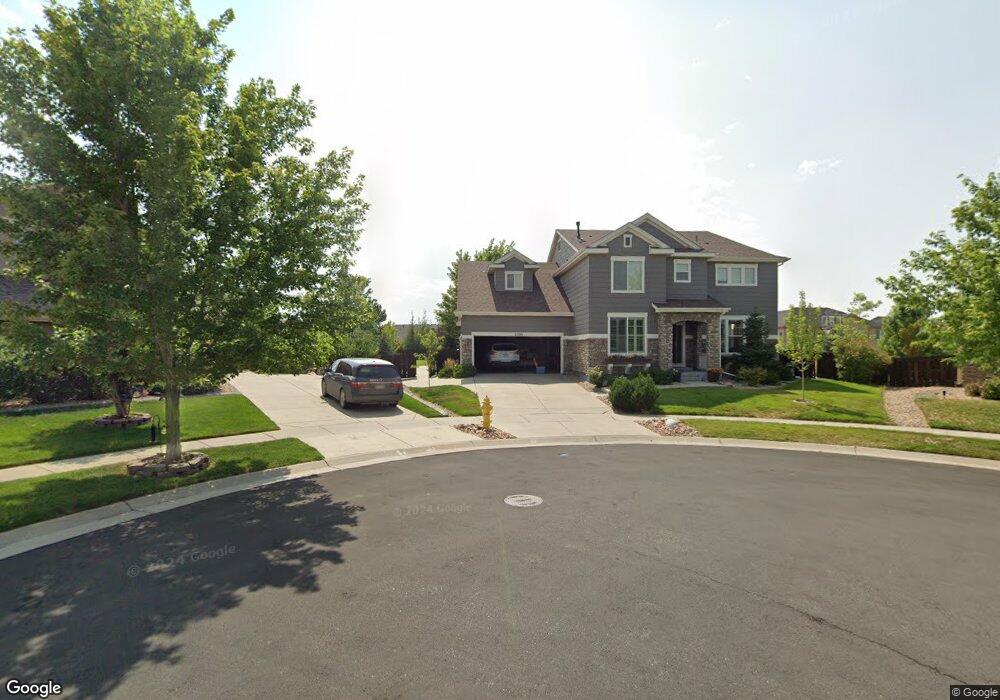
25740 E Euclid Dr Aurora, CO 80016
Southeast Aurora NeighborhoodEstimated Value: $842,695 - $955,000
5
Beds
4
Baths
5,021
Sq Ft
$180/Sq Ft
Est. Value
About This Home
This home is located at 25740 E Euclid Dr, Aurora, CO 80016 and is currently estimated at $903,924, approximately $180 per square foot. 25740 E Euclid Dr is a home located in Arapahoe County with nearby schools including Pine Ridge Elementary School, Infinity Middle School, and Cherokee Trail High School.
Ownership History
Date
Name
Owned For
Owner Type
Purchase Details
Closed on
Jun 5, 2015
Sold by
Somerville John D and Somerville Kathleen M
Bought by
Campbell Aaron Brent and Campbell Aimee Wilson
Current Estimated Value
Home Financials for this Owner
Home Financials are based on the most recent Mortgage that was taken out on this home.
Original Mortgage
$439,920
Outstanding Balance
$337,183
Interest Rate
3.7%
Mortgage Type
New Conventional
Estimated Equity
$566,741
Purchase Details
Closed on
Feb 26, 2008
Sold by
Standard Pacific Of Colorado Inc
Bought by
Somerville John D and Somerville Kathleen M
Home Financials for this Owner
Home Financials are based on the most recent Mortgage that was taken out on this home.
Original Mortgage
$384,850
Interest Rate
5.47%
Mortgage Type
Purchase Money Mortgage
Create a Home Valuation Report for This Property
The Home Valuation Report is an in-depth analysis detailing your home's value as well as a comparison with similar homes in the area
Home Values in the Area
Average Home Value in this Area
Purchase History
| Date | Buyer | Sale Price | Title Company |
|---|---|---|---|
| Campbell Aaron Brent | $549,900 | First American Title Ins Co | |
| Somerville John D | $481,072 | Land Title Guarantee Company |
Source: Public Records
Mortgage History
| Date | Status | Borrower | Loan Amount |
|---|---|---|---|
| Open | Campbell Aaron Brent | $439,920 | |
| Previous Owner | Somerville John D | $384,850 |
Source: Public Records
Tax History
| Year | Tax Paid | Tax Assessment Tax Assessment Total Assessment is a certain percentage of the fair market value that is determined by local assessors to be the total taxable value of land and additions on the property. | Land | Improvement |
|---|---|---|---|---|
| 2025 | $8,769 | $59,169 | -- | -- |
| 2024 | $7,800 | $63,335 | -- | -- |
| 2023 | $7,800 | $63,335 | $0 | $0 |
| 2022 | $6,293 | $49,477 | $0 | $0 |
| 2021 | $6,310 | $49,477 | $0 | $0 |
| 2020 | $6,224 | $50,637 | $0 | $0 |
| 2019 | $6,096 | $50,637 | $0 | $0 |
| 2018 | $5,486 | $43,603 | $0 | $0 |
| 2017 | $5,440 | $43,603 | $0 | $0 |
| 2016 | $5,501 | $42,482 | $0 | $0 |
| 2015 | $5,342 | $42,482 | $0 | $0 |
| 2014 | -- | $36,815 | $0 | $0 |
| 2013 | -- | $35,250 | $0 | $0 |
Source: Public Records
Map
Nearby Homes
- 6563 S Little River Way
- 6477 S Oak Hill Cir
- 6468 S Oak Hill Cir
- 6769 S Old Hammer Ct
- 6492 S Millbrook Way
- 25150 E Ottawa Dr
- 6265 S Kewaunee Way
- 6236 S Millbrook Way
- 6646 S Patsburg St
- 6333 S Jackson Gap Ct
- 25338 E Costilla Place
- 2132 S Irvington Ct
- 24880 E Euclid Place
- 26591 E Calhoun Place
- 6404 S Harvest St
- 6584 S Quantock Ct
- 24702 E Hoover Place
- 26633 E Peakview Place
- 6189 S Oak Hill Way
- 6977 S Riverwood Way
- 25750 E Euclid Dr
- 25730 E Euclid Dr
- 25643 E Calhoun Place
- 25653 E Calhoun Place
- 25663 E Calhoun Place
- 25760 E Euclid Dr
- 25633 E Calhoun Place
- 25720 E Euclid Dr
- 25770 E Euclid Dr
- 25790 E Euclid Dr
- 25710 E Euclid Dr
- 25623 E Calhoun Place
- 6564 S Little River Way
- 25810 E Euclid Dr
- 25642 E Calhoun Place
- 25662 E Calhoun Place
- 25622 E Calhoun Place
- 25603 E Calhoun Place
- 25700 E Euclid Dr
- 25690 E Hoover Place
Your Personal Tour Guide
Ask me questions while you tour the home.