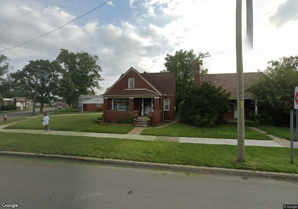
25821 W Outer Dr Detroit, MI 48217
Boynton NeighborhoodEstimated Value: $37,000 - $78,414
--
Bed
2
Baths
1,509
Sq Ft
$44/Sq Ft
Est. Value
About This Home
This home is located at 25821 W Outer Dr, Detroit, MI 48217 and is currently estimated at $65,854, approximately $43 per square foot. 25821 W Outer Dr is a home located in Wayne County with nearby schools including Mark Twain Elementary-Middle School, Charles L. Spain Elementary-Middle School, and Edward 'Duke' Ellington Conservatory of Music and Art.
Ownership History
Date
Name
Owned For
Owner Type
Purchase Details
Closed on
Jul 23, 2007
Sold by
Fannie Mae
Bought by
Weston Rhonda
Current Estimated Value
Purchase Details
Closed on
Feb 9, 2006
Sold by
Financial Freedom Senior Funding Corp
Bought by
Federal National Mortgage Association
Purchase Details
Closed on
Jan 11, 2006
Sold by
Butler Peutronia
Bought by
Financial Freedom Senior Funding Corp
Create a Home Valuation Report for This Property
The Home Valuation Report is an in-depth analysis detailing your home's value as well as a comparison with similar homes in the area
Home Values in the Area
Average Home Value in this Area
Purchase History
| Date | Buyer | Sale Price | Title Company |
|---|---|---|---|
| Weston Rhonda | $28,000 | None Available | |
| Federal National Mortgage Association | -- | None Available | |
| Financial Freedom Senior Funding Corp | $84,569 | None Available |
Source: Public Records
Tax History Compared to Growth
Tax History
| Year | Tax Paid | Tax Assessment Tax Assessment Total Assessment is a certain percentage of the fair market value that is determined by local assessors to be the total taxable value of land and additions on the property. | Land | Improvement |
|---|---|---|---|---|
| 2025 | $987 | $39,000 | $0 | $0 |
| 2024 | $987 | $31,800 | $0 | $0 |
| 2023 | $957 | $24,800 | $0 | $0 |
| 2022 | $1,042 | $19,700 | $0 | $0 |
| 2021 | $1,013 | $14,100 | $0 | $0 |
| 2020 | $981 | $12,300 | $0 | $0 |
| 2019 | $992 | $10,700 | $0 | $0 |
| 2018 | $900 | $11,400 | $0 | $0 |
| 2017 | $209 | $11,000 | $0 | $0 |
| 2016 | $2,011 | $24,800 | $0 | $0 |
| 2015 | $2,480 | $24,800 | $0 | $0 |
| 2013 | $2,751 | $27,507 | $0 | $0 |
| 2010 | -- | $39,413 | $1,223 | $38,190 |
Source: Public Records
Map
Nearby Homes
- 3550 S Edsel St
- 26165 W Outer Dr
- 3422 S Annabelle St
- 2908 S Edsel St
- 1523 Reo Ave
- 1587 Reo Ave
- 12836 Conway St
- 3381 S Ethel St
- 3553 S Ethel St
- 2601 S Fort St
- 3329 S Bassett St
- 3519 S Bassett St
- 1424 Cicotte Ave
- 1458 Cicotte Ave
- 1383 Cicotte Ave
- 2906 S Ethel St
- 2900 S Ethel St
- 1463 Cicotte Ave
- 3989 19th St
- 4128 19th St
- 25831 W Outer Dr
- 3421 S Greyfriar St Unit Bldg-Unit
- 3421 S Greyfriar St
- 3412 S Waring St
- 25841 W Outer Dr
- 3422 S Waring St
- 25849 W Outer Dr
- 3393 S Greyfriar St
- 25801 W Outer Dr
- 3387 S Greyfriar St
- 25785 W Outer Dr
- 3386 S Waring St
- 3381 S Greyfriar St
- 3375 S Greyfriar St
- 3380 S Waring St
- 3400 S Fort St
- 25771 W Outer Dr
- 3370 S Waring St
- 3365 S Greyfriar St
- 3374 S Greyfriar St