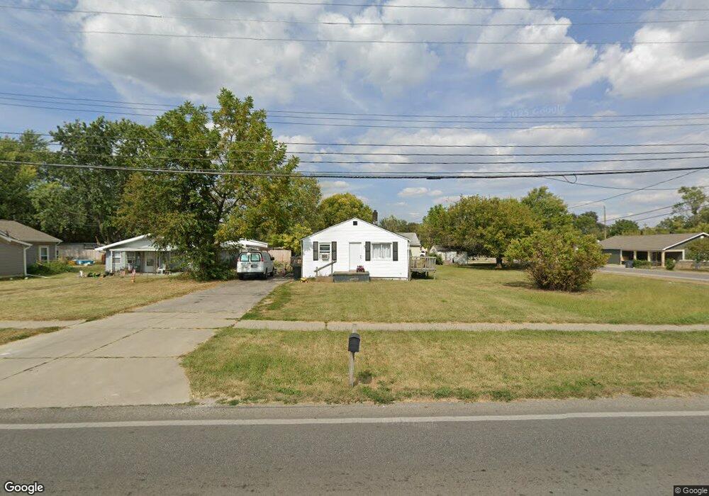
2588 Briggs Rd Columbus, OH 43223
Brookshire NeighborhoodEstimated Value: $134,000 - $162,000
2
Beds
1
Bath
1,092
Sq Ft
$136/Sq Ft
Est. Value
About This Home
This home is located at 2588 Briggs Rd, Columbus, OH 43223 and is currently estimated at $148,180, approximately $135 per square foot. 2588 Briggs Rd is a home located in Franklin County with nearby schools including James A Harmon Elementary School, Franklin Woods Intermediate School, and Finland Middle School.
Ownership History
Date
Name
Owned For
Owner Type
Purchase Details
Closed on
Aug 18, 2005
Sold by
Indeed Ltd
Bought by
Wooten Carol A
Current Estimated Value
Home Financials for this Owner
Home Financials are based on the most recent Mortgage that was taken out on this home.
Original Mortgage
$69,700
Outstanding Balance
$46,304
Interest Rate
9.45%
Mortgage Type
Fannie Mae Freddie Mac
Estimated Equity
$109,777
Purchase Details
Closed on
Jul 16, 2002
Sold by
Indeed Ltd
Bought by
Wooten Carol A
Home Financials for this Owner
Home Financials are based on the most recent Mortgage that was taken out on this home.
Original Mortgage
$65,900
Interest Rate
9%
Mortgage Type
Seller Take Back
Purchase Details
Closed on
Jul 10, 1995
Sold by
Ope Inc
Bought by
Hoover Virgil Brunner and Hoover Sandra L
Purchase Details
Closed on
Jun 15, 1995
Sold by
Stewart Terry L
Bought by
Ope Inc
Purchase Details
Closed on
Oct 31, 1989
Purchase Details
Closed on
Apr 21, 1989
Create a Home Valuation Report for This Property
The Home Valuation Report is an in-depth analysis detailing your home's value as well as a comparison with similar homes in the area
Home Values in the Area
Average Home Value in this Area
Purchase History
| Date | Buyer | Sale Price | Title Company |
|---|---|---|---|
| Wooten Carol A | $69,900 | -- | |
| Wooten Carol A | $69,900 | -- | |
| Hoover Virgil Brunner | $57,900 | -- | |
| Ope Inc | $51,759 | -- | |
| -- | $49,900 | -- | |
| -- | $20,000 | -- |
Source: Public Records
Mortgage History
| Date | Status | Borrower | Loan Amount |
|---|---|---|---|
| Open | Wooten Carol A | $69,700 | |
| Previous Owner | Indeed Ltd | $7,100 | |
| Previous Owner | Indeed Ltd | $12,772 | |
| Previous Owner | Indeed Ltd | $5,762 | |
| Previous Owner | Wooten Carol A | $65,900 |
Source: Public Records
Tax History Compared to Growth
Tax History
| Year | Tax Paid | Tax Assessment Tax Assessment Total Assessment is a certain percentage of the fair market value that is determined by local assessors to be the total taxable value of land and additions on the property. | Land | Improvement |
|---|---|---|---|---|
| 2024 | $3,970 | $41,310 | $15,160 | $26,150 |
| 2023 | $4,134 | $41,310 | $15,160 | $26,150 |
| 2022 | $4,911 | $16,880 | $2,350 | $14,530 |
| 2021 | $1,873 | $16,880 | $2,350 | $14,530 |
| 2020 | $1,890 | $16,880 | $2,350 | $14,530 |
| 2019 | $1,549 | $14,070 | $1,960 | $12,110 |
| 2018 | $1,117 | $14,070 | $1,960 | $12,110 |
| 2017 | $1,097 | $14,070 | $1,960 | $12,110 |
| 2016 | $1,079 | $12,750 | $3,610 | $9,140 |
| 2015 | $1,004 | $12,750 | $3,610 | $9,140 |
| 2014 | $1,004 | $12,750 | $3,610 | $9,140 |
| 2013 | $580 | $14,980 | $4,235 | $10,745 |
Source: Public Records
Map
Nearby Homes
- 0 Lindbergh Dr
- 1226 Woodbrook Cir W Unit D
- 1261 Woodbrook Ln Unit D
- 1272 Woodbrook Ln Unit 267
- 2345 Woodbrook Cir N Unit 100
- 2362 Woodbrook Cir N Unit 81
- 2434 Hardesty Dr S Unit S5
- 1119 Hardesty Place E Unit 1
- 2382 Hardesty Dr S Unit Q-5
- 2336 Woodbrook Cir N Unit 92 B
- 2336 Woodbrook Cir N Unit 91
- 2337 Hardesty Ct Unit 1
- 1015 Hodges Dr
- 2322 Hardesty Ct Unit I11
- 2354 Hardesty Ct Unit JA6
- 1169 Woodbrook Ln Unit 371
- 2367 Hardesty Dr N Unit 1-1
- 1116 Bellflower Ave
- 2743 Saint Joseph Ave
- 1267 Bellflower Ave
- 2588 Briggs Rd
- 2594 Briggs Rd
- 2584 Briggs Rd
- 2595 Plainview Ave
- 2590 Briggs Rd
- 2562 Briggs Rd
- 0 Plainview Ave
- 1235 Tedco Dr
- 2558 Briggs Rd
- 1248 Tedco Dr
- 1226 Tedco Dr
- 0 Tedco Dr
- 1223 Tedco Dr
- 0 Plainview Ave
- 1228 Tedco Dr
- 2600 Plainview Ave
- 1235 Eureka Blvd
- 1225 Eureka Blvd
- 1220 Tedco Dr
- 2538 Briggs Rd