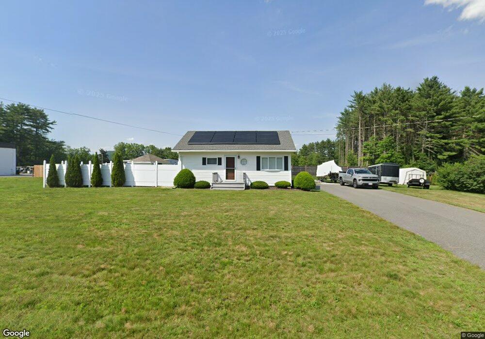
259 Log Plain Rd Greenfield, MA 01301
Estimated Value: $220,152 - $328,000
2
Beds
1
Bath
720
Sq Ft
$381/Sq Ft
Est. Value
About This Home
This home is located at 259 Log Plain Rd, Greenfield, MA 01301 and is currently estimated at $274,288, approximately $380 per square foot. 259 Log Plain Rd is a home located in Franklin County with nearby schools including Greenfield Center School, Cornerstone Christian School, and Stoneleigh-Burnham School.
Ownership History
Date
Name
Owned For
Owner Type
Purchase Details
Closed on
May 23, 2008
Sold by
Baer Brenton T
Bought by
Keniston Carl A and Keniston Lori A
Current Estimated Value
Home Financials for this Owner
Home Financials are based on the most recent Mortgage that was taken out on this home.
Original Mortgage
$151,020
Outstanding Balance
$95,515
Interest Rate
5.94%
Mortgage Type
Purchase Money Mortgage
Estimated Equity
$178,773
Purchase Details
Closed on
Jan 2, 2007
Sold by
Dalton Michele A and Wheeler Michele A
Bought by
Baer Brenton T
Home Financials for this Owner
Home Financials are based on the most recent Mortgage that was taken out on this home.
Original Mortgage
$111,000
Interest Rate
6.29%
Mortgage Type
Purchase Money Mortgage
Purchase Details
Closed on
Aug 18, 1995
Sold by
Gibson Warren S
Bought by
Wheeler Michele A
Create a Home Valuation Report for This Property
The Home Valuation Report is an in-depth analysis detailing your home's value as well as a comparison with similar homes in the area
Home Values in the Area
Average Home Value in this Area
Purchase History
| Date | Buyer | Sale Price | Title Company |
|---|---|---|---|
| Keniston Carl A | $148,000 | -- | |
| Keniston Carl A | $148,000 | -- | |
| Baer Brenton T | $143,000 | -- | |
| Baer Brenton T | $143,000 | -- | |
| Wheeler Michele A | $84,900 | -- | |
| Wheeler Michele A | $84,900 | -- |
Source: Public Records
Mortgage History
| Date | Status | Borrower | Loan Amount |
|---|---|---|---|
| Open | Keniston Carl A | $151,020 | |
| Closed | Wheeler Michele A | $151,020 | |
| Previous Owner | Baer Brenton T | $111,000 |
Source: Public Records
Tax History
| Year | Tax Paid | Tax Assessment Tax Assessment Total Assessment is a certain percentage of the fair market value that is determined by local assessors to be the total taxable value of land and additions on the property. | Land | Improvement |
|---|---|---|---|---|
| 2025 | $3,687 | $188,500 | $74,400 | $114,100 |
| 2024 | $3,601 | $176,600 | $63,300 | $113,300 |
| 2023 | $3,293 | $167,600 | $63,300 | $104,300 |
| 2022 | $3,442 | $154,200 | $63,400 | $90,800 |
| 2021 | $3,471 | $149,500 | $67,000 | $82,500 |
| 2020 | $3,247 | $141,600 | $67,000 | $74,600 |
| 2019 | $2,972 | $132,900 | $58,300 | $74,600 |
| 2018 | $2,923 | $130,300 | $57,300 | $73,000 |
| 2017 | $2,831 | $130,300 | $57,300 | $73,000 |
| 2016 | $2,763 | $126,700 | $57,300 | $69,400 |
| 2015 | $2,821 | $125,300 | $58,700 | $66,600 |
| 2014 | $2,572 | $125,300 | $58,700 | $66,600 |
Source: Public Records
Map
Nearby Homes
- 001 Adams Rd
- 47 Cross St
- 85 Verde Dr
- 111 South St
- 696 Bernardston Rd
- 75 South St Unit 3
- 25 Barton Rd
- 18 Lillian St
- 23 Industrial Dr
- 1 Northfield Rd
- 0 Fox Hill Rd Unit 73477185
- 6 Burrows Turnpike Rd
- 539 Fox Hill Rd
- 182 Main Rd
- 20 Dunnell Rd
- 132 Poplar St
- 77 Summer St
- 116 Bald Mountain Rd
- 372 Federal St
- 10 Worcester Ave
- 0 Fargo St
- 267 Log Plain Rd
- 260 Log Plain Rd
- 1173 Bernardston Rd
- 252 Log Plain Rd
- 271 Log Plain Rd
- 8 Fargo St
- 280 Log Plain Rd
- 1175 Bernardston Rd
- 283 Log Plain Rd
- 1207 Bernardston Rd
- 1182 Bernardston Rd
- 1164 Bernardston Rd
- 26 Fargo St
- 29 Fargo St
- 1196 Bernardston Rd
- 225 Log Plain Rd
- 1200 Bernardston Rd
- 298 Log Plain Rd
- 32 Fargo St
Your Personal Tour Guide
Ask me questions while you tour the home.