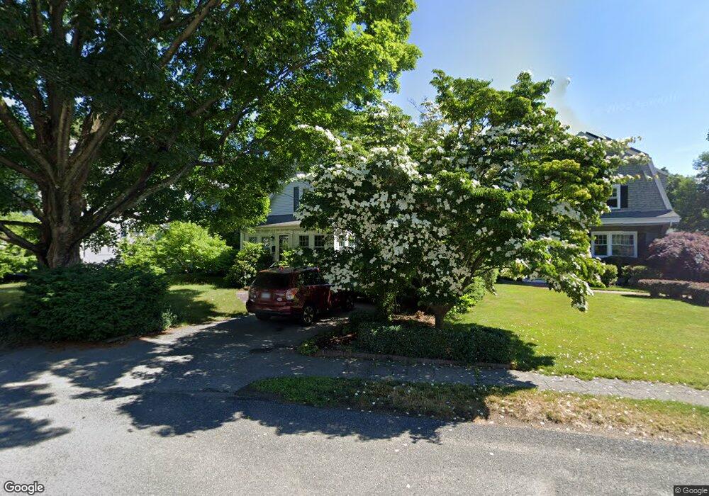
26 Burnside Rd Needham Heights, MA 02494
Estimated Value: $1,243,000 - $1,502,000
3
Beds
4
Baths
2,000
Sq Ft
$662/Sq Ft
Est. Value
About This Home
This home is located at 26 Burnside Rd, Needham Heights, MA 02494 and is currently estimated at $1,323,486, approximately $661 per square foot. 26 Burnside Rd is a home located in Norfolk County with nearby schools including Mitchell Elementary School, High Rock Middle School, and Pollard Middle School.
Ownership History
Date
Name
Owned For
Owner Type
Purchase Details
Closed on
Jun 21, 2010
Sold by
Hider Andrew P and Hider Alison S
Bought by
Mattuchio Banu and Mattuchio Todd
Current Estimated Value
Home Financials for this Owner
Home Financials are based on the most recent Mortgage that was taken out on this home.
Original Mortgage
$488,000
Interest Rate
5.03%
Mortgage Type
Purchase Money Mortgage
Purchase Details
Closed on
Jun 22, 2009
Sold by
Church Richard L
Bought by
Hider Andrew P and Hider Alison S
Home Financials for this Owner
Home Financials are based on the most recent Mortgage that was taken out on this home.
Original Mortgage
$417,000
Interest Rate
4.91%
Mortgage Type
Purchase Money Mortgage
Purchase Details
Closed on
Jan 10, 2003
Sold by
Mccarthy Irene T Est and Mccarthy
Bought by
Church Richard L
Create a Home Valuation Report for This Property
The Home Valuation Report is an in-depth analysis detailing your home's value as well as a comparison with similar homes in the area
Home Values in the Area
Average Home Value in this Area
Purchase History
| Date | Buyer | Sale Price | Title Company |
|---|---|---|---|
| Mattuchio Banu | $610,000 | -- | |
| Mattuchio Banu | $610,000 | -- | |
| Hider Andrew P | $539,000 | -- | |
| Hider Andrew P | $539,000 | -- | |
| Church Richard L | $370,000 | -- | |
| Church Richard L | $370,000 | -- |
Source: Public Records
Mortgage History
| Date | Status | Borrower | Loan Amount |
|---|---|---|---|
| Open | Church Richard L | $480,600 | |
| Closed | Church Richard L | $487,400 | |
| Closed | Mattuchio Banu | $488,000 | |
| Previous Owner | Hider Andrew P | $417,000 |
Source: Public Records
Tax History Compared to Growth
Tax History
| Year | Tax Paid | Tax Assessment Tax Assessment Total Assessment is a certain percentage of the fair market value that is determined by local assessors to be the total taxable value of land and additions on the property. | Land | Improvement |
|---|---|---|---|---|
| 2025 | $10,307 | $972,400 | $773,600 | $198,800 |
| 2024 | $10,189 | $813,800 | $581,500 | $232,300 |
| 2023 | $10,379 | $795,900 | $581,500 | $214,400 |
| 2022 | $9,974 | $746,000 | $538,500 | $207,500 |
| 2021 | $9,720 | $746,000 | $538,500 | $207,500 |
| 2020 | $9,326 | $746,700 | $538,500 | $208,200 |
| 2019 | $8,586 | $693,000 | $489,600 | $203,400 |
| 2018 | $8,233 | $693,000 | $489,600 | $203,400 |
| 2017 | $7,985 | $671,600 | $489,600 | $182,000 |
| 2016 | $7,750 | $671,600 | $489,600 | $182,000 |
| 2015 | $7,582 | $671,600 | $489,600 | $182,000 |
| 2014 | $7,042 | $605,000 | $425,800 | $179,200 |
Source: Public Records
Map
Nearby Homes
- 36 Davenport Rd
- 9 Jayne Rd
- 143 Hunting Rd
- 556 Webster St
- 400 Hunnewell St Unit 103
- 379 Hunnewell St Unit 379
- 3 Crescent Rd
- 7 Avery St
- 445 Hillside Ave
- 23 Cheney St
- 190 Brookline St
- 62 Evelyn Rd
- 332 Hillcrest Rd
- 35 Andrea Cir
- 34 Pershing Rd
- 41 Lee Rd
- 62 Washington Ave
- 40 Otis St Unit L
- 12 Hill St
- 42 Otis St Unit R
- 20 Burnside Rd
- 28 Burnside Rd
- 34 Burnside Rd
- 31 Bennington St
- 25 Bennington St
- 37 Bennington St
- 14 Burnside Rd
- 19 Bennington St
- 25 Burnside Rd
- 40 Burnside Rd
- 19 Burnside Rd
- 31 Burnside Rd
- 45 Bennington St
- 85 High St
- 37 Burnside Rd
- 13 Burnside Rd
- 13 Bennington St
- 69 High St
- 32 Bennington St
- 38 Bennington St