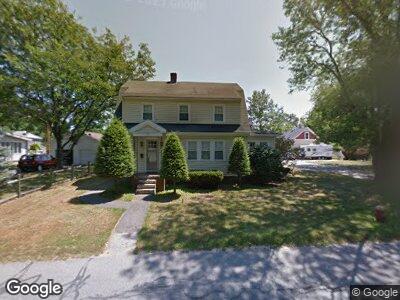
26 Chestnut St Unit 28 Georgetown, MA 01833
Estimated Value: $592,353 - $644,000
3
Beds
1
Bath
1,400
Sq Ft
$435/Sq Ft
Est. Value
About This Home
This home is located at 26 Chestnut St Unit 28, Georgetown, MA 01833 and is currently estimated at $609,338, approximately $435 per square foot. 26 Chestnut St Unit 28 is a home located in Essex County with nearby schools including Perley Elementary School, Penn Brook School, and Georgetown High School.
Ownership History
Date
Name
Owned For
Owner Type
Purchase Details
Closed on
Oct 27, 2006
Sold by
Biron James R
Bought by
Melchin Paul C and Melchin Stacie J
Current Estimated Value
Home Financials for this Owner
Home Financials are based on the most recent Mortgage that was taken out on this home.
Original Mortgage
$255,000
Interest Rate
6.48%
Mortgage Type
Purchase Money Mortgage
Create a Home Valuation Report for This Property
The Home Valuation Report is an in-depth analysis detailing your home's value as well as a comparison with similar homes in the area
Home Values in the Area
Average Home Value in this Area
Purchase History
| Date | Buyer | Sale Price | Title Company |
|---|---|---|---|
| Melchin Paul C | $355,000 | -- |
Source: Public Records
Mortgage History
| Date | Status | Borrower | Loan Amount |
|---|---|---|---|
| Open | Melchin Paul C | $77,999 | |
| Open | Melchin Paul C | $341,000 | |
| Closed | Melchin Paul | $35,500 | |
| Closed | Melchin Paul C | $266,200 | |
| Closed | Melchin Paul C | $283,882 | |
| Closed | Melchin Paul C | $35,000 | |
| Closed | Melchin Paul C | $255,000 | |
| Previous Owner | Biron Amber L | $250,000 |
Source: Public Records
Tax History Compared to Growth
Tax History
| Year | Tax Paid | Tax Assessment Tax Assessment Total Assessment is a certain percentage of the fair market value that is determined by local assessors to be the total taxable value of land and additions on the property. | Land | Improvement |
|---|---|---|---|---|
| 2025 | $6,795 | $614,400 | $292,600 | $321,800 |
| 2024 | $5,537 | $441,200 | $201,900 | $239,300 |
| 2023 | $5,727 | $441,200 | $201,900 | $239,300 |
| 2022 | $5,840 | $414,800 | $175,500 | $239,300 |
| 2021 | $5,585 | $351,500 | $175,500 | $176,000 |
| 2020 | $5,104 | $320,600 | $175,500 | $145,100 |
| 2019 | $5,007 | $317,300 | $172,200 | $145,100 |
| 2018 | $5,039 | $317,300 | $172,200 | $145,100 |
| 2017 | $4,960 | $306,000 | $172,200 | $133,800 |
| 2016 | $4,856 | $306,000 | $172,200 | $133,800 |
| 2015 | $4,775 | $297,900 | $172,200 | $125,700 |
| 2014 | $4,185 | $297,900 | $172,200 | $125,700 |
Source: Public Records
Map
Nearby Homes
- 152 Central St
- 15 Andover St
- 201 Central St Unit 3
- 21 Molloy Rd
- 64 North St
- 82 W Main St
- 30 Searle St
- 13 Lisa Ln
- 2 Marlboro Rd
- 63 Pond St
- 40 Lakeshore Dr
- 117 W Main St
- 6 Rosemarie Ln
- 71 Pond St
- 145 Nelson St
- 22 Mohawk Cir
- 206 W Main St Unit 5
- 206 W Main St Unit 3
- 206 W Main St Unit 6
- 206 W Main St Unit 4