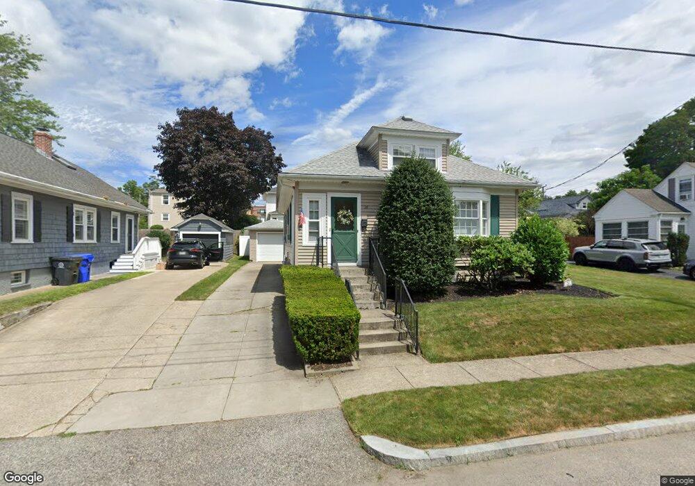
26 Cumberland Rd Riverside, RI 02915
Boyden Heights NeighborhoodEstimated Value: $355,000 - $452,000
2
Beds
1
Bath
940
Sq Ft
$419/Sq Ft
Est. Value
About This Home
This home is located at 26 Cumberland Rd, Riverside, RI 02915 and is currently estimated at $393,792, approximately $418 per square foot. 26 Cumberland Rd is a home located in Providence County with nearby schools including East Providence High School, St Mary Academy-Bay View, and The Gordon School.
Ownership History
Date
Name
Owned For
Owner Type
Purchase Details
Closed on
May 9, 2011
Sold by
Amaral Barbara A
Bought by
Barbara A Amaral Ret and Amaral
Current Estimated Value
Purchase Details
Closed on
Oct 19, 2000
Sold by
Walsh June E
Bought by
Amaral Barbara A
Create a Home Valuation Report for This Property
The Home Valuation Report is an in-depth analysis detailing your home's value as well as a comparison with similar homes in the area
Home Values in the Area
Average Home Value in this Area
Purchase History
| Date | Buyer | Sale Price | Title Company |
|---|---|---|---|
| Barbara A Amaral Ret | -- | -- | |
| Amaral Barbara A | $120,000 | -- | |
| Barbara A Amaral Ret | -- | -- | |
| Amaral Barbara A | $120,000 | -- |
Source: Public Records
Mortgage History
| Date | Status | Borrower | Loan Amount |
|---|---|---|---|
| Previous Owner | Amaral Barbara A | $77,000 | |
| Previous Owner | Amaral Barbara A | $50,000 |
Source: Public Records
Tax History Compared to Growth
Tax History
| Year | Tax Paid | Tax Assessment Tax Assessment Total Assessment is a certain percentage of the fair market value that is determined by local assessors to be the total taxable value of land and additions on the property. | Land | Improvement |
|---|---|---|---|---|
| 2025 | $4,363 | $333,800 | $144,200 | $189,600 |
| 2024 | $4,725 | $308,200 | $120,200 | $188,000 |
| 2023 | $4,549 | $308,200 | $120,200 | $188,000 |
| 2022 | $4,394 | $201,000 | $71,700 | $129,300 |
| 2021 | $4,322 | $201,000 | $68,700 | $132,300 |
| 2020 | $4,139 | $201,000 | $68,700 | $132,300 |
| 2019 | $4,024 | $201,000 | $68,700 | $132,300 |
| 2018 | $3,606 | $157,600 | $53,200 | $104,400 |
| 2017 | $3,526 | $157,600 | $53,200 | $104,400 |
| 2016 | $3,508 | $157,600 | $53,200 | $104,400 |
| 2015 | $3,277 | $142,800 | $49,300 | $93,500 |
| 2014 | $3,277 | $142,800 | $49,300 | $93,500 |
Source: Public Records
Map
Nearby Homes
- 14 Waterview Ave Unit 16
- 59 Merritt Rd
- 10 Fairfield Ave
- 50 Kettle Point Ave Unit 50
- 108 Ivan Ave
- 53 Wampanoag Trail
- 3421 Pawtucket Ave
- 36 Gerald St
- 6 Fuller Ave
- 25 Bullocks Point Ave Unit 5C
- 740 Veterans Memorial Pkwy
- 31 Bullocks Point Ave Unit 2A
- 43 Bullocks Point Ave Unit 4C
- 87 Vincent Ave
- 1 Fales St
- 1463 S Broadway
- 180 Grassmere Ave
- 151 Willett Ave Unit 2
- 151 Willett Ave Unit 5
- 74 Brookhaven Dr
- 22 Cumberland Rd
- 30 Cumberland Rd
- 3113 Pawtucket Ave Unit 3115
- 3115 Pawtucket Ave
- 3113 -3115 Pawtucket
- 18 Cumberland Rd
- 3109 Pawtucket Ave
- 3117 Pawtucket Ave
- 40 Cumberland Rd
- 3121 Pawtucket Ave
- 3105 Pawtucket Ave Unit 3107
- 17 Cumberland Rd
- 11 Cumberland Rd
- 3125 Pawtucket Ave
- 8 Cumberland Rd
- 19 Cumberland Rd
- 3101 Pawtucket Ave
- 3101 Pawtucket Ave Unit 2
- 44 Cumberland Rd
- 3129 Pawtucket Ave