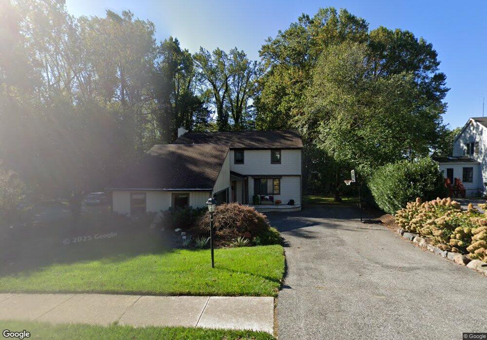
26 Kings Grant Rd Hockessin, DE 19707
Estimated Value: $591,000 - $635,964
4
Beds
3
Baths
2,628
Sq Ft
$233/Sq Ft
Est. Value
About This Home
This home is located at 26 Kings Grant Rd, Hockessin, DE 19707 and is currently estimated at $612,991, approximately $233 per square foot. 26 Kings Grant Rd is a home located in New Castle County with nearby schools including Dupont (H.B.) Middle School, Alexis I. du Pont High School, and Sanford School.
Ownership History
Date
Name
Owned For
Owner Type
Purchase Details
Closed on
May 28, 2025
Sold by
Shaver Robert T and Shaver Joanne K
Bought by
Robert T Shaver Jr 2025 Trust and Joanne K Shaver 2025 Trust
Current Estimated Value
Purchase Details
Closed on
Jul 30, 2004
Sold by
Sorgi Ronald and Sorgi Kathleen B
Bought by
Shaver Robert T and Shaver Joanne K
Home Financials for this Owner
Home Financials are based on the most recent Mortgage that was taken out on this home.
Original Mortgage
$200,000
Interest Rate
6.33%
Mortgage Type
Purchase Money Mortgage
Create a Home Valuation Report for This Property
The Home Valuation Report is an in-depth analysis detailing your home's value as well as a comparison with similar homes in the area
Home Values in the Area
Average Home Value in this Area
Purchase History
| Date | Buyer | Sale Price | Title Company |
|---|---|---|---|
| Robert T Shaver Jr 2025 Trust | -- | None Listed On Document | |
| Shaver Robert T | $390,000 | -- |
Source: Public Records
Mortgage History
| Date | Status | Borrower | Loan Amount |
|---|---|---|---|
| Previous Owner | Shaver Robert T | $200,000 |
Source: Public Records
Tax History Compared to Growth
Tax History
| Year | Tax Paid | Tax Assessment Tax Assessment Total Assessment is a certain percentage of the fair market value that is determined by local assessors to be the total taxable value of land and additions on the property. | Land | Improvement |
|---|---|---|---|---|
| 2024 | $4,741 | $128,300 | $23,100 | $105,200 |
| 2023 | $4,182 | $128,300 | $23,100 | $105,200 |
| 2022 | $4,232 | $128,300 | $23,100 | $105,200 |
| 2021 | $4,231 | $128,300 | $23,100 | $105,200 |
| 2020 | $4,245 | $128,300 | $23,100 | $105,200 |
| 2019 | $4,624 | $128,300 | $23,100 | $105,200 |
| 2018 | $4,154 | $128,300 | $23,100 | $105,200 |
| 2017 | $4,104 | $128,300 | $23,100 | $105,200 |
| 2016 | $3,919 | $128,300 | $23,100 | $105,200 |
| 2015 | $3,672 | $128,300 | $23,100 | $105,200 |
| 2014 | $3,398 | $128,300 | $23,100 | $105,200 |
Source: Public Records
Map
Nearby Homes
- 6 Kings Grant Rd
- 504 Hemingway Dr
- 513 Pershing Rd
- 832 Evanson Rd
- 10 Equestrian Cir
- 12 Foxview Cir
- 404 Kimberley Rd
- 3 Scarlett Ct
- 5 Foxview Cir
- 1131 Valley Rd
- 108 Evanson Rd
- 253 Peoples Way
- 308 Detjen Dr
- 27 Raphael Rd
- 23 Raphael Rd
- 15 Staten Dr
- 202 Clover Dr
- 3 Ashleaf Ct
- 551 Southwood Rd
- 34 Cinnamon Dr
- 24 Kings Grant Rd
- 28 Kings Grant Rd
- 527 Faraday Rd
- 529 Faraday Rd
- 22 Kings Grant Rd
- 23 Kings Grant Rd
- 30 Kings Grant Rd
- 25 Kings Grant Rd
- 525 Faraday Rd
- 543 Cabot Dr
- 20 Kings Grant Rd
- 547 Cabot Dr
- 541 Cabot Dr
- 530 Faraday Rd
- 24 Kenwick Rd
- 26 Kenwick Rd
- 27 Kings Grant Rd
- 28 Kenwick Rd
- 753 Stonehouse Way
- 539 Cabot Dr