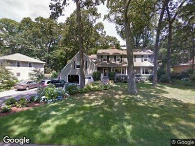
26 Possum Ln Norwalk, CT 06854
Brookside NeighborhoodEstimated Value: $1,088,000 - $1,375,722
5
Beds
3
Baths
2,985
Sq Ft
$409/Sq Ft
Est. Value
About This Home
This home is located at 26 Possum Ln, Norwalk, CT 06854 and is currently estimated at $1,222,181, approximately $409 per square foot. 26 Possum Ln is a home located in Fairfield County with nearby schools including Rowayton Elementary School, Roton Middle School, and Brien Mcmahon High School.
Ownership History
Date
Name
Owned For
Owner Type
Purchase Details
Closed on
Jun 8, 2005
Sold by
Range Maryjane
Bought by
Casey John P and Casey Michele L
Current Estimated Value
Purchase Details
Closed on
Jun 11, 1997
Sold by
Taylor Robert J and Taylor Gayle J
Bought by
Range Mary Jane
Purchase Details
Closed on
Nov 15, 1995
Sold by
Lau Hock and Lau Grace
Bought by
Taylor Robert and Taylor Gayle
Purchase Details
Closed on
May 11, 1990
Sold by
Kreager Richard
Bought by
Lau Hock
Create a Home Valuation Report for This Property
The Home Valuation Report is an in-depth analysis detailing your home's value as well as a comparison with similar homes in the area
Home Values in the Area
Average Home Value in this Area
Purchase History
| Date | Buyer | Sale Price | Title Company |
|---|---|---|---|
| Casey John P | $889,000 | -- | |
| Casey John P | $889,000 | -- | |
| Range Mary Jane | $437,500 | -- | |
| Range Mary Jane | $437,500 | -- | |
| Taylor Robert | $395,000 | -- | |
| Taylor Robert | $395,000 | -- | |
| Lau Hock | $322,000 | -- |
Source: Public Records
Mortgage History
| Date | Status | Borrower | Loan Amount |
|---|---|---|---|
| Open | Casey John P | $500,000 | |
| Closed | Kreager Richard | $400,000 | |
| Closed | Kreager Richard | $325,000 |
Source: Public Records
Tax History Compared to Growth
Tax History
| Year | Tax Paid | Tax Assessment Tax Assessment Total Assessment is a certain percentage of the fair market value that is determined by local assessors to be the total taxable value of land and additions on the property. | Land | Improvement |
|---|---|---|---|---|
| 2024 | $15,588 | $707,030 | $331,420 | $375,610 |
| 2023 | $12,966 | $515,320 | $212,660 | $302,660 |
| 2022 | $12,725 | $515,360 | $212,700 | $302,660 |
| 2021 | $12,393 | $515,320 | $212,660 | $302,660 |
| 2020 | $12,387 | $515,320 | $212,660 | $302,660 |
| 2019 | $12,040 | $515,320 | $212,660 | $302,660 |
| 2018 | $13,660 | $512,330 | $242,550 | $269,780 |
| 2017 | $13,190 | $512,330 | $242,550 | $269,780 |
| 2016 | $11,825 | $515,480 | $242,550 | $272,930 |
| 2015 | $13,029 | $512,330 | $242,550 | $269,780 |
| 2014 | $12,859 | $512,330 | $242,550 | $269,780 |
Source: Public Records
Map
Nearby Homes
- 72 Rowayton Woods Dr Unit 72
- 98 Rowayton Woods Dr
- 54 Rowayton Woods Dr Unit 54
- 73 Devils Garden Rd
- 79 Devils Garden Rd
- 132 Rowayton Woods Dr Unit 132
- 14 Arnold Ln
- 147 Rowayton Woods Dr Unit 147
- 193 Rowayton Woods Dr Unit 193
- 201 Rowayton Woods Dr
- 199 Highland Ave
- 290 Rowayton Ave
- 32 Burchard Ln
- 1 Mckendry Ct
- 2 Steeple Top Rd
- 36 Hunt St
- 48 Hunt St
- 176 Bouton St
- 3 Topping Ln
- 33 Raymond St