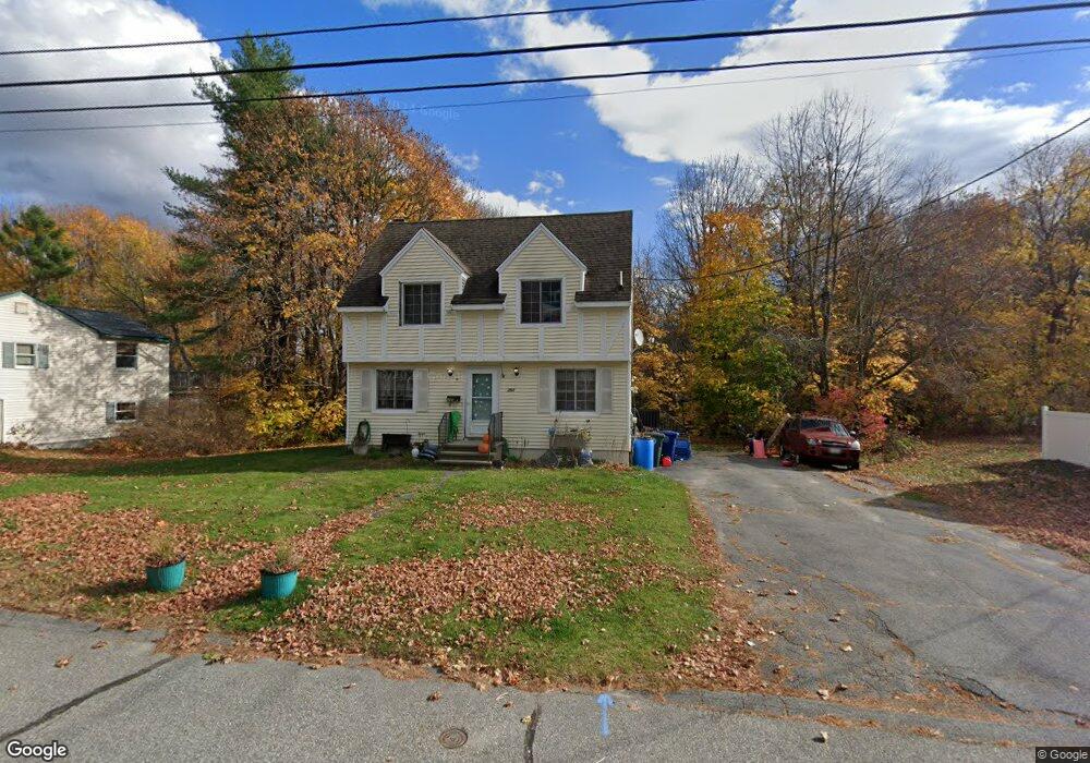
260 Central St Westbrook, ME 04092
Estimated Value: $456,750 - $498,000
3
Beds
2
Baths
1,400
Sq Ft
$340/Sq Ft
Est. Value
About This Home
This home is located at 260 Central St, Westbrook, ME 04092 and is currently estimated at $475,438, approximately $339 per square foot. 260 Central St is a home located in Cumberland County with nearby schools including Westbrook High School, The Little Dolphin School Foundation, and Breakwater School.
Ownership History
Date
Name
Owned For
Owner Type
Purchase Details
Closed on
Aug 20, 2007
Sold by
Harriman Larry A and Harriman Diane M
Bought by
Hildreth Timothy and Hildreth Christine
Current Estimated Value
Home Financials for this Owner
Home Financials are based on the most recent Mortgage that was taken out on this home.
Original Mortgage
$213,300
Outstanding Balance
$135,120
Interest Rate
6.67%
Mortgage Type
Purchase Money Mortgage
Estimated Equity
$340,318
Create a Home Valuation Report for This Property
The Home Valuation Report is an in-depth analysis detailing your home's value as well as a comparison with similar homes in the area
Home Values in the Area
Average Home Value in this Area
Purchase History
| Date | Buyer | Sale Price | Title Company |
|---|---|---|---|
| Hildreth Timothy | -- | -- |
Source: Public Records
Mortgage History
| Date | Status | Borrower | Loan Amount |
|---|---|---|---|
| Open | Hildreth Timothy | $213,300 |
Source: Public Records
Tax History Compared to Growth
Tax History
| Year | Tax Paid | Tax Assessment Tax Assessment Total Assessment is a certain percentage of the fair market value that is determined by local assessors to be the total taxable value of land and additions on the property. | Land | Improvement |
|---|---|---|---|---|
| 2023 | $4,445 | $266,500 | $92,900 | $173,600 |
| 2022 | $4,025 | $222,400 | $77,400 | $145,000 |
| 2021 | $3,965 | $222,400 | $77,400 | $145,000 |
| 2020 | $3,972 | $222,400 | $77,400 | $145,000 |
| 2019 | $3,972 | $222,400 | $77,400 | $145,000 |
| 2018 | $3,642 | $187,600 | $67,300 | $120,300 |
| 2017 | $3,542 | $187,600 | $67,300 | $120,300 |
| 2016 | $2,897 | $187,600 | $67,300 | $120,300 |
| 2015 | $3,369 | $187,600 | $67,300 | $120,300 |
| 2014 | $3,227 | $187,600 | $67,300 | $120,300 |
| 2013 | $3,227 | $187,600 | $67,300 | $120,300 |
Source: Public Records
Map
Nearby Homes
- 186 Central St
- 154 Brackett St
- 94 Pennell St
- 345 Saco St Unit 35
- 124 Brackett St
- 115 Saco St Unit 2
- 77 Mechanic St
- 68 Huntress Ave Unit 2
- 245 Spring St Unit 8
- 26 Cross St
- 140 Spring St
- 31 Cross St
- 17 Mechanic St
- 8 Freedom Rd
- 11 New Gorham Rd
- 77 Anderson Ave
- 30 Palmer St
- 500 Spring St
- 18 Doyle St
- 87 Mill Ln