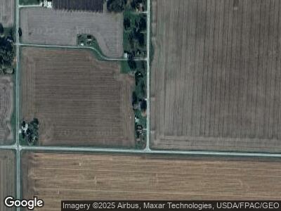
260 Mohawk St Marietta, IL 61459
Estimated Value: $59,000 - $60,286
--
Bed
--
Bath
--
Sq Ft
1.09
Acres
About This Home
This home is located at 260 Mohawk St, Marietta, IL 61459 and is currently estimated at $59,643. 260 Mohawk St is a home located in McDonough County with nearby schools including Bushnell-Prairie City Elementary School, Bushnell-Prairie City Junior High School, and Bushnell-Prairie City High School.
Ownership History
Date
Name
Owned For
Owner Type
Purchase Details
Closed on
Apr 18, 2023
Sold by
Logsdon Amy L
Bought by
Thomas Florence M
Current Estimated Value
Purchase Details
Closed on
Apr 7, 2016
Sold by
Shannon Chad E and Shannon Amy L
Bought by
Shannon Amy L and Thomas Florence M
Purchase Details
Closed on
Mar 11, 2005
Sold by
Shanon Chad E
Bought by
Shannon Chad E and Shannon Amy L
Create a Home Valuation Report for This Property
The Home Valuation Report is an in-depth analysis detailing your home's value as well as a comparison with similar homes in the area
Home Values in the Area
Average Home Value in this Area
Purchase History
| Date | Buyer | Sale Price | Title Company |
|---|---|---|---|
| Thomas Florence M | -- | None Listed On Document | |
| Shannon Amy L | -- | None Available | |
| Shannon Chad E | -- | None Available |
Source: Public Records
Mortgage History
| Date | Status | Borrower | Loan Amount |
|---|---|---|---|
| Previous Owner | Chad | $25,434 |
Source: Public Records
Tax History Compared to Growth
Tax History
| Year | Tax Paid | Tax Assessment Tax Assessment Total Assessment is a certain percentage of the fair market value that is determined by local assessors to be the total taxable value of land and additions on the property. | Land | Improvement |
|---|---|---|---|---|
| 2024 | $253 | $11,185 | $2,391 | $8,794 |
| 2023 | $253 | $11,185 | $2,391 | $8,794 |
| 2022 | $334 | $10,201 | $2,181 | $8,020 |
| 2021 | $299 | $9,755 | $1,996 | $7,759 |
| 2020 | $293 | $11,529 | $1,958 | $9,571 |
| 2019 | $180 | $10,176 | $2,082 | $8,094 |
| 2018 | $182 | $10,382 | $2,124 | $8,258 |
| 2017 | $195 | $10,353 | $2,118 | $8,235 |
| 2016 | $326 | $9,878 | $2,064 | $7,814 |
| 2015 | $333 | $9,878 | $2,064 | $7,814 |
| 2014 | $383 | $9,693 | $2,025 | $7,668 |
| 2013 | $382 | $10,628 | $2,220 | $8,408 |
Source: Public Records
Map
Nearby Homes
- 20195 N 1150th Rd
- 122 W Coal St
- 14 Hillcrest Dr
- 19 Hillcrest Dr
- 427 W Main St
- 302 Oak St
- 445 N Sperry St
- 354 E Hail St
- 777 Cole St
- 250 E Gridley St
- 759 N Rile St
- 697 N Crafford St
- 195 W Hail St
- 495 N Washington St
- 537 N Washington St
- 4059 E Il Hwy 95
- 1002 N Dean St
- 4 Hiel Dr
- 1436 W Main St
- 19135 E 2000th St
