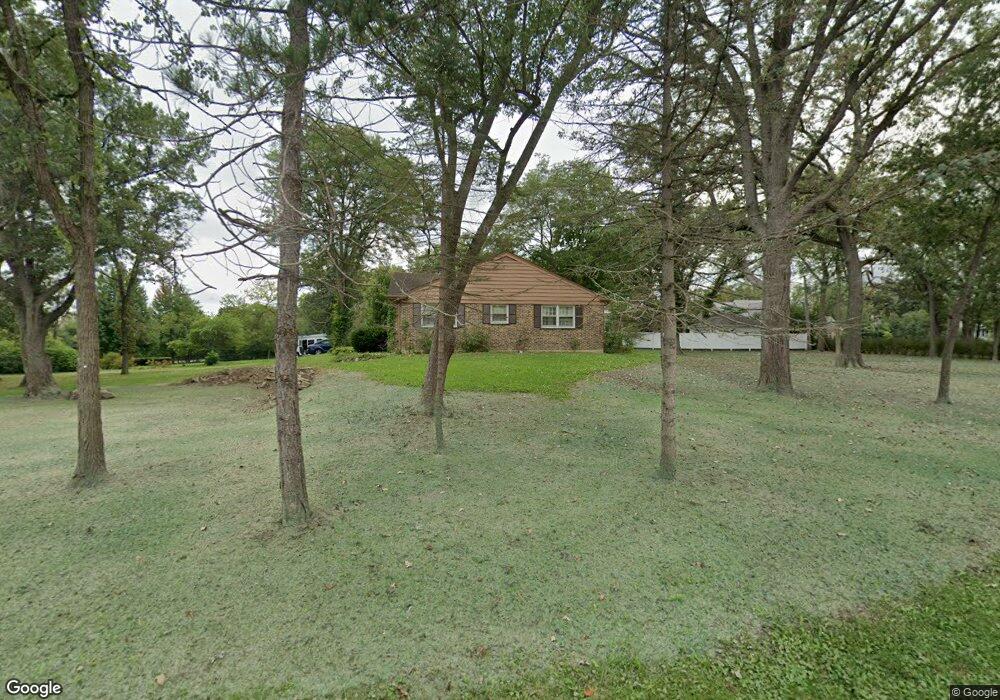
260 N Ahwahnee Rd Lake Forest, IL 60045
Estimated Value: $835,219 - $1,279,000
3
Beds
2
Baths
2,107
Sq Ft
$464/Sq Ft
Est. Value
About This Home
This home is located at 260 N Ahwahnee Rd, Lake Forest, IL 60045 and is currently estimated at $978,305, approximately $464 per square foot. 260 N Ahwahnee Rd is a home located in Lake County with nearby schools including Deer Path Middle School East, Cherokee Elementary School, and Lake Forest High School.
Ownership History
Date
Name
Owned For
Owner Type
Purchase Details
Closed on
Feb 10, 2005
Sold by
The Goebeler Co
Bought by
Btt Investment Group Llc and Tht Investment Group Llc
Current Estimated Value
Purchase Details
Closed on
Aug 4, 2003
Sold by
Cornell Theodore E
Bought by
The Goebeler Co
Home Financials for this Owner
Home Financials are based on the most recent Mortgage that was taken out on this home.
Original Mortgage
$680,000
Interest Rate
4%
Mortgage Type
Purchase Money Mortgage
Purchase Details
Closed on
Apr 13, 1999
Sold by
Cornell Theodore E
Bought by
Cornell Theodore E
Purchase Details
Closed on
Jan 13, 1998
Sold by
Cornell Theodore E and Cornell Kathryn H
Bought by
Cornell Theodore E and Cornell Kathryn H
Purchase Details
Closed on
Sep 29, 1997
Sold by
Cornell Theodore E and Cornell Kathryn H
Bought by
Cornell Theodore E and Cornell Kathryn H
Create a Home Valuation Report for This Property
The Home Valuation Report is an in-depth analysis detailing your home's value as well as a comparison with similar homes in the area
Home Values in the Area
Average Home Value in this Area
Purchase History
| Date | Buyer | Sale Price | Title Company |
|---|---|---|---|
| Btt Investment Group Llc | $915,000 | St | |
| The Goebeler Co | $850,000 | -- | |
| Cornell Theodore E | -- | -- | |
| Cornell Theodore E | -- | Chicago Title Insurance Co | |
| Cornell Theodore E | -- | Chicago Title Insurance Co |
Source: Public Records
Mortgage History
| Date | Status | Borrower | Loan Amount |
|---|---|---|---|
| Previous Owner | The Goebeler Co | $680,000 |
Source: Public Records
Tax History Compared to Growth
Tax History
| Year | Tax Paid | Tax Assessment Tax Assessment Total Assessment is a certain percentage of the fair market value that is determined by local assessors to be the total taxable value of land and additions on the property. | Land | Improvement |
|---|---|---|---|---|
| 2024 | $12,914 | $221,777 | $148,305 | $73,472 |
| 2023 | $11,923 | $204,441 | $136,712 | $67,729 |
| 2022 | $11,923 | $215,803 | $131,520 | $84,283 |
| 2021 | $12,722 | $213,942 | $130,386 | $83,556 |
| 2020 | $12,432 | $215,125 | $131,107 | $84,018 |
| 2019 | $11,814 | $211,176 | $128,700 | $82,476 |
| 2018 | $10,864 | $207,450 | $158,524 | $48,926 |
| 2017 | $10,682 | $203,982 | $155,874 | $48,108 |
| 2016 | $10,253 | $194,158 | $148,367 | $45,791 |
| 2015 | $10,099 | $182,823 | $139,705 | $43,118 |
| 2014 | $11,246 | $202,640 | $144,241 | $58,399 |
| 2012 | $11,015 | $204,398 | $145,492 | $58,906 |
Source: Public Records
Map
Nearby Homes
- 380 Deerpath Square
- 50 S Orchard Cir
- 206 Warwick Rd
- 560 Jacqulyn Ln
- Lot 5 Whitehall Ln
- Lot 7 Whitehall Ln
- Lot 8 Whitehall Ln
- Lot 6 Whitehall Ln
- Lot 9 Whitehall Ln
- 210 Majestic Oak Ct
- 51 Sequoia Ct
- 285 W Westminster
- 27 W Onwentsia Rd
- 980 Mellody Rd
- 979 Verda Ln
- 985 W Deerpath
- 355 Hickory Ct
- 740 W Tamarack Trail
- 725 W Tamarack Trail
- 765 W Tamarack Trail
- 240 N Ahwahnee Rd
- 290 N Ahwahnee Rd
- 242 Ahwahnee Ln
- 210 N Ahwahnee Rd
- 231 Ahwahnee Ln
- 310 N Ahwahnee Rd
- 249 Ahwahnee Ln
- 250 Ahwahnee Ln
- 180 N Ahwahnee Rd
- 325 N Ahwahnee Rd
- 281 Ahwahnee Ln
- 262 Ahwahnee Ln
- 291 Ahwahnee Ln
- 299 Ahwahnee Ln
- 190 N Ahwahnee Rd
- 340 N Ahwahnee Rd
- 264 Ahwahnee Ln
- 270 Ahwahnee Ln
- 309 Ahwahnee Ln
- 274 Ahwahnee Ln