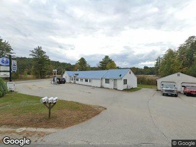
260 Stark Hwy N Dunbarton, NH 03046
Estimated Value: $472,156
--
Bed
--
Bath
2,440
Sq Ft
$194/Sq Ft
Est. Value
About This Home
This home is located at 260 Stark Hwy N, Dunbarton, NH 03046 and is currently estimated at $472,156, approximately $193 per square foot. 260 Stark Hwy N is a home located in Merrimack County with nearby schools including Dunbarton Elementary School, Bow Memorial School, and Bow High School.
Ownership History
Date
Name
Owned For
Owner Type
Purchase Details
Closed on
Sep 11, 2012
Sold by
D & C Transportation Inc
Bought by
Heavens Trailside Mart
Current Estimated Value
Purchase Details
Closed on
Jan 24, 2011
Sold by
Barkie Holdings Llc
Bought by
D & C Transportation Inc
Purchase Details
Closed on
Apr 15, 2009
Sold by
Jsys Country Props Llc
Bought by
Barkie Holdings Llc
Create a Home Valuation Report for This Property
The Home Valuation Report is an in-depth analysis detailing your home's value as well as a comparison with similar homes in the area
Home Values in the Area
Average Home Value in this Area
Purchase History
| Date | Buyer | Sale Price | Title Company |
|---|---|---|---|
| Heavens Trailside Mart | $215,000 | -- | |
| Heavens Trailside Mart | $215,000 | -- | |
| D & C Transportation Inc | $111,000 | -- | |
| D & C Transportation Inc | $111,000 | -- | |
| Barkie Holdings Llc | $12,500 | -- | |
| Barkie Holdings Llc | $12,500 | -- |
Source: Public Records
Mortgage History
| Date | Status | Borrower | Loan Amount |
|---|---|---|---|
| Open | Heavens Trailside Mart | $176,000 | |
| Previous Owner | Barkie Holdings Llc | $494,116 |
Source: Public Records
Tax History Compared to Growth
Tax History
| Year | Tax Paid | Tax Assessment Tax Assessment Total Assessment is a certain percentage of the fair market value that is determined by local assessors to be the total taxable value of land and additions on the property. | Land | Improvement |
|---|---|---|---|---|
| 2024 | $5,909 | $223,999 | $69,299 | $154,700 |
| 2023 | $5,728 | $223,999 | $69,299 | $154,700 |
| 2022 | $5,147 | $223,999 | $69,299 | $154,700 |
| 2021 | $5,244 | $223,999 | $69,299 | $154,700 |
| 2020 | $4,991 | $224,011 | $69,311 | $154,700 |
| 2018 | $4,055 | $179,976 | $60,776 | $119,200 |
| 2017 | $4,609 | $179,964 | $60,764 | $119,200 |
| 2016 | $4,316 | $179,964 | $60,764 | $119,200 |
| 2015 | $4,245 | $179,964 | $60,764 | $119,200 |
| 2014 | $5,648 | $267,176 | $60,776 | $206,400 |
| 2013 | $5,612 | $267,105 | $60,705 | $206,400 |
Source: Public Records
Map
Nearby Homes
- 324 Stark Hwy N
- 12 Old Fort Ln
- 51 Overlook Dr
- 21 Old Fort Ln
- 6 Samuels Ct
- I3-03-05 Clinton St
- 31 Jewett Rd
- 165 Concord Stage Rd
- 5 Sullivan Dr
- 4 Longview Dr
- 95 Sherwood Forest Rd
- 6 Sherwood Forest Rd
- 167 Branch Londonderry Turnpike
- 470 Jewett Rd
- 256-0-17 Jewett Rd
- 28 Brown Hill Rd
- 20 Clement Rd
- 1003 School St
- 6 Bona Vista Dr
- 35 Fox Hollow Dr