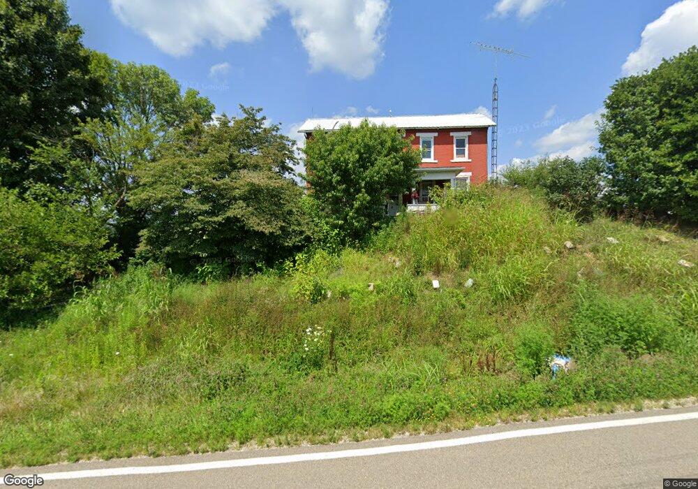
2600 State Route 83 Beverly, OH 45715
Estimated Value: $57,000 - $95,049
3
Beds
1
Bath
1,670
Sq Ft
$45/Sq Ft
Est. Value
About This Home
This home is located at 2600 State Route 83, Beverly, OH 45715 and is currently estimated at $74,512, approximately $44 per square foot. 2600 State Route 83 is a home located in Morgan County with nearby schools including Fort Frye High School.
Ownership History
Date
Name
Owned For
Owner Type
Purchase Details
Closed on
Sep 1, 2020
Sold by
Paul L And Linda R Wagner Living Trust
Bought by
Silvus Brian A and Silvus Francine N
Current Estimated Value
Purchase Details
Closed on
Dec 30, 2013
Sold by
Silvus Robert H
Bought by
Wagner Linda R and Wagner Paul L
Purchase Details
Closed on
Dec 16, 2013
Sold by
Wagner Paul L and Wagner Linda R
Bought by
Wagner Paul L and Wagner Linda R
Purchase Details
Closed on
Jun 14, 2005
Sold by
Silvus Robert and Silvus Sarah
Bought by
Wagner Linda R and Wagner Paul L
Purchase Details
Closed on
Apr 23, 1991
Bought by
Silvus Robert and Silvus Sarah
Purchase Details
Closed on
Apr 1, 1991
Create a Home Valuation Report for This Property
The Home Valuation Report is an in-depth analysis detailing your home's value as well as a comparison with similar homes in the area
Purchase History
| Date | Buyer | Sale Price | Title Company |
|---|---|---|---|
| Silvus Brian A | $50,000 | -- | |
| Silvus Brian A | $50,000 | None Listed On Document | |
| Wagner Linda R | -- | None Available | |
| Wagner Paul L | -- | None Available | |
| Wagner Linda R | -- | -- | |
| Silvus Robert | $10,000 | -- | |
| -- | $10,000 | -- |
Source: Public Records
Tax History
| Year | Tax Paid | Tax Assessment Tax Assessment Total Assessment is a certain percentage of the fair market value that is determined by local assessors to be the total taxable value of land and additions on the property. | Land | Improvement |
|---|---|---|---|---|
| 2024 | $893 | $28,720 | $5,150 | $23,570 |
| 2023 | $893 | $20,890 | $4,380 | $16,510 |
| 2022 | $611 | $19,940 | $4,380 | $15,560 |
| 2021 | $616 | $19,980 | $4,380 | $15,600 |
| 2019 | $559 | $17,410 | $3,810 | $13,600 |
| 2018 | $530 | $17,410 | $3,810 | $13,600 |
| 2017 | $533 | $17,077 | $3,304 | $13,773 |
| 2016 | $531 | $17,077 | $3,304 | $13,773 |
| 2015 | $547 | $17,077 | $3,304 | $13,773 |
| 2014 | $564 | $17,077 | $3,304 | $13,773 |
| 2013 | $274 | $17,077 | $3,304 | $13,773 |
Source: Public Records
Map
Nearby Homes
- 911 Ohio 83
- 590 Stony Run Rd
- 5855 Olney Run Rd
- 1550 Swift Rd
- 2050 Ohio 266
- 2680 Mummey Rd
- 22 Spring St
- 0 Spring St Unit 5105838
- 4 Center St
- 8100 Ohio 78
- 5 Center St
- 0 Milner Rd
- 500 Applegate Dr
- 1747 E Airport Rd NE
- 322 and 318 3rd St
- 31 Leget St
- 0 Ohio 339
- 2242 S McCoy Ridge Rd
- 3439 Columbus St
- 395 Main St
- 2645 State Route 83
- 2680 State Route 83
- 2686 State Route 83
- 2700 State Route 83
- 2701 State Route 83
- 2699 State Route 83
- 2710 State Route 83
- 2535 State Route 83
- 2540 State Route 83
- 2535 Ohio 83
- 2715 State Route 83
- 2460 Hackney Rd
- 2714 State Route 83
- 2450 Hackney Rd
- 7393 Wagner Center Ln
- 2520 State Route 83
- 2488 State Route 83
- 2747 State Route 83
- 2466 State Route 83
- 2875 State Route 83
Your Personal Tour Guide
Ask me questions while you tour the home.