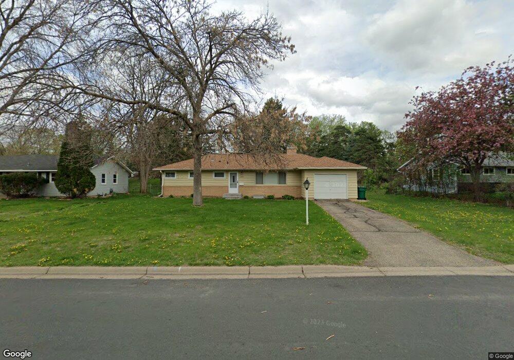
2600 W 91st St Minneapolis, MN 55431
West Bloomington NeighborhoodEstimated Value: $361,126 - $395,000
4
Beds
1
Bath
1,148
Sq Ft
$328/Sq Ft
Est. Value
About This Home
This home is located at 2600 W 91st St, Minneapolis, MN 55431 and is currently estimated at $377,032, approximately $328 per square foot. 2600 W 91st St is a home located in Hennepin County with nearby schools including Washburn Elementary School, Oak Grove Middle School, and Kennedy Senior High School.
Ownership History
Date
Name
Owned For
Owner Type
Purchase Details
Closed on
Dec 30, 2019
Sold by
Ladue John and Ladue Jean Elizabeth
Bought by
Olson Nickolas
Current Estimated Value
Home Financials for this Owner
Home Financials are based on the most recent Mortgage that was taken out on this home.
Original Mortgage
$264,300
Outstanding Balance
$233,969
Interest Rate
3.7%
Mortgage Type
New Conventional
Estimated Equity
$143,063
Purchase Details
Closed on
Apr 8, 2013
Sold by
Starr Dennis Dennis
Bought by
White Michael Michael
Home Financials for this Owner
Home Financials are based on the most recent Mortgage that was taken out on this home.
Original Mortgage
$257,850
Interest Rate
3.54%
Purchase Details
Closed on
Feb 28, 2007
Sold by
Ladue Michael G and Ladue Shelley
Bought by
Ladue John E and Ladue Jean Elizabeth
Create a Home Valuation Report for This Property
The Home Valuation Report is an in-depth analysis detailing your home's value as well as a comparison with similar homes in the area
Home Values in the Area
Average Home Value in this Area
Purchase History
| Date | Buyer | Sale Price | Title Company |
|---|---|---|---|
| Olson Nickolas | $272,500 | Land Title Inc | |
| White Michael Michael | $286,500 | -- | |
| Ladue John E | $101,651 | -- |
Source: Public Records
Mortgage History
| Date | Status | Borrower | Loan Amount |
|---|---|---|---|
| Open | Olson Nickolas | $264,300 | |
| Previous Owner | White Michael Michael | $257,850 |
Source: Public Records
Tax History Compared to Growth
Tax History
| Year | Tax Paid | Tax Assessment Tax Assessment Total Assessment is a certain percentage of the fair market value that is determined by local assessors to be the total taxable value of land and additions on the property. | Land | Improvement |
|---|---|---|---|---|
| 2024 | $4,274 | $342,200 | $151,900 | $190,300 |
| 2023 | $3,944 | $333,200 | $142,900 | $190,300 |
| 2022 | $3,481 | $326,200 | $139,800 | $186,400 |
| 2021 | $3,206 | $281,200 | $137,500 | $143,700 |
| 2020 | $3,489 | $263,400 | $133,700 | $129,700 |
| 2019 | $3,117 | $266,400 | $133,700 | $132,700 |
| 2018 | $3,034 | $233,400 | $129,700 | $103,700 |
| 2017 | $3,290 | $211,800 | $116,400 | $95,400 |
| 2016 | $3,122 | $209,900 | $116,900 | $93,000 |
| 2015 | $2,929 | $195,300 | $113,400 | $81,900 |
| 2014 | -- | $181,600 | $109,900 | $71,700 |
Source: Public Records
Map
Nearby Homes
- 9116 Vincent Ave S
- 9016 Morgan Ave S
- 9132 Morgan Ave S
- 9101 Morgan Ave S
- 2300 W 95th St
- 8541 Queen Ave S
- 9516 Russell Ave S
- 8545 Penn Ave S
- 8525 Penn Ave S
- 9540 Penn Cir
- 9632 Vincent Ave S
- 8516 Zenith Cir S
- 8225 Xerxes Ave S
- 2311 Jones Place W
- 8549 Irwin Rd Unit 239
- 9917 Brookside Cir
- 8141 York Ave S
- 3816 W 84th St
- 8208 Abbott Ave S
- 8441 Irwin Rd Unit 202
- 2610 W 91st St
- 2520 W 91st St
- 2620 W 91st St
- 2500 W 91st St
- 2531 W 90th St
- 2601 W 90th St
- 2521 W 90th St
- 2611 W 90th St
- 9016 Russell Ave S
- 2515 W 90th St
- 2700 W 91st St
- 2601 W 91st St
- 2501 W 91st St
- 2611 W 91st St
- 2702 W 91st Street Cir
- 2521 W 91st St
- 2621 W 91st St
- 9008 Russell Ave S
- 2704 W 91st Street Cir
- 9040 Russell Ave S