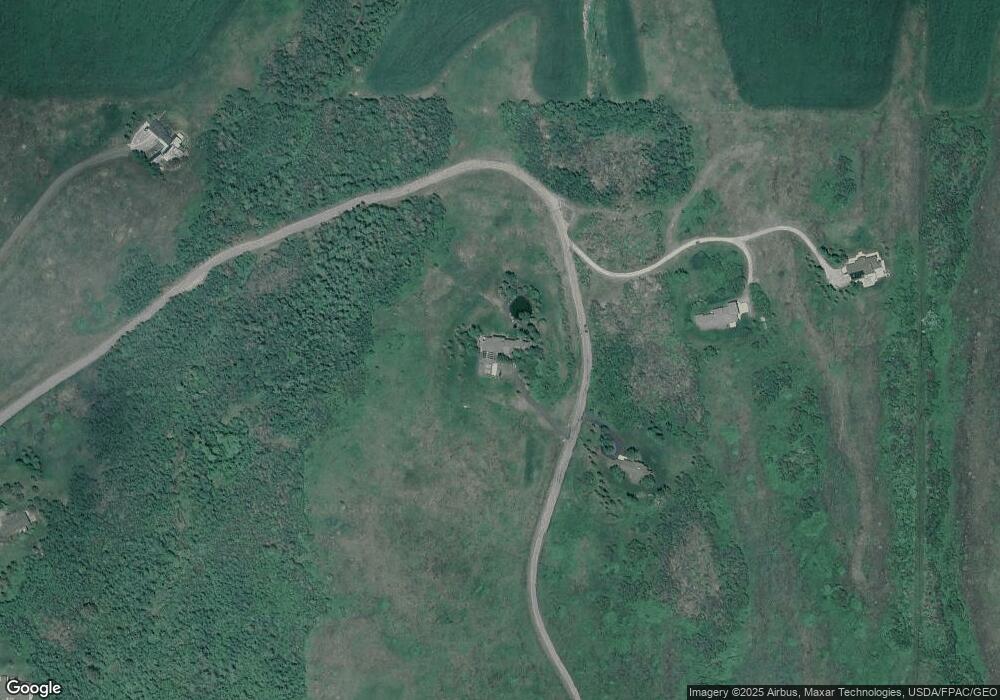
2601 Star Ridge Rd Bozeman, MT 59715
Estimated Value: $1,980,000 - $5,176,293
5
Beds
6
Baths
3,970
Sq Ft
$901/Sq Ft
Est. Value
About This Home
This home is located at 2601 Star Ridge Rd, Bozeman, MT 59715 and is currently estimated at $3,578,147, approximately $901 per square foot. 2601 Star Ridge Rd is a home located in Gallatin County with nearby schools including LaMotte School, LaMotte Junior High School, and Bozeman High School.
Ownership History
Date
Name
Owned For
Owner Type
Purchase Details
Closed on
Jan 31, 2025
Sold by
Oneill James Warner and Oneill Susan Hastings
Bought by
Oneill Family Trust and Oneill
Current Estimated Value
Purchase Details
Closed on
Jun 22, 2005
Sold by
George Anthea
Bought by
Muhlenfeld William H and Muhlenfeld George Anthea
Home Financials for this Owner
Home Financials are based on the most recent Mortgage that was taken out on this home.
Original Mortgage
$870,000
Interest Rate
5.65%
Mortgage Type
Purchase Money Mortgage
Create a Home Valuation Report for This Property
The Home Valuation Report is an in-depth analysis detailing your home's value as well as a comparison with similar homes in the area
Home Values in the Area
Average Home Value in this Area
Purchase History
| Date | Buyer | Sale Price | Title Company |
|---|---|---|---|
| Oneill Family Trust | -- | None Listed On Document | |
| Muhlenfeld William H | -- | Montana Title & Escrow |
Source: Public Records
Mortgage History
| Date | Status | Borrower | Loan Amount |
|---|---|---|---|
| Previous Owner | Muhlenfeld William H | $870,000 |
Source: Public Records
Tax History Compared to Growth
Tax History
| Year | Tax Paid | Tax Assessment Tax Assessment Total Assessment is a certain percentage of the fair market value that is determined by local assessors to be the total taxable value of land and additions on the property. | Land | Improvement |
|---|---|---|---|---|
| 2025 | $32,638 | $4,883,117 | $0 | $0 |
| 2024 | $26,842 | $4,490,567 | $0 | $0 |
| 2023 | $26,298 | $4,490,567 | $0 | $0 |
| 2022 | $18,208 | $2,687,382 | $0 | $0 |
| 2021 | $20,274 | $2,687,382 | $0 | $0 |
| 2020 | $19,598 | $2,545,559 | $0 | $0 |
| 2019 | $19,327 | $2,545,559 | $0 | $0 |
| 2018 | $17,406 | $2,151,838 | $0 | $0 |
| 2017 | $16,568 | $2,151,838 | $0 | $0 |
| 2016 | $14,292 | $1,921,746 | $0 | $0 |
| 2015 | $14,174 | $1,921,746 | $0 | $0 |
| 2014 | $16,169 | $1,321,428 | $0 | $0 |
Source: Public Records
Map
Nearby Homes
- 2594 Star Ridge Rd
- 1878 Star Ridge Rd
- 1856 Star Ridge Rd
- 370 Star Ridge Rd
- 168 Hawthorn Ln
- 709 Limestone Rd
- 317 Limestone Meadows Ln
- TBD Jack Leg Ln
- NKN Mount Ellis Ln
- 585 Wildrose Ln
- 340 Silver Tip Trail
- 101 Painted Ridge Rd
- TBD Lot 17 Boreal Way
- NHN Trooper Trail
- Tbd Sourdough Rd
- 8472 Wagon Boss Rd
- 130 Cook Ct
- 145 Blossom Way
- 125 Blossom Way
- TBD Lot 33 Boreal Way
- 2492 Star Ridge Rd
- 2103 Star Ridge Rd
- 2940 Star Ridge Rd
- 1949 Star Ridge Rd
- 2953 Star Ridge Rd
- 3075 Star Ridge Rd
- 1951 Star Ridge Rd
- 1970 Star Ridge Rd
- Lot 13 Kermodi St
- Lot 17 Kermodi St
- Lot 20 Kermodi St
- Lot 60 Kermodi St
- 1895 Mount Ellis Ln
- Tract 10 Star Ridge Rd
- Tract 22 Star Ridge Rd
- TBD Star Ridge Rd
- Tract 11 Star Ridge Rd
- 2375 Mount Ellis Ln
- 1783 Star Ridge Rd
- 1577 Star Ridge Rd
