
Seller's Agent in 2026
Shalwin Shajan
Taylor Properties
(443) 869-0793
1 in this area
11 Total Sales
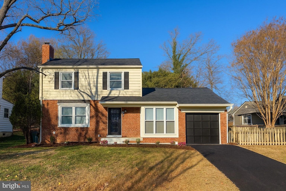
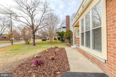
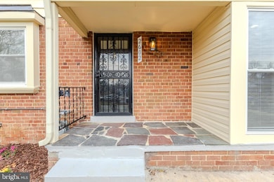
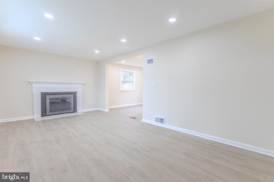
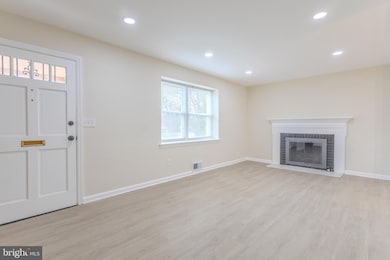

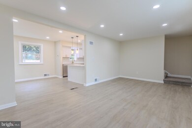
UNIQUE LAYOUT w/ WHOLE HOME Water Filtration System - 2beds/2bath UPSTAIRS, 1bed on MAIN LEVEL, and 1bed/1bath on BASEMENT LEVEL. Lavishly renovated + brand new roof & asphalt driveway! *** This move-in ready 4BR/3BA home at 2602 Fox St has been upgraded top to bottom with high-end kitchen and bath finishes, brand NEW FLOORING, and a MAIN-LEVEL BEDROOM or flex office space—perfect for convenience and flexibility. This total renovation includes a BRAND NEW designer kitchen w/ an island, NEW LVT flooring, NEW carpet, FULL paint job, brand NEW appliances, and modern fixtures throughout. Outside, enjoy a BRAND NEW PAVED DRIVEWAY and a HUGE 8,500+ sq ft lot ideal for entertaining, pets, or future expansion. Just 5 minutes to UMD and convenient to College Park, DC, shopping, dining, and major commuter routes. is new. PRIME location. Turnkey living. Homes like this go fast—act fast.
Last Agent to Sell the Property
(301) 970-2447 shalwin.realtor@gmail.com Taylor Properties Brokerage Phone: 3019702447 License #055011110 Listed on: 11/18/2025
| Date | Type | Sale Price | Title Company |
|---|---|---|---|
| Deed | $281,215 | None Listed On Document | |
| Deed | -- | None Listed On Document | |
| Deed | -- | None Listed On Document | |
| Deed | -- | None Listed On Document | |
| Deed | -- | None Listed On Document | |
| Deed | $133,000 | -- | |
| Deed | $131,000 | -- |
| Date | Event | Price | List to Sale | Price per Sq Ft |
|---|---|---|---|---|
| 03/02/2026 03/02/26 | Sold | $515,000 | +3.0% | $296 / Sq Ft |
| 02/28/2026 02/28/26 | Price Changed | $499,999 | 0.0% | $287 / Sq Ft |
| 01/30/2026 01/30/26 | Pending | -- | -- | -- |
| 01/28/2026 01/28/26 | Price Changed | $499,999 | -2.0% | $287 / Sq Ft |
| 12/14/2025 12/14/25 | Price Changed | $509,999 | -1.9% | $293 / Sq Ft |
| 12/08/2025 12/08/25 | Price Changed | $519,999 | -1.0% | $299 / Sq Ft |
| 11/30/2025 11/30/25 | Price Changed | $525,000 | -0.9% | $302 / Sq Ft |
| 11/18/2025 11/18/25 | For Sale | $530,000 | -- | $305 / Sq Ft |
| Year | Tax Paid | Tax Assessment Tax Assessment Total Assessment is a certain percentage of the fair market value that is determined by local assessors to be the total taxable value of land and additions on the property. | Land | Improvement |
|---|---|---|---|---|
| 2025 | $4,394 | $417,600 | $140,900 | $276,700 |
| 2024 | $4,394 | $423,600 | $125,900 | $297,700 |
| 2023 | $4,159 | $373,367 | $0 | $0 |
| 2022 | $3,901 | $323,133 | $0 | $0 |
| 2021 | $3,659 | $272,900 | $125,400 | $147,500 |
| 2020 | $3,561 | $256,767 | $0 | $0 |
| 2019 | $3,445 | $240,633 | $0 | $0 |
| 2018 | $3,312 | $224,500 | $100,400 | $124,100 |
| 2017 | $3,200 | $208,667 | $0 | $0 |
| 2016 | -- | $192,833 | $0 | $0 |
| 2015 | $2,939 | $177,000 | $0 | $0 |
| 2014 | $2,939 | $177,000 | $0 | $0 |
Seller's Agent in 2026
Shalwin Shajan
Taylor Properties
(443) 869-0793
1 in this area
11 Total Sales
Buyer's Agent in 2026
Edwin Escarraman
Compass
(301) 219-7185
2 in this area
126 Total Sales
Source: Bright MLS
MLS Number: MDPG2183754
APN: 21-2347185
Disclaimer: Certain information contained herein is derived from information provided by parties other than Homes.com. All information provided is deemed reliable, but is not guaranteed to be accurate and should be independently verified.
![]() The data relating to real estate for sale on this website appears in part through the BRIGHT Internet Data Exchange program, a voluntary cooperative exchange of property listing data between licensed real estate brokerage firms, and is provided by BRIGHT through a licensing agreement.
The data relating to real estate for sale on this website appears in part through the BRIGHT Internet Data Exchange program, a voluntary cooperative exchange of property listing data between licensed real estate brokerage firms, and is provided by BRIGHT through a licensing agreement.
Listing information is from various brokers who participate in the Bright MLS IDX program and not all listings may be visible on the site.
The property information being provided on or through the website is for the personal, non-commercial use of consumers and such information may not be used for any purpose other than to identify prospective properties consumers may be interested in purchasing.
Some properties which appear for sale on the website may no longer be available because they are for instance, under contract, sold or are no longer being offered for sale.
Property information displayed is deemed reliable but is not guaranteed.
Copyright 2026 Bright MLS, Inc.
Ask me questions while you tour the home.