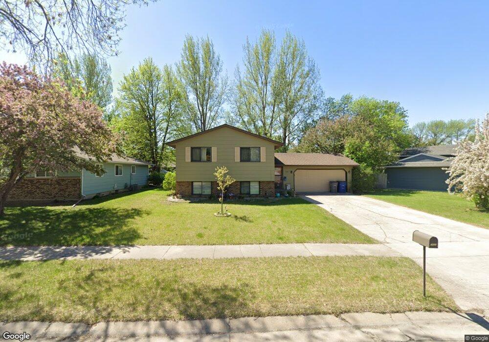
2603 Walnut Cir Moorhead, MN 56560
Estimated Value: $255,586 - $296,000
4
Beds
2
Baths
1,860
Sq Ft
$149/Sq Ft
Est. Value
About This Home
This home is located at 2603 Walnut Cir, Moorhead, MN 56560 and is currently estimated at $277,897, approximately $149 per square foot. 2603 Walnut Cir is a home located in Clay County with nearby schools including Dorothy Dodds Elementary School, Horizon Middle School, and Moorhead High School.
Ownership History
Date
Name
Owned For
Owner Type
Purchase Details
Closed on
May 19, 2008
Sold by
Sivra Relocation Llc
Bought by
Qualtyu Cory A
Current Estimated Value
Home Financials for this Owner
Home Financials are based on the most recent Mortgage that was taken out on this home.
Original Mortgage
$138,649
Outstanding Balance
$88,035
Interest Rate
5.93%
Mortgage Type
Purchase Money Mortgage
Estimated Equity
$189,862
Purchase Details
Closed on
Mar 20, 2008
Sold by
Munighan Jeffrey S and Munighan Kirsten A
Bought by
Sirva Relocation Llc
Home Financials for this Owner
Home Financials are based on the most recent Mortgage that was taken out on this home.
Original Mortgage
$138,649
Outstanding Balance
$88,035
Interest Rate
5.93%
Mortgage Type
Purchase Money Mortgage
Estimated Equity
$189,862
Create a Home Valuation Report for This Property
The Home Valuation Report is an in-depth analysis detailing your home's value as well as a comparison with similar homes in the area
Home Values in the Area
Average Home Value in this Area
Purchase History
| Date | Buyer | Sale Price | Title Company |
|---|---|---|---|
| Qualtyu Cory A | $139,900 | None Available | |
| Sirva Relocation Llc | $139,900 | None Available |
Source: Public Records
Mortgage History
| Date | Status | Borrower | Loan Amount |
|---|---|---|---|
| Open | Qualtyu Cory A | $138,649 | |
| Previous Owner | Sirva Relocation Llc | $138,649 |
Source: Public Records
Tax History Compared to Growth
Tax History
| Year | Tax Paid | Tax Assessment Tax Assessment Total Assessment is a certain percentage of the fair market value that is determined by local assessors to be the total taxable value of land and additions on the property. | Land | Improvement |
|---|---|---|---|---|
| 2025 | $2,948 | $219,400 | $48,800 | $170,600 |
| 2024 | $2,948 | $211,000 | $48,800 | $162,200 |
| 2023 | $2,924 | $205,400 | $48,800 | $156,600 |
| 2022 | $2,632 | $199,900 | $45,000 | $154,900 |
| 2021 | $2,650 | $180,600 | $41,300 | $139,300 |
| 2020 | $2,558 | $180,100 | $41,300 | $138,800 |
| 2019 | $2,638 | $178,800 | $41,300 | $137,500 |
| 2018 | $2,654 | $194,000 | $41,300 | $152,700 |
| 2017 | $2,428 | $195,700 | $43,000 | $152,700 |
| 2016 | $2,182 | $186,200 | $43,000 | $143,200 |
| 2015 | $1,750 | $148,900 | $36,900 | $112,000 |
| 2014 | $1,626 | $148,900 | $36,900 | $112,000 |
Source: Public Records
Map
Nearby Homes
- 453 Rensvold Blvd
- 525 Maple Ln
- 537 Maple Ln
- 530 Cedar Ln
- 509 Birch Ln
- 2225 4th Ave S
- 2203 4th Ave S Unit 4
- 638 Appletree Ln
- 419 18th St S
- 766 36th St S
- 516 16th St S
- 104 16th St S
- 1325 32nd Street Cir S
- 1107 17th St S
- 302 14th St S
- 1512 10th Ave S
- 600 32nd St N
- 1715 33rd St S
- 427 33rd St N
- 1516 19 1 2 St S Unit 6
- 2509 Walnut Cir
- 2607 Walnut Cir
- 2602 Spruce Ln
- 2505 Walnut Cir
- 2611 Walnut Cir
- 2508 Spruce Ln
- 2606 Walnut Cir
- 2602 Walnut Cir
- 2501 Walnut Cir
- 2610 Walnut Cir
- 2615 Walnut Cir
- 440 Rensvold Blvd
- 2612 Spruce Ln
- 2506 Walnut Cir
- 2510 Walnut Cir
- 2614 Walnut Cir
- 2705 Walnut Cir
- 414 Rensvold Blvd
- 2609 4th Ave S
- 2605 Spruce Ln