Estimated Value: $84,171 - $134,000
2
Beds
1
Bath
936
Sq Ft
$111/Sq Ft
Est. Value
About This Home
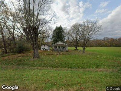
This home is located at 26069 Us Highway 52, Stout, OH 45684 and is currently estimated at $103,543, approximately $110 per square foot. 26069 Us Highway 52 is a home located in Adams County with nearby schools including Manchester Elementary School and Manchester High School.
Ownership History
Date
Name
Owned For
Owner Type
Purchase Details
Closed on
Feb 15, 2019
Sold by
Deutsche Bank National Trust Co
Bought by
Taylor Wesley and Taylor Melinda K
Current Estimated Value
Purchase Details
Closed on
Nov 14, 2018
Sold by
Yates Edna C and Blevins Edna C
Bought by
Deutsche Bank National Trust Co and Morgan Stanley Home Equity Loan Trust 20
Purchase Details
Closed on
Nov 9, 2006
Sold by
Yates Edna C and Blevins Edna C
Bought by
Yates Edna C
Home Financials for this Owner
Home Financials are based on the most recent Mortgage that was taken out on this home.
Original Mortgage
$65,000
Interest Rate
8.5%
Mortgage Type
Assumption
Purchase Details
Closed on
Mar 14, 2001
Bought by
Blevins Edna C
Purchase Details
Closed on
Jun 1, 1978
Bought by
Franklin Real Estate Co
Create a Home Valuation Report for This Property
The Home Valuation Report is an in-depth analysis detailing your home's value as well as a comparison with similar homes in the area
Home Values in the Area
Average Home Value in this Area
Purchase History
| Date | Buyer | Sale Price | Title Company |
|---|---|---|---|
| Taylor Wesley | $23,943 | None Available | |
| Deutsche Bank National Trust Co | $30,000 | None Available | |
| Yates Edna C | -- | None Available | |
| Blevins Edna C | $48,000 | -- | |
| Franklin Real Estate Co | $55,000 | -- |
Source: Public Records
Mortgage History
| Date | Status | Borrower | Loan Amount |
|---|---|---|---|
| Open | Taylor Wesley | $28,500 | |
| Previous Owner | Yates Edna C | $65,000 |
Source: Public Records
Tax History Compared to Growth
Tax History
| Year | Tax Paid | Tax Assessment Tax Assessment Total Assessment is a certain percentage of the fair market value that is determined by local assessors to be the total taxable value of land and additions on the property. | Land | Improvement |
|---|---|---|---|---|
| 2024 | $705 | $21,430 | $6,410 | $15,020 |
| 2023 | $709 | $21,430 | $6,410 | $15,020 |
| 2022 | $704 | $15,510 | $4,620 | $10,890 |
| 2021 | $542 | $15,510 | $4,620 | $10,890 |
| 2020 | $528 | $15,510 | $4,620 | $10,890 |
| 2019 | $528 | $15,510 | $4,620 | $10,890 |
| 2018 | $581 | $14,070 | $4,620 | $9,450 |
| 2017 | $516 | $14,070 | $4,620 | $9,450 |
| 2016 | $514 | $14,070 | $4,620 | $9,450 |
| 2015 | $435 | $12,150 | $4,060 | $8,090 |
| 2014 | $435 | $12,150 | $4,060 | $8,090 |
Source: Public Records
Map
Nearby Homes
- 26960 U S 52
- 583 Kentucky 8
- 1156 Walnut St
- 484 Clarksburg Rd
- 78 Halbert Ave
- 3555 W Ky 8
- 3555 Kentucky 8
- 38 High St
- 10976 Kentucky 59
- 10976 Kentucky 59 Unit A
- 10976-A Kentucky 59
- 0 Town Branch Rd
- 4457 Kentucky 9
- 128 Southern Manor Rd
- 0 Lower Twin Creek Rd Unit 1824783
- 151 White Pine Ln
- 281 Chestnut St
- 000 Aa Hwy
- 0 Aa Hwy
- 5290 Kentucky 8