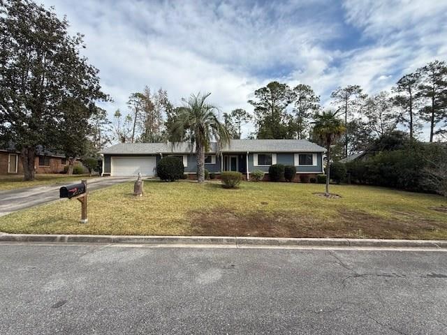
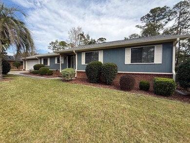
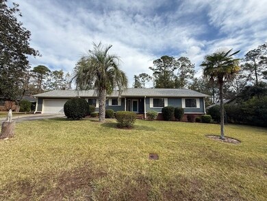

2607 Rolling Hill Dr Valdosta, GA 31602
Estimated payment $1,393/month
Highlights
- No HOA
- Rear Porch
- Screened Patio
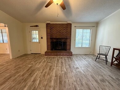
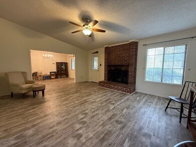
- Fireplace
- Double Pane Windows
- Cooling Available
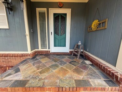
About This Home
Beautiful 3BR/2BA home in Old Wood Valley! Centrally located near SGMC, VSU, shopping, and restaurants, this well-maintained property features updated bathrooms and LVP flooring throughout. Spacious living room with a brick fireplace, plus a kitchen with granite countertops, stainless steel appliances, and abundant cabinetry. Enjoy outdoor living on the screened-in back porch with hot tub, overlooking a large fenced backyard with attractive landscaping. Move-in ready and convenient to everything!
Listing Agent
Southern Classic Realtors Brokerage Phone: 6786358877 License #352283 Listed on: 11/25/2025

Home Details
Home Type
- Single Family
Est. Annual Taxes
- $1,928
Year Built
- Built in 1977
Lot Details
- 0.3 Acre Lot
- Lot Dimensions are 100 x 130
- Fenced
- Property is zoned R-10
Parking
- 2 Car Garage
- Garage Door Opener
Home Design
- Slab Foundation
- Architectural Shingle Roof
- Cement Siding
Interior Spaces
- 1,656 Sq Ft Home
- 1-Story Property
- Ceiling Fan
- Fireplace
- Double Pane Windows
- Blinds
- Luxury Vinyl Tile Flooring
Kitchen
- Electric Range
- Dishwasher
- Disposal
Bedrooms and Bathrooms
- 3 Bedrooms
- 2 Full Bathrooms
Laundry
- Laundry Room
- Dryer
- Washer
Home Security
- Home Security System
- Termite Clearance
Outdoor Features
- Screened Patio
- Rear Porch
Utilities
- Cooling Available
- Heat Pump System
Community Details
- No Home Owners Association
- Old Wood Valley Subdivision
Listing and Financial Details
- Assessor Parcel Number 0081B 110
Map
Home Values in the Area
Average Home Value in this Area
Tax History
| Year | Tax Paid | Tax Assessment Tax Assessment Total Assessment is a certain percentage of the fair market value that is determined by local assessors to be the total taxable value of land and additions on the property. | Land | Improvement |
|---|---|---|---|---|
| 2024 | $1,928 | $75,194 | $18,000 | $57,194 |
| 2023 | $1,821 | $75,194 | $18,000 | $57,194 |
| 2022 | $1,777 | $62,571 | $18,000 | $44,571 |
| 2021 | $1,518 | $53,657 | $18,000 | $35,657 |
| 2020 | $1,551 | $53,657 | $18,000 | $35,657 |
| 2019 | $1,550 | $53,657 | $18,000 | $35,657 |
| 2018 | $1,570 | $53,657 | $18,000 | $35,657 |
| 2017 | $1,716 | $53,657 | $18,000 | $35,657 |
| 2016 | $1,940 | $53,657 | $18,000 | $35,657 |
| 2015 | -- | $53,657 | $18,000 | $35,657 |
| 2014 | -- | $53,657 | $18,000 | $35,657 |
Property History
| Date | Event | Price | List to Sale | Price per Sq Ft |
|---|---|---|---|---|
| 11/25/2025 11/25/25 | Pending | -- | -- | -- |
| 11/25/2025 11/25/25 | For Sale | $235,000 | -- | $142 / Sq Ft |
Purchase History
| Date | Type | Sale Price | Title Company |
|---|---|---|---|
| Warranty Deed | $133,500 | -- | |
| Deed | $86,000 | -- | |
| Deed | $30,600 | -- | |
| Deed | $30,000 | -- | |
| Deed | $51,000 | -- | |
| Deed | $8,500 | -- | |
| Deed | $180,300 | -- |
Mortgage History
| Date | Status | Loan Amount | Loan Type |
|---|---|---|---|
| Open | $106,800 | New Conventional |
Source: South Georgia MLS
MLS Number: 146916
APN: 0081B-110
- 21701 Highpoint Dr
- 2507 Lakewood Dr
- 2005 Baytree Rd
- 2523 Buena Vista Cir
- 5983 Lakeshore Dr
- 2525 Buena Vista Cir
- 2115 Westfield Dr
- 2213 Riverside Dr
- 2008 Baytree Rd
- 2115 Pinecliff Dr
- 2210 Lakeshore Cir
- 2201 Riverside Dr
- 2411 Riverside Dr
- 2206 Briarcliff Dr
- 2317 Riverhill Dr
- 2243 Oakgrove Cir
- 2121 Northwood Cir
- 2092 S Sherwood Dr Unit P130
- 2092 S Sherwood Dr Unit P130
- 2092 S Sherwood Dr Unit 88