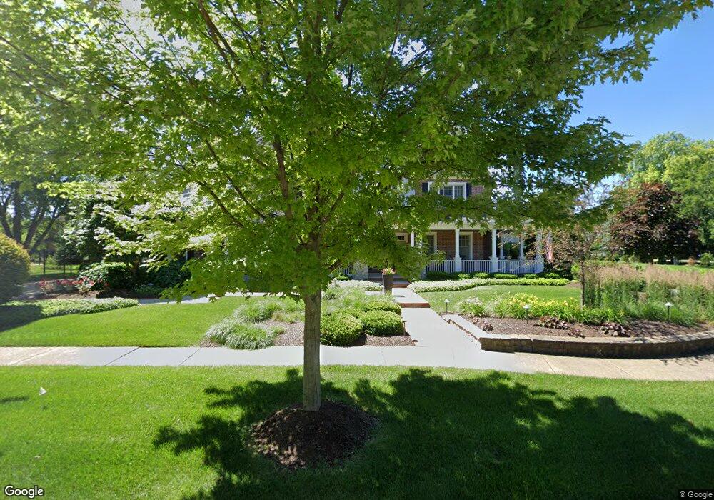
2607 Sutton Cir Naperville, IL 60564
Brook Crossing NeighborhoodEstimated Value: $946,000 - $2,341,675
Studio
1
Bath
30,928
Sq Ft
$56/Sq Ft
Est. Value
About This Home
This home is located at 2607 Sutton Cir, Naperville, IL 60564 and is currently estimated at $1,735,225, approximately $56 per square foot. 2607 Sutton Cir is a home located in Will County with nearby schools including Robert Clow Elementary School, Gordon Gregory Middle School, and Neuqua Valley High School.
Ownership History
Date
Name
Owned For
Owner Type
Purchase Details
Closed on
Jul 21, 2004
Sold by
Harris Trust & Savings Bank
Bought by
Wolf Randall and Wolf Kimberly
Current Estimated Value
Home Financials for this Owner
Home Financials are based on the most recent Mortgage that was taken out on this home.
Original Mortgage
$1,000,000
Outstanding Balance
$505,458
Interest Rate
6.4%
Mortgage Type
Purchase Money Mortgage
Estimated Equity
$1,229,767
Create a Home Valuation Report for This Property
The Home Valuation Report is an in-depth analysis detailing your home's value as well as a comparison with similar homes in the area
Home Values in the Area
Average Home Value in this Area
Purchase History
| Date | Buyer | Sale Price | Title Company |
|---|---|---|---|
| Wolf Randall | -- | -- |
Source: Public Records
Mortgage History
| Date | Status | Borrower | Loan Amount |
|---|---|---|---|
| Open | Wolf Randall | $1,000,000 |
Source: Public Records
Tax History
| Year | Tax Paid | Tax Assessment Tax Assessment Total Assessment is a certain percentage of the fair market value that is determined by local assessors to be the total taxable value of land and additions on the property. | Land | Improvement |
|---|---|---|---|---|
| 2024 | $37,623 | $582,411 | $137,766 | $444,645 |
| 2023 | $37,623 | $514,497 | $121,701 | $392,796 |
| 2022 | $23,005 | $323,524 | $115,126 | $208,398 |
| 2021 | $22,007 | $405,589 | $109,644 | $295,945 |
| 2020 | $28,564 | $408,132 | $107,907 | $300,225 |
| 2019 | $28,734 | $396,630 | $104,866 | $291,764 |
| 2018 | $30,541 | $413,706 | $102,559 | $311,147 |
| 2017 | $30,095 | $403,025 | $99,911 | $303,114 |
| 2016 | $29,526 | $394,349 | $97,760 | $296,589 |
| 2015 | $30,492 | $379,182 | $94,000 | $285,182 |
| 2014 | $30,492 | $383,525 | $94,000 | $289,525 |
| 2013 | $30,492 | $383,525 | $94,000 | $289,525 |
Source: Public Records
Map
Nearby Homes
- 28W587 Leverenz Rd
- 28W555 Leverenz Rd
- 2939 Brossman St
- 2828 Bluewater Cir
- 2311 Leverenz Rd
- 3111 Landore Dr
- 2552 Dewes Ln
- 3027 Brossman St
- 2423 Durango Ln
- 2503 Skylane Dr
- 1329 Neskola Ct
- 3212 Bennett Dr
- 2240 Mecan Dr
- 2809 Alameda Ct
- 1367 Saxon Ln
- 2627 Homestead Dr
- 1364 Saxon Ln
- 1137 Crimson Ct
- 1211 Conan Doyle Rd
- 3412 Falkner Dr
- 2603 Sutton Cir
- 2631 Sutton Cir
- 2647 Sutton Cir
- 2608 Sutton Cir
- 2604 Sutton Cir
- 2616 Sutton Cir
- 2624 Sutton Cir
- 10S538 Book Rd
- 10S485 Book Rd
- 2620 Sutton Cir
- 2644 Sutton Cir
- 2640 Sutton Cir
- 2632 Sutton Cir
- 28W753 Davidson Rd
- 2648 Sutton Cir
- 10S556 Book Rd
- 29W015 Shell Lake Dr
- 10S574 Book Rd
- 28W737 Davidson Rd
- 10S473 Book Rd
Your Personal Tour Guide
Ask me questions while you tour the home.