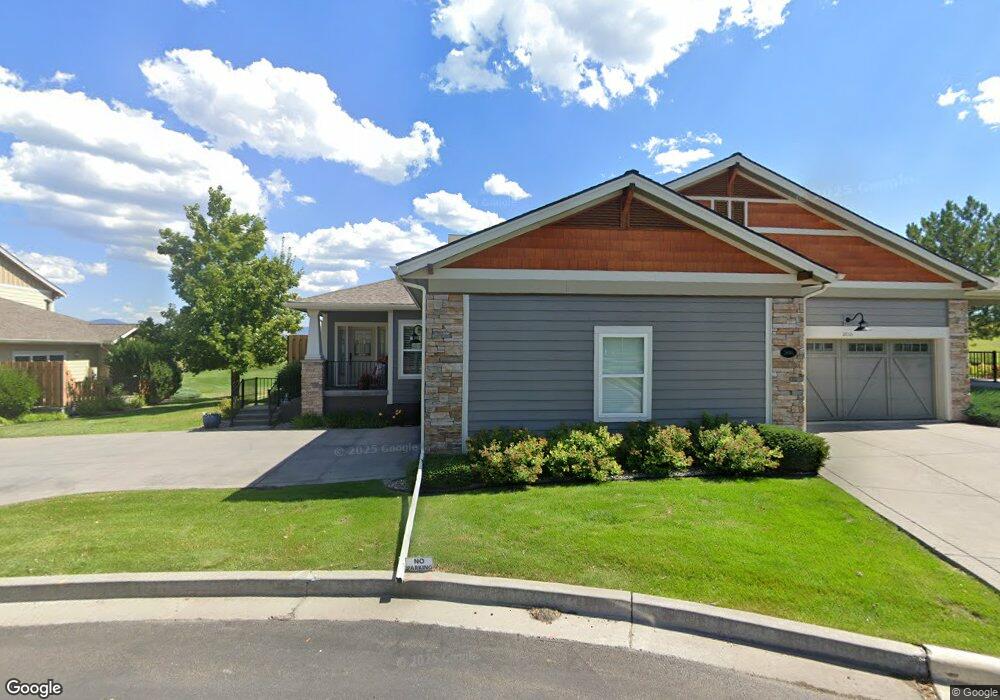
2614B Tanbark Way Missoula, MT 59808
Captain John Mullan NeighborhoodEstimated Value: $651,000 - $862,520
1
Bed
2
Baths
--
Sq Ft
$-378,920/Sq Ft
Est. Value
About This Home
This home is located at 2614B Tanbark Way, Missoula, MT 59808 and is currently estimated at $757,840. 2614B Tanbark Way is a home located in Missoula County with nearby schools including Hellgate Elementary Lower Grades, Hellgate Middle School, and Big Sky High School.
Ownership History
Date
Name
Owned For
Owner Type
Purchase Details
Closed on
Jun 13, 2016
Sold by
Gordon Carol A
Bought by
Larson Sandra K
Current Estimated Value
Purchase Details
Closed on
May 27, 2005
Sold by
Mostad Construction Inc
Bought by
Gordon John R and Gordon Carol A
Home Financials for this Owner
Home Financials are based on the most recent Mortgage that was taken out on this home.
Original Mortgage
$90,000
Interest Rate
5.84%
Mortgage Type
Fannie Mae Freddie Mac
Create a Home Valuation Report for This Property
The Home Valuation Report is an in-depth analysis detailing your home's value as well as a comparison with similar homes in the area
Home Values in the Area
Average Home Value in this Area
Purchase History
| Date | Buyer | Sale Price | Title Company |
|---|---|---|---|
| Larson Sandra K | -- | Insured Title Llc | |
| Gordon John R | -- | Insured Titles Llc |
Source: Public Records
Mortgage History
| Date | Status | Borrower | Loan Amount |
|---|---|---|---|
| Previous Owner | Gordon John R | $90,000 |
Source: Public Records
Tax History Compared to Growth
Tax History
| Year | Tax Paid | Tax Assessment Tax Assessment Total Assessment is a certain percentage of the fair market value that is determined by local assessors to be the total taxable value of land and additions on the property. | Land | Improvement |
|---|---|---|---|---|
| 2025 | $7,233 | $754,874 | $140,484 | $614,390 |
| 2024 | $7,166 | $601,700 | $100,044 | $501,656 |
| 2023 | $6,699 | $601,700 | $100,044 | $501,656 |
| 2022 | $6,632 | $500,300 | $0 | $0 |
| 2021 | $5,981 | $500,300 | $0 | $0 |
| 2020 | $5,763 | $447,200 | $0 | $0 |
| 2019 | $5,696 | $447,200 | $0 | $0 |
| 2018 | $5,953 | $454,700 | $0 | $0 |
| 2017 | $5,861 | $454,700 | $0 | $0 |
| 2016 | $5,437 | $447,700 | $0 | $0 |
| 2015 | $5,128 | $447,700 | $0 | $0 |
| 2014 | $4,888 | $234,843 | $0 | $0 |
Source: Public Records
Map
Nearby Homes
- 2625 Tanbark Way Unit A
- 2626 Muirfield Ct
- 2669 Bunkhouse Place
- 2645 Bunkhouse Place
- 3068 Rustler Dr
- 3069 Trading Post Place
- 8245 Pheasant Dr
- 8645 Mourning Dove Dr
- 2789 Paniolo Place
- 2783 Paniolo Place
- 2130 Oriole Dr
- 2100 Hummingbird Dr
- 8105 Pheasant Dr
- 2729 Paniolo Place
- 2736 Paniolo Place
- 1935 Oriole Dr
- NHN, Lot 24 Royal Coachman Dr
- NHN Lot 25 Spinner Fall Way
- 146 New Meadows Dr
- 121 New Meadows Dr
- 2614 Tanbark Way Unit B
- 2614A Tanbark Way
- 2625B Tanbark Way
- 8709A Ranch Club Rd
- 8709 Ranch Club Rd Unit B
- 2622B Tanbark Way
- 8709A Ranch Club Rd
- 8709B Ranch Club Rd
- 8715A Ranch Club Rd
- 2625 A Tanbark Way
- 8715 Ranch Club Rd Unit A
- 8715 Ranch Club Rd
- 8715 Ranch Club Rd Unit B
- 2625A Tanbark Way
- 8715B Ranch Club Rd
- 2630 Tanbark Way Unit B
- 2630 Tanbark Way Unit A
- 2630 Tanbark Way
- 2630A Tanbark Way