
2615 Brook Dr Kalamazoo, MI 49048
Estimated payment $1,133/month
Highlights
- 2.53 Acre Lot
- Traditional Architecture
- 1 Fireplace
- Wooded Lot
- Wood Flooring
- No HOA
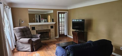
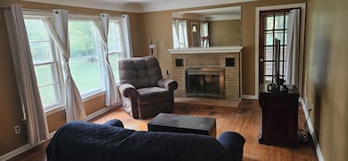
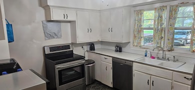
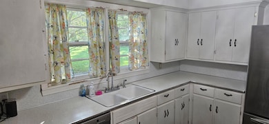
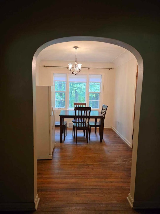
About This Home
Exciting home with a large upside placed on 2.5 acres backing up to Spring Valley Park. Many mature trees. Very solid home has much character. Plenty of opportunity to earn sweat equity as you update the home to your liking. Priced to sell. Newer roof. Wonderful opportunity!
Home Details
Home Type
- Single Family
Est. Annual Taxes
- $3,470
Year Built
- Built in 1943
Lot Details
- 2.53 Acre Lot
- Lot Dimensions are 318x445x370x250
- Wooded Lot
Parking
- 2 Car Attached Garage
- Front Facing Garage
Home Design
- Traditional Architecture
- Vinyl Siding
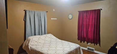
Interior Spaces
- 1,525 Sq Ft Home
- 2-Story Property
- 1 Fireplace
- Wood Flooring
- Laundry on main level
Bedrooms and Bathrooms
- 3 Bedrooms | 2 Main Level Bedrooms
- 1 Full Bathroom
Basement
- Basement Fills Entire Space Under The House
- Laundry in Basement
Utilities
- Forced Air Heating System
- Heating System Uses Oil
Community Details
- No Home Owners Association
Map
Home Values in the Area
Average Home Value in this Area
Tax History
| Year | Tax Paid | Tax Assessment Tax Assessment Total Assessment is a certain percentage of the fair market value that is determined by local assessors to be the total taxable value of land and additions on the property. | Land | Improvement |
|---|---|---|---|---|
| 2025 | $3,338 | $103,000 | $0 | $0 |
| 2024 | $1,517 | $103,100 | $0 | $0 |
| 2023 | $1,446 | $94,500 | $0 | $0 |
| 2022 | $3,032 | $78,000 | $0 | $0 |
| 2021 | $2,812 | $72,700 | $0 | $0 |
| 2020 | $2,768 | $66,100 | $0 | $0 |
| 2019 | $2,643 | $60,300 | $0 | $0 |
| 2018 | $2,526 | $55,400 | $0 | $0 |
| 2017 | $0 | $55,400 | $0 | $0 |
| 2016 | -- | $54,100 | $0 | $0 |
| 2015 | -- | $53,800 | $0 | $0 |
| 2014 | -- | $50,600 | $0 | $0 |
Property History
| Date | Event | Price | List to Sale | Price per Sq Ft |
|---|---|---|---|---|
| 11/06/2025 11/06/25 | Pending | -- | -- | -- |
| 10/30/2025 10/30/25 | For Sale | $159,900 | 0.0% | $105 / Sq Ft |
| 10/23/2025 10/23/25 | Pending | -- | -- | -- |
| 10/14/2025 10/14/25 | For Sale | $159,900 | -- | $105 / Sq Ft |
Purchase History
| Date | Type | Sale Price | Title Company |
|---|---|---|---|
| Quit Claim Deed | -- | None Listed On Document | |
| Interfamily Deed Transfer | -- | None Available |
Mortgage History
| Date | Status | Loan Amount | Loan Type |
|---|---|---|---|
| Previous Owner | $21,000 | Stand Alone Second |
Source: MichRIC
MLS Number: 25052935
APN: 06-12-105-010
Disclaimer: Certain information contained herein is derived from information provided by parties other than Homes.com. All information provided is deemed reliable, but is not guaranteed to be accurate and should be independently verified.
![]() Information is deemed reliable but not guaranteed.
Information is deemed reliable but not guaranteed.
Copyright 2025 MichRIC, LLC. All rights reserved.
- 2215 Brook Dr
- 3045 Alpine St
- 2535 Gull Rd
- 2930 Onondaga Ave
- 2517 Ashton Ave
- 2423 Ashton Ave
- 2428 Glendale Blvd
- 3104 Courtlandt Ave
- 1727 Sunnyside Dr
- 1726 Upland Dr
- 3704 Borgess Dr
- 3022 Virginia Ave
- 3221 Miami Ave
- 3316 Nazareth Rd
- 2921 Virginia Ave
- 2105 Gull Rd
- 1934 Nazareth Rd
- 1718 Henson Ave
- 5015 Gull Rd
- 1415 Nassau St
