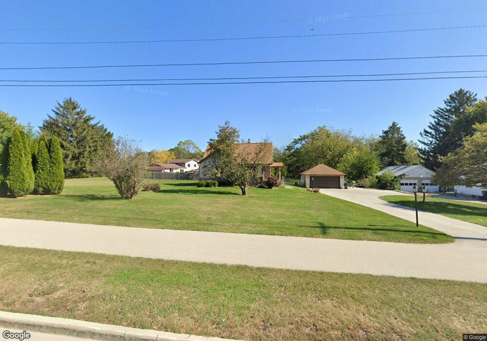
2615 Meadowbrook Rd Waukesha, WI 53188
Estimated Value: $420,000 - $429,215
4
Beds
2
Baths
1,871
Sq Ft
$226/Sq Ft
Est. Value
About This Home
This home is located at 2615 Meadowbrook Rd, Waukesha, WI 53188 and is currently estimated at $423,554, approximately $226 per square foot. 2615 Meadowbrook Rd is a home located in Waukesha County with nearby schools including Meadowbrook Elementary School, Butler Middle School, and North High School.
Ownership History
Date
Name
Owned For
Owner Type
Purchase Details
Closed on
Apr 29, 2010
Sold by
Tannis Mary K and Tannis Michael J
Bought by
Hosking Michael and Hosking Theresa
Current Estimated Value
Home Financials for this Owner
Home Financials are based on the most recent Mortgage that was taken out on this home.
Original Mortgage
$180,667
Outstanding Balance
$123,731
Interest Rate
5.5%
Mortgage Type
FHA
Estimated Equity
$299,823
Create a Home Valuation Report for This Property
The Home Valuation Report is an in-depth analysis detailing your home's value as well as a comparison with similar homes in the area
Home Values in the Area
Average Home Value in this Area
Purchase History
| Date | Buyer | Sale Price | Title Company |
|---|---|---|---|
| Hosking Michael | $184,000 | First American Title Ins Co |
Source: Public Records
Mortgage History
| Date | Status | Borrower | Loan Amount |
|---|---|---|---|
| Open | Hosking Michael | $180,667 |
Source: Public Records
Tax History Compared to Growth
Tax History
| Year | Tax Paid | Tax Assessment Tax Assessment Total Assessment is a certain percentage of the fair market value that is determined by local assessors to be the total taxable value of land and additions on the property. | Land | Improvement |
|---|---|---|---|---|
| 2024 | $5,351 | $359,600 | $149,400 | $210,200 |
| 2023 | $5,206 | $359,600 | $149,400 | $210,200 |
| 2022 | $4,015 | $210,900 | $99,800 | $111,100 |
| 2021 | $4,106 | $210,900 | $99,800 | $111,100 |
| 2020 | $3,973 | $210,900 | $99,800 | $111,100 |
| 2019 | $3,846 | $210,900 | $99,800 | $111,100 |
| 2018 | $3,671 | $197,100 | $88,000 | $109,100 |
| 2017 | $4,122 | $197,100 | $88,000 | $109,100 |
| 2016 | $3,544 | $179,200 | $88,000 | $91,200 |
| 2015 | $3,524 | $179,200 | $88,000 | $91,200 |
| 2014 | $3,392 | $165,900 | $88,000 | $77,900 |
| 2013 | $3,392 | $165,900 | $88,000 | $77,900 |
Source: Public Records
Map
Nearby Homes
- 3014 Plymouth Ct
- 2912 Willard Ln
- 2312 Judith Ln
- W276N544 Arrowhead Trail
- 2106 Bluestem Dr Unit 1301
- The Adalyn Plan at Tallgrass - Villas
- 2108 Bluestem Dr Unit 1302
- 2119 Bluestem Dr Unit 201
- 2127 Bluestem Dr Unit 101
- 2117 Bluestem Dr Unit 202
- 2125 Bluestem Dr Unit 102
- 2728 Northview Rd Unit 61
- 2605 Emslie Dr
- 2912 N University Dr Unit 305
- 2912 N University Dr Unit 208
- 2732 Northview Rd Unit 88
- 1917 Tree Line Ct
- N15W26518 Tall Reeds Ln Unit C
- N16W26571 Tall Reeds Ln Unit B
- N16W26539 Tall Reeds Ln Unit D
- 2607 Meadowbrook Rd
- 2608 Meadowbrook Rd
- 2612 Meadowbrook Rd
- 2604 Meadowbrook Rd
- 2601 Faringdon Ct
- 2616 Meadowbrook Rd
- 2600 Meadowbrook Rd
- W270N730 Joanne Dr
- 2605 Faringdon Ct
- 2604 Joanne Dr
- 2600 Faringdon Ct
- 2604 Faringdon Ct
- 2620 Meadowbrook Rd
- W270N770 Joanne Dr
- 2501 Lancaster Dr
- 2610 Joanne Dr
- 2608 Faringdon Ct
- 2600 Joanne Dr
- 2609 Faringdon Ct
- 2508 Lancaster Dr