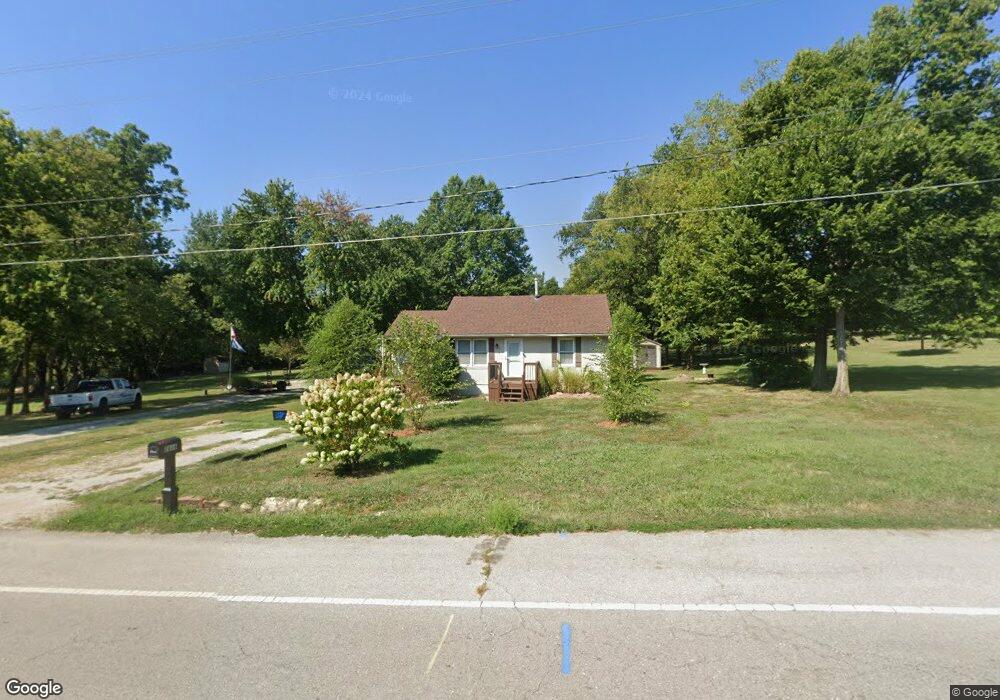
2616 Ringo Rd Independence, MO 64057
Blackburn NeighborhoodEstimated Value: $155,000 - $201,000
About This Home
This home is located at 2616 Ringo Rd, Independence, MO 64057 and is currently estimated at $168,636, approximately $215 per square foot. 2616 Ringo Rd is a home located in Jackson County with nearby schools including Blackburn Elementary School, Bridger Middle School, and Pioneer Ridge Middle School.
Ownership History
We collect this data history from publicly available records. To have your information removed, we recommend requesting removal directly through your county’s website.
Purchase Details
Home Financials for this Owner
Home Financials are based on the most recent Mortgage that was taken out on this home.Purchase Details
Home Values in the Area
Average Home Value in this Area
Purchase History
We collect this data history from publicly available records. To have your information removed, we recommend requesting removal directly through your county’s website.
| Date | Buyer | Sale Price | Title Company |
|---|---|---|---|
| -- | None Listed On Document | ||
| -- | Commonwealth Land Title | ||
| -- | -- |
Mortgage History
We collect this data history from publicly available records. To have your information removed, we recommend requesting removal directly through your county’s website.
| Date | Status | Borrower | Loan Amount |
|---|---|---|---|
| Open | $159,856 |
Tax History
We collect this data history from publicly available records. To have your information removed, we recommend requesting removal directly through your county’s website.
| Year | Tax Paid | Tax Assessment Tax Assessment Total Assessment is a certain percentage of the fair market value that is determined by local assessors to be the total taxable value of land and additions on the property. | Land | Improvement |
|---|---|---|---|---|
| 2025 | $1,249 | $15,077 | $3,960 | $11,117 |
| 2024 | $1,221 | $18,031 | $2,711 | $15,320 |
| 2023 | $1,221 | $18,031 | $2,785 | $15,246 |
| 2022 | $842 | $11,400 | $2,052 | $9,348 |
| 2021 | $842 | $11,400 | $2,052 | $9,348 |
| 2020 | $762 | $10,023 | $2,052 | $7,971 |
| 2019 | $749 | $10,023 | $2,052 | $7,971 |
| 2018 | $683 | $8,723 | $1,786 | $6,937 |
| 2017 | $673 | $8,723 | $1,786 | $6,937 |
| 2016 | $673 | $8,505 | $2,541 | $5,964 |
| 2014 | $658 | $8,505 | $2,541 | $5,964 |
Map
- 2721 Trenchard Dr
- 19019 E Ringo Cir
- 2821 Tepee Ave
- 18606 E 28th St S
- 2600 S Cochise Ave
- 18719 Gateway Dr
- 2431 S Ponca Ave
- 3008 S Bryn Mawr Dr
- 2916 Sweet Briar Dr
- 18901 E 30th Terrace S
- 3008 S Cochise Dr
- 3004 Iva Dr
- 18200 Hanthorne Dr
- 3115 S Arrowhead Dr
- 3212 Bryn Mawr Dr
- 3220 S Bryn Mawr Dr
- 3217 S Elizabeth Ave
- 20125 E 24th Terrace Ct S
- 3305 S Sioux Ct
- 3320 Hanthorn Ave
- 19100 E 27th Street Ct S
- 2611S Ringo Rd
- 2700 Ringo Rd
- 19101 E 27th Street Ct S
- 19104 E 27th Street Ct S
- 2720 Ringo Rd
- 2614 Ringo Rd
- 19105 E 27th Street Ct S
- 2721 Ringo Rd
- 2607 Ringo Rd
- 19108 E 27th Street Ct S
- 19112 E 27th Street Ct S
- 19100 E 28th Terrace Ct S
- 19109 E 27th Street Ct S
- 18904 E Ringo Ct
- 2605 Ringo Rd
- 2610 Ringo Rd
- 19104 E 28th Terrace Ct S
- 18912 E Ringo Ct
- 18909 E Ringo Ct
Ask me questions while you tour the home.