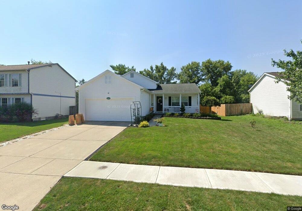
2617 Admiral Dr Grove City, OH 43123
Willow Creek NeighborhoodEstimated Value: $272,728 - $322,000
3
Beds
2
Baths
1,142
Sq Ft
$257/Sq Ft
Est. Value
About This Home
This home is located at 2617 Admiral Dr, Grove City, OH 43123 and is currently estimated at $293,182, approximately $256 per square foot. 2617 Admiral Dr is a home located in Franklin County with nearby schools including James A Harmon Elementary School, Franklin Woods Intermediate School, and Finland Middle School.
Ownership History
Date
Name
Owned For
Owner Type
Purchase Details
Closed on
Jul 27, 1999
Sold by
Ford Crystal L
Bought by
Ford Dolan D
Current Estimated Value
Home Financials for this Owner
Home Financials are based on the most recent Mortgage that was taken out on this home.
Original Mortgage
$8,741
Interest Rate
7.77%
Mortgage Type
Stand Alone Second
Purchase Details
Closed on
Jun 26, 1998
Sold by
Layman Homes Inc
Bought by
Ford Dolan D and Ford Crystal L
Home Financials for this Owner
Home Financials are based on the most recent Mortgage that was taken out on this home.
Original Mortgage
$127,700
Interest Rate
7.18%
Mortgage Type
FHA
Create a Home Valuation Report for This Property
The Home Valuation Report is an in-depth analysis detailing your home's value as well as a comparison with similar homes in the area
Home Values in the Area
Average Home Value in this Area
Purchase History
| Date | Buyer | Sale Price | Title Company |
|---|---|---|---|
| Ford Dolan D | -- | -- | |
| Ford Dolan D | $128,500 | Preferred Title Agency Inc |
Source: Public Records
Mortgage History
| Date | Status | Borrower | Loan Amount |
|---|---|---|---|
| Closed | Ford Dolan D | $22,724 | |
| Closed | Ford Dolan D | $131,239 | |
| Closed | Ford Dolan D | $9,077 | |
| Closed | Ford Dolan D | $130,000 | |
| Closed | Ford Doland D | $8,741 | |
| Closed | Ford Dolan D | $127,700 |
Source: Public Records
Tax History Compared to Growth
Tax History
| Year | Tax Paid | Tax Assessment Tax Assessment Total Assessment is a certain percentage of the fair market value that is determined by local assessors to be the total taxable value of land and additions on the property. | Land | Improvement |
|---|---|---|---|---|
| 2024 | $3,210 | $88,030 | $21,350 | $66,680 |
| 2023 | $3,153 | $88,025 | $21,350 | $66,675 |
| 2022 | $2,948 | $60,410 | $8,400 | $52,010 |
| 2021 | $3,008 | $60,410 | $8,400 | $52,010 |
| 2020 | $2,990 | $60,410 | $8,400 | $52,010 |
| 2019 | $2,315 | $41,270 | $7,000 | $34,270 |
| 2018 | $2,372 | $41,270 | $7,000 | $34,270 |
| 2017 | $2,367 | $41,270 | $7,000 | $34,270 |
| 2016 | $2,440 | $40,330 | $7,250 | $33,080 |
| 2015 | $2,440 | $40,330 | $7,250 | $33,080 |
| 2014 | $2,442 | $40,330 | $7,250 | $33,080 |
| 2013 | $1,275 | $42,455 | $7,630 | $34,825 |
Source: Public Records
Map
Nearby Homes
- 2564 Hardy Parkway St
- 2000 Candlenut Cir
- 1962 Farmbrook Cir N Unit 6
- 1948 Farmbrook Cir S Unit 7
- 1896 Dyer Rd
- 1892 Farmbrook Cir S
- 2321 Hunterstown Dr
- 2365 Creek View Place
- 1969 Forest Lake Ct
- 2407 Sunladen Dr
- 1735 Dyer Rd
- 3343 Marshrun Dr
- 3140 Catan Loop Unit 3140
- 2408 Warfield Dr
- 3187 Parkview Cir Unit 3187
- 3400 Marshrun Dr
- 3201 Parkview Cir
- 2402 Rock Creek Ct
- 2272 Topaz Dr
- 2843 Horsham Dr
- 2611 Admiral Dr
- 2623 Admiral Dr
- 2629 Admiral Dr
- 2605 Admiral Dr
- 2612 Admiral Dr
- 2600 Admiral Dr
- 2635 Admiral Dr
- 2618 Admiral Dr
- 2599 Admiral Dr
- 2063 Emerald Way
- 2063 Emerald Way Dr
- 2624 Admiral Dr
- 2641 Admiral Dr
- 2055 Emerald Way Dr
- 0 Admiral Dr Unit L-618 2632118
- 0 Admiral Dr
- 2593 Admiral Dr
- 2047 Emerald Way Dr
- 2587 Admiral Dr
- 2115 Dyer Rd