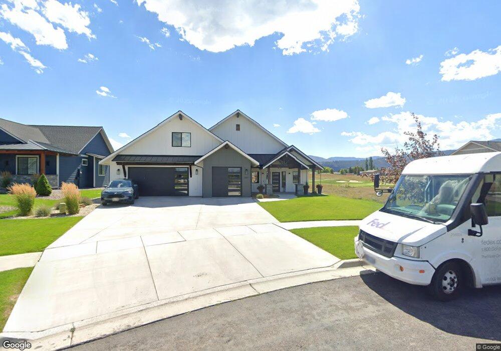
2621 Bunkhouse Place Unit Lot 147 Missoula, MT 59808
Captain John Mullan NeighborhoodEstimated Value: $928,391 - $1,085,000
3
Beds
4
Baths
2,255
Sq Ft
$446/Sq Ft
Est. Value
About This Home
This home is located at 2621 Bunkhouse Place Unit Lot 147, Missoula, MT 59808 and is currently estimated at $1,004,848, approximately $445 per square foot. 2621 Bunkhouse Place Unit Lot 147 is a home located in Missoula County with nearby schools including Hellgate Elementary Lower Grades, Hellgate Middle School, and Big Sky High School.
Ownership History
Date
Name
Owned For
Owner Type
Purchase Details
Closed on
Feb 9, 2018
Sold by
Appaloosa Landholdings Llc
Bought by
Maddux Real Estate Group Inc
Current Estimated Value
Home Financials for this Owner
Home Financials are based on the most recent Mortgage that was taken out on this home.
Original Mortgage
$51,386
Interest Rate
3.99%
Mortgage Type
Commercial
Create a Home Valuation Report for This Property
The Home Valuation Report is an in-depth analysis detailing your home's value as well as a comparison with similar homes in the area
Home Values in the Area
Average Home Value in this Area
Purchase History
| Date | Buyer | Sale Price | Title Company |
|---|---|---|---|
| Maddux Real Estate Group Inc | -- | Insured Title Llc |
Source: Public Records
Mortgage History
| Date | Status | Borrower | Loan Amount |
|---|---|---|---|
| Closed | Maddux Real Estate Group Inc | $51,386 |
Source: Public Records
Tax History Compared to Growth
Tax History
| Year | Tax Paid | Tax Assessment Tax Assessment Total Assessment is a certain percentage of the fair market value that is determined by local assessors to be the total taxable value of land and additions on the property. | Land | Improvement |
|---|---|---|---|---|
| 2025 | $8,463 | $887,500 | $172,213 | $715,287 |
| 2024 | $8,386 | $704,200 | $121,538 | $582,662 |
| 2023 | $7,838 | $704,200 | $121,538 | $582,662 |
| 2022 | $7,759 | $585,400 | $0 | $0 |
| 2021 | $7,782 | $651,000 | $0 | $0 |
| 2020 | $1,422 | $110,563 | $0 | $0 |
| 2019 | $1,406 | $110,563 | $0 | $0 |
| 2018 | $1,280 | $97,875 | $0 | $0 |
| 2017 | $1,259 | $97,875 | $0 | $0 |
| 2016 | $851 | $70,250 | $0 | $0 |
| 2015 | $802 | $70,250 | $0 | $0 |
| 2014 | $749 | $36,063 | $0 | $0 |
Source: Public Records
Map
Nearby Homes
- 2669 Bunkhouse Place
- 2645 Bunkhouse Place
- 2789 Paniolo Place
- 2783 Paniolo Place
- 8245 Pheasant Dr
- 2911 Bunkhouse Place
- 8105 Pheasant Dr
- 2729 Paniolo Place
- 2625 Tanbark Way Unit A
- 2310 Sage Hen Ct
- 2736 Paniolo Place
- 3069 Trading Post Place
- 2340 Bob White Ct
- 2100 Hummingbird Dr
- 2626 Muirfield Ct
- 8645 Mourning Dove Dr
- 121 New Meadows Dr
- 1935 Oriole Dr
- NHN Haven Heights Rd
- 7950 Toby Way
- 2621 Bunkhouse Place
- 2613 Bunkhouse Place Unit Lot 148
- 2613 Bunkhouse Place
- 2629 Bunkhouse Place Unit Lot 146
- 2629 Bunkhouse Place
- 2637 Bunkhouse Place Unit Lot 145
- 2637 Bunkhouse Place
- 2605 Bunkhouse Place Unit Lot 149
- 2605 Bunkhouse Place
- 2645 Bunkhouse Place Unit Lot 144
- 2653 Bunkhouse Place
- 2653 Bunkhouse Place Unit Lot 143
- 2632 Bunkhouse Place Unit Lot 154
- 2632 Bunkhouse Place
- 2624 Bunkhouse Place Unit Lot 153
- 2624 Bunkhouse Place
- 2661 Bunkhouse Place Unit Lot 142
- 2640 Bunkhouse Place Unit Lot 155
- 2640 Bunkhouse Place
- 2616 Bunkhouse Place Unit Lot 152