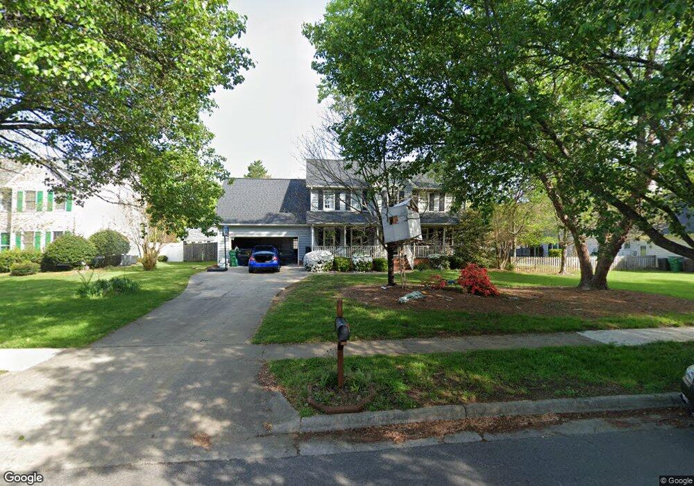
2626 White Fence Way High Point, NC 27265
Johnson Street Park NeighborhoodEstimated Value: $352,768 - $389,000
3
Beds
3
Baths
2,200
Sq Ft
$165/Sq Ft
Est. Value
About This Home
This home is located at 2626 White Fence Way, High Point, NC 27265 and is currently estimated at $363,192, approximately $165 per square foot. 2626 White Fence Way is a home located in Guilford County with nearby schools including Shadybrook Elementary School, Ferndale Middle School, and High Point Central High School.
Ownership History
Date
Name
Owned For
Owner Type
Purchase Details
Closed on
Jul 22, 2010
Sold by
Black Curtis Richard Herbert and Black Curtis Wanda
Bought by
Shaw Aaron D and Shaw Susanne Elizabeth
Current Estimated Value
Home Financials for this Owner
Home Financials are based on the most recent Mortgage that was taken out on this home.
Original Mortgage
$150,400
Outstanding Balance
$99,993
Interest Rate
4.73%
Mortgage Type
New Conventional
Estimated Equity
$263,199
Purchase Details
Closed on
Aug 28, 1992
Bought by
Curtis Richard Herbert
Create a Home Valuation Report for This Property
The Home Valuation Report is an in-depth analysis detailing your home's value as well as a comparison with similar homes in the area
Home Values in the Area
Average Home Value in this Area
Purchase History
| Date | Buyer | Sale Price | Title Company |
|---|---|---|---|
| Shaw Aaron D | $188,000 | None Available | |
| Curtis Richard Herbert | $139,000 | -- |
Source: Public Records
Mortgage History
| Date | Status | Borrower | Loan Amount |
|---|---|---|---|
| Open | Shaw Aaron D | $150,400 |
Source: Public Records
Tax History Compared to Growth
Tax History
| Year | Tax Paid | Tax Assessment Tax Assessment Total Assessment is a certain percentage of the fair market value that is determined by local assessors to be the total taxable value of land and additions on the property. | Land | Improvement |
|---|---|---|---|---|
| 2025 | $2,909 | $211,100 | $37,000 | $174,100 |
| 2024 | $2,909 | $211,100 | $37,000 | $174,100 |
| 2023 | $2,909 | $211,100 | $37,000 | $174,100 |
| 2022 | $2,846 | $211,100 | $37,000 | $174,100 |
| 2021 | $2,507 | $181,900 | $37,000 | $144,900 |
| 2020 | $2,507 | $181,900 | $37,000 | $144,900 |
| 2019 | $2,507 | $181,900 | $0 | $0 |
| 2018 | $2,494 | $181,900 | $0 | $0 |
| 2017 | $2,494 | $181,900 | $0 | $0 |
| 2016 | $2,595 | $185,000 | $0 | $0 |
| 2015 | $2,609 | $185,000 | $0 | $0 |
| 2014 | $2,653 | $185,000 | $0 | $0 |
Source: Public Records
Map
Nearby Homes
- 2512 Burch Point
- 4103 Quarterstaff Ct
- 4004 Baywater Point
- 2170 Glen Cove Way
- 2166 Glen Cove Way
- 2304 Castleloch Ct
- 1835 Morgans Mill Way
- 4407 Oak Hollow Dr
- 3753 Carvette Ct
- 3827 Edgewater St
- 4307 Oak Hollow Dr
- 4212 Canter Creek Ln Unit , Lot 88 ,
- 4212 Canter Creek Ln
- 4218 Pelican St
- 4244 Canter Creek Ln
- 4244 Canter Creek Ln Unit 96
- 3713 Blairwood St
- 3905 Wynne Brook Ct
- 1014 Shamrock Ct
- 3819 Oak Forest Dr
- 2628 White Fence Way
- 2622 White Fence Way
- 2620 White Fence Way
- 2608 White Fence Way
- 2630 White Fence Way
- 2606 White Fence Way
- 2631 White Fence Way
- 2629 White Fence Way
- 2614 White Fence Way
- 2604 White Fence Way
- 2633 White Fence Way
- 2627 White Fence Way
- 2632 White Fence Way
- 2625 White Fence Way
- 2623 White Fence Way
- 2602 White Fence Way
- 2619 White Fence Way
- 2635 White Fence Way
- 2634 White Fence Way
- 2609 White Fence Way