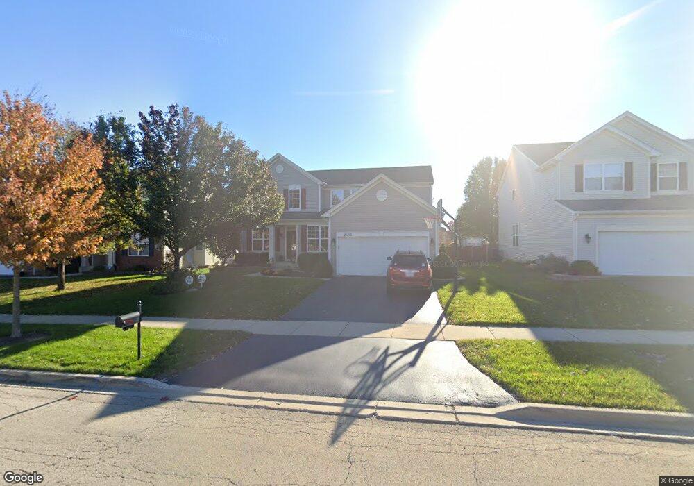
2632 Lundquist Dr Aurora, IL 60503
Far Southeast NeighborhoodEstimated Value: $475,000 - $496,000
4
Beds
3
Baths
2,345
Sq Ft
$206/Sq Ft
Est. Value
About This Home
This home is located at 2632 Lundquist Dr, Aurora, IL 60503 and is currently estimated at $482,154, approximately $205 per square foot. 2632 Lundquist Dr is a home located in Kendall County with nearby schools including Wolfs Crossing Elementary School, Bednarcik Jr. High School, and Oswego East High School.
Ownership History
Date
Name
Owned For
Owner Type
Purchase Details
Closed on
Oct 26, 2004
Sold by
The Ryland Group Inc
Bought by
Jasek Andrew John and Deanna Jasek M
Current Estimated Value
Home Financials for this Owner
Home Financials are based on the most recent Mortgage that was taken out on this home.
Original Mortgage
$250,750
Interest Rate
5.77%
Mortgage Type
Purchase Money Mortgage
Create a Home Valuation Report for This Property
The Home Valuation Report is an in-depth analysis detailing your home's value as well as a comparison with similar homes in the area
Home Values in the Area
Average Home Value in this Area
Purchase History
| Date | Buyer | Sale Price | Title Company |
|---|---|---|---|
| Jasek Andrew John | $279,000 | First American Title Ins Co |
Source: Public Records
Mortgage History
| Date | Status | Borrower | Loan Amount |
|---|---|---|---|
| Previous Owner | Jasek Andrew John | $250,750 |
Source: Public Records
Tax History
| Year | Tax Paid | Tax Assessment Tax Assessment Total Assessment is a certain percentage of the fair market value that is determined by local assessors to be the total taxable value of land and additions on the property. | Land | Improvement |
|---|---|---|---|---|
| 2024 | $11,177 | $131,796 | $30,348 | $101,448 |
| 2023 | $10,070 | $116,634 | $26,857 | $89,777 |
| 2022 | $10,070 | $106,030 | $24,415 | $81,615 |
| 2021 | $9,831 | $100,028 | $23,033 | $76,995 |
| 2020 | $9,542 | $96,181 | $22,147 | $74,034 |
| 2019 | $9,765 | $96,181 | $22,147 | $74,034 |
| 2018 | $8,990 | $89,155 | $20,529 | $68,626 |
| 2017 | $8,738 | $82,551 | $19,008 | $63,543 |
| 2016 | $8,505 | $79,376 | $18,277 | $61,099 |
| 2015 | $8,637 | $77,064 | $17,745 | $59,319 |
| 2014 | -- | $72,702 | $16,741 | $55,961 |
| 2013 | -- | $73,436 | $16,910 | $56,526 |
Source: Public Records
Map
Nearby Homes
- 2322 Pagosa Springs Dr
- 240 Devoe Dr
- 1893 Indian Hill Ln Unit 4053
- 1851 Indian Hill Ln Unit 4083
- 2811 Imperial Valley Trail
- 3017 Lundquist Dr
- 10140 S Eola Rd
- 464 Valentine Way
- 102 Devoe Dr Unit 465
- 460 Valentine Way
- 2799 Squaw Valley Trail
- 2413 Sunrise Cir Unit 34126
- 2406 Sunshine Ln Unit 2386
- 3237 Peyton Cir
- 3235 Kimblewick Cir
- 3284 Mallory Creek Ln
- 2812 Stuart Kaplan Ct
- 621 Lincoln Station Dr Unit 1403
- 628 Lincoln Station Dr Unit 303
- 2325 Georgetown Cir Unit 191
- 2622 Lundquist Dr
- 2652 Lundquist Dr
- 2612 Lundquist Dr
- 2653 Rourke Dr
- 2643 Rourke Dr
- 2663 Rourke Dr
- 2662 Lundquist Dr
- 2633 Rourke Dr
- 2673 Rourke Dr
- 2602 Lundquist Dr
- 2623 Rourke Dr
- 2089 Antietam Ct
- 2096 Antietam Ct
- 2672 Lundquist Dr
- 2683 Rourke Dr
- 2613 Rourke Dr
- 2084 Antietam Ct
- 2603 Rourke Dr
- 2693 Rourke Dr
- 2682 Lundquist Dr
Your Personal Tour Guide
Ask me questions while you tour the home.