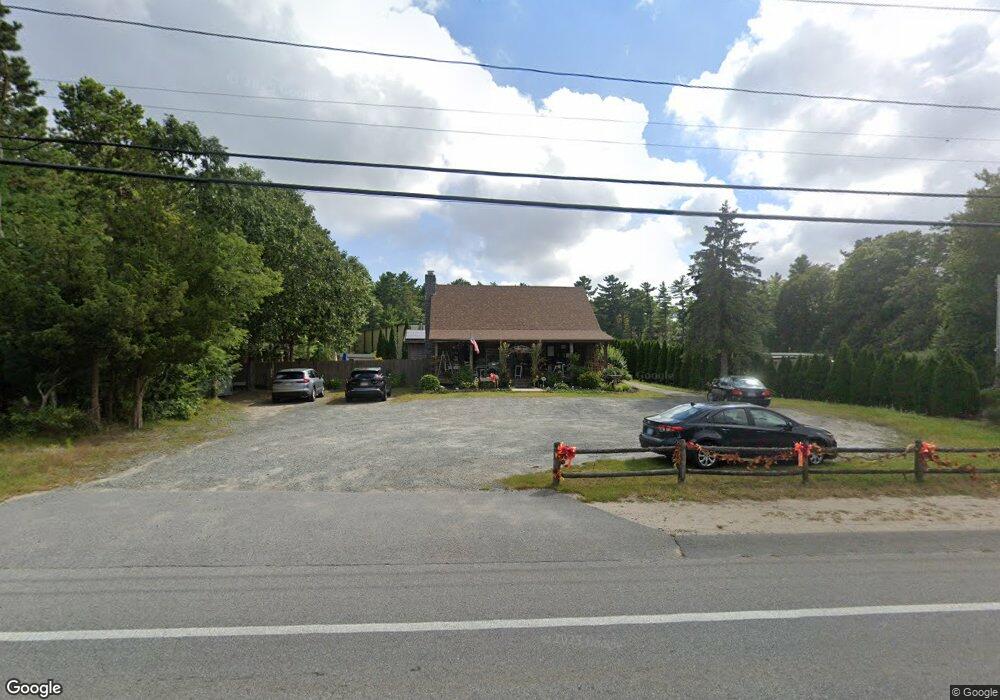
2639 Cranberry Hwy Wareham, MA 02571
Estimated Value: $569,678
3
Beds
2
Baths
2,201
Sq Ft
$259/Sq Ft
Est. Value
About This Home
This home is located at 2639 Cranberry Hwy, Wareham, MA 02571 and is currently estimated at $569,678, approximately $258 per square foot. 2639 Cranberry Hwy is a home located in Plymouth County.
Ownership History
Date
Name
Owned For
Owner Type
Purchase Details
Closed on
Jan 17, 2007
Sold by
Silveira Timothy S
Bought by
Silveira Nancy A
Current Estimated Value
Purchase Details
Closed on
Dec 6, 2004
Sold by
Arone Carol F and Arone Patricia
Bought by
Silveira Timothy S and Silveira Nancy A
Home Financials for this Owner
Home Financials are based on the most recent Mortgage that was taken out on this home.
Original Mortgage
$236,000
Interest Rate
5.69%
Mortgage Type
Purchase Money Mortgage
Purchase Details
Closed on
May 27, 1999
Sold by
Hathaway David T and Holik-Hathaway Karen
Bought by
Arone John L and Arone Carol F
Purchase Details
Closed on
May 18, 1993
Sold by
Jaskolka Christopher and Mcguire Cheryl A
Bought by
Hathaway David T and Hathaway Karen Holik
Create a Home Valuation Report for This Property
The Home Valuation Report is an in-depth analysis detailing your home's value as well as a comparison with similar homes in the area
Home Values in the Area
Average Home Value in this Area
Purchase History
| Date | Buyer | Sale Price | Title Company |
|---|---|---|---|
| Silveira Nancy A | -- | -- | |
| Silveira Nancy A | -- | -- | |
| Silveira Timothy S | $295,000 | -- | |
| Silveira Timothy S | $295,000 | -- | |
| Arone John L | $142,000 | -- | |
| Arone John L | $142,000 | -- | |
| Hathaway David T | $79,900 | -- |
Source: Public Records
Mortgage History
| Date | Status | Borrower | Loan Amount |
|---|---|---|---|
| Previous Owner | Hathaway David T | $236,000 | |
| Previous Owner | Hathaway David T | $29,500 |
Source: Public Records
Tax History Compared to Growth
Tax History
| Year | Tax Paid | Tax Assessment Tax Assessment Total Assessment is a certain percentage of the fair market value that is determined by local assessors to be the total taxable value of land and additions on the property. | Land | Improvement |
|---|---|---|---|---|
| 2025 | $4,082 | $391,700 | $108,500 | $283,200 |
| 2024 | $3,266 | $290,800 | $84,300 | $206,500 |
| 2023 | $3,478 | $263,900 | $76,700 | $187,200 |
| 2022 | $3,478 | $263,900 | $76,700 | $187,200 |
| 2021 | $3,549 | $263,900 | $76,700 | $187,200 |
| 2020 | $3,499 | $263,900 | $76,700 | $187,200 |
| 2019 | $3,414 | $256,900 | $72,600 | $184,300 |
| 2018 | $3,502 | $256,900 | $72,600 | $184,300 |
| 2017 | $3,455 | $256,900 | $72,600 | $184,300 |
| 2016 | $3,438 | $254,100 | $69,800 | $184,300 |
| 2015 | $3,321 | $254,100 | $69,800 | $184,300 |
| 2014 | $3,525 | $274,300 | $66,300 | $208,000 |
Source: Public Records
Map
Nearby Homes
- 125 Jeffreys Path
- 2596 Cranberry Hwy
- 110 Mayflower Ridge Dr
- 50 Avenue A St
- 6 Back St
- 425 Main St Unit E
- 437 Main St
- 13 Cherry St
- 2731 Cranberry Hwy
- 39 Highland Rd
- 3 Cedar St
- 5 Oak Hill Rd
- 24 Kimberly Ct
- 6 Gilbert Way
- 136 Marion Rd
- 51 Minot Ave Unit 1
- 2783 Cranberry Hwy
- 687 Main St
- 10 Nimrod Way
- 12 Linwood Ave
- 2645 Cranberry Hwy
- 2637 Cranberry Hwy
- 2640 Cranberry Hwy
- 6 Mattos Ave
- 2 Mattos Ave
- 2629 Cranberry Hwy
- 13 Mattos Ave
- 14 Essex Way
- 5 Mattos Ave
- 7 Mattos Ave
- 2648 Cranberry Hwy
- 11 Recovery Rd
- 15 Mattos Ave
- 11 Mattos Ave
- 8 Monteiro St
- 2622 Cranberry Hwy
- 17 Mattos Ave
- 6 Old Carr Lndg Rd
- 3 Cabral Way
- 3 Cabral Way Unit na