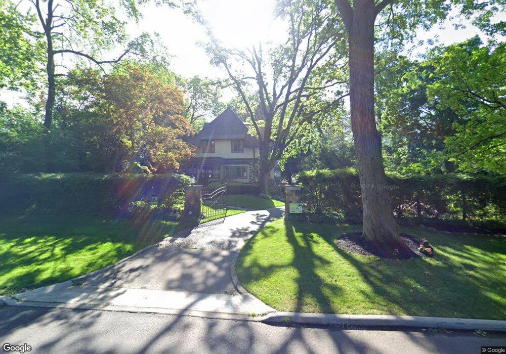
266 Preston Rd Columbus, OH 43209
Estimated Value: $1,536,000 - $1,851,982
4
Beds
6
Baths
5,682
Sq Ft
$306/Sq Ft
Est. Value
About This Home
This home is located at 266 Preston Rd, Columbus, OH 43209 and is currently estimated at $1,740,496, approximately $306 per square foot. 266 Preston Rd is a home located in Franklin County with nearby schools including Ohio Avenue Elementary School, Champion Middle School, and East High School.
Ownership History
Date
Name
Owned For
Owner Type
Purchase Details
Closed on
Nov 30, 2022
Sold by
Andrew A Dunn Marital Trust
Bought by
Dunn Diane L
Current Estimated Value
Purchase Details
Closed on
Nov 24, 2022
Sold by
Andrew A Dunn Trust
Bought by
Andrew A Dunn Marital Trust
Purchase Details
Closed on
Oct 13, 1997
Sold by
Dunn Andrew A and Dunn Diane L
Bought by
Dunn Andrew A
Home Financials for this Owner
Home Financials are based on the most recent Mortgage that was taken out on this home.
Original Mortgage
$265,000
Interest Rate
7.65%
Purchase Details
Closed on
Sep 9, 1996
Sold by
Ostrander Charles Edward
Bought by
Huntington Trust Co
Home Financials for this Owner
Home Financials are based on the most recent Mortgage that was taken out on this home.
Original Mortgage
$200,000
Interest Rate
8.27%
Mortgage Type
Balloon
Create a Home Valuation Report for This Property
The Home Valuation Report is an in-depth analysis detailing your home's value as well as a comparison with similar homes in the area
Home Values in the Area
Average Home Value in this Area
Purchase History
| Date | Buyer | Sale Price | Title Company |
|---|---|---|---|
| Dunn Diane L | -- | Central City Title Agency, Ltd | |
| Andrew A Dunn Marital Trust | -- | Simplifile | |
| Dunn Andrew A | -- | Connor Title Co | |
| Huntington Trust Co | $547,500 | -- |
Source: Public Records
Mortgage History
| Date | Status | Borrower | Loan Amount |
|---|---|---|---|
| Previous Owner | Dunn Andrew A | $265,000 | |
| Previous Owner | Huntington Trust Co | $200,000 |
Source: Public Records
Tax History
| Year | Tax Paid | Tax Assessment Tax Assessment Total Assessment is a certain percentage of the fair market value that is determined by local assessors to be the total taxable value of land and additions on the property. | Land | Improvement |
|---|---|---|---|---|
| 2025 | $22,662 | $504,950 | $135,730 | $369,220 |
| 2024 | $22,662 | $504,950 | $135,730 | $369,220 |
| 2023 | $22,372 | $504,950 | $135,730 | $369,220 |
| 2022 | $19,796 | $381,680 | $88,060 | $293,620 |
| 2021 | $19,831 | $381,680 | $88,060 | $293,620 |
| 2020 | $19,857 | $381,680 | $88,060 | $293,620 |
| 2019 | $21,078 | $347,450 | $80,080 | $267,370 |
| 2018 | $10,517 | $347,450 | $80,080 | $267,370 |
| 2017 | $21,065 | $347,450 | $80,080 | $267,370 |
| 2016 | $22,573 | $340,760 | $78,750 | $262,010 |
| 2015 | $10,246 | $340,760 | $78,750 | $262,010 |
| 2014 | $20,541 | $340,760 | $78,750 | $262,010 |
| 2013 | $6,088 | $204,750 | $71,575 | $133,175 |
Source: Public Records
Map
Nearby Homes
- 211 Preston Rd
- 57 Preston Rd
- 1847 Oak St
- 2417 Fair Ave
- 2465 E Broad St
- 140 N Parkview Ave
- 1779 E Main St
- 1905 Clifton Ave
- 592 Rhoads Ave Unit 594
- 572 Bulen Ave
- 423 Stoddart Ave
- 1707 E Main St Unit 1705
- 422-424 Morrison Ave
- 409-411 Morrison Ave
- 377 Berkeley Rd
- 1670 E Broad St Unit 206
- 1670 E Broad St Unit 309
- 389-391 Berkeley Rd
- 661 S Cassingham Rd
- 544 Seymour Ave
- 252 Preston Rd
- 240 Preston Rd
- 295 Preston Rd
- 299 Preston Rd
- 291 Preston Rd
- 277 S Parkview Ave
- 275 S Parkview Ave
- 2123 Fair Ave
- 265 S Parkview Ave
- 259 Preston Rd
- 228 Preston Rd
- 247 Preston Rd
- 295 S Parkview Ave
- 281 S Parkview Ave
- 311 Westland Ave
- 271 S Parkview Ave
- 320 Westland Ave
- 261 S Parkview Ave
- 311 S Parkview Ave
Your Personal Tour Guide
Ask me questions while you tour the home.